File:Nordsee oder Schwarzes Meer^ Neckarursprung und Wasserscheide im Moos, Der Ursprung des Neckars liegt im Schwenninger Moos. Im 19. Jahrhundert waren zwei Neckarursprünge festgelegt. Die historische Neckarquel - panoramio (1).jpg
Jump to navigation
Jump to search

Size of this preview: 800 × 598 pixels. Other resolutions: 320 × 239 pixels | 640 × 478 pixels | 1,024 × 766 pixels | 1,280 × 957 pixels | 2,560 × 1,914 pixels | 4,588 × 3,430 pixels.
Original file (4,588 × 3,430 pixels, file size: 6.41 MB, MIME type: image/jpeg)
Captions
Captions
Add a one-line explanation of what this file represents
Summary
[edit].jpg&action=edit§ion=1)
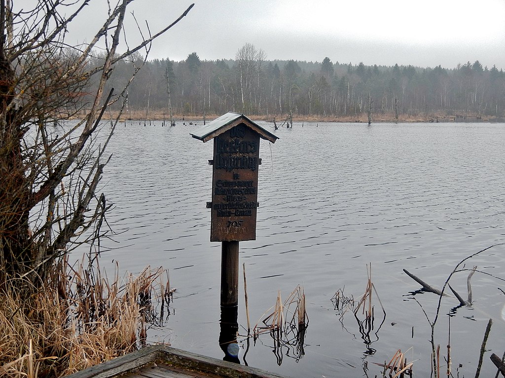
| Description | Nordsee oder Schwarzes Meer? Neckarursprung und Wasserscheide im Moos: Der Ursprung des Neckars liegt im Schwenninger Moos. Im 19. Jahrhundert waren zwei Neckarursprünge festgelegt. Die historische Neckarquelle liegt außerhalb des Naturschutzgebiets. Sein Wasser erhält das Neckar-Bächlein allerdings fast vollständig vom Moosbach, also aus dem Schwenniger Moos (alter Torfstich der 30er Jahre). Allerdings entwässert der südliche Teil des Moos‘ über den Marbacher Talbach und die Brigach in die Donau. | ||
| Date | Taken on 23 March 2016 | ||
| Source | https://web.archive.org/web/20161031112902/http://www.panoramio.com/photo/129035481 | ||
| Author | qwesy qwesy | ||
| Permission (Reusing this file) |
This file is licensed under the Creative Commons Attribution 3.0 Unported license. Attribution: qwesy qwesy
|
||
| Panoramio Tags | Villingen-Schwenningen, 2016, Baden-Württemberg, best, Dauchingen, Deißlingen, Deutschland, Villingen-Schwenningen |
| Camera location | | View this and other nearby images on: OpenStreetMap |
|---|
.jpg¶ms=048.043308_N_0008.527348_E_globe:Earth_type:camera_source:Panoramio_&language=en)
File history
Click on a date/time to view the file as it appeared at that time.
| Date/Time | Thumbnail | Dimensions | User | Comment | |
|---|---|---|---|---|---|
| current | 21:19, 1 July 2017 | | 4,588 × 3,430 (6.41 MB) | Panoramio upload bot (talk | contribs) | == {{int:filedesc}} == {{Information |description=Nordsee oder Schwarzes Meer? Neckarursprung und Wasserscheide im Moos: Der Ursprung des Neckars liegt im Schwenninger Moos. Im 19. Jahrhundert waren zwei Neckarursprünge festgelegt. Die historische N... |
You cannot overwrite this file.
File usage on Commons
There are no pages that use this file.
.jpg&oldid=762365178)