File:Northbound Highway 12, Kitty Hawk, North Carolina (14469107765).jpg

Original file (4,000 × 3,000 pixels, file size: 2.82 MB, MIME type: image/jpeg)
Captions
Captions
Summary[edit]
.jpg&action=edit§ion=1)
| Description |
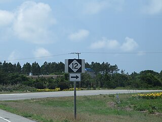
North Carolina Highway 12 (NC 12) is a state highway that traverses the northeastern coastline of North Carolina, linking the peninsulas and islands of the northern Outer Banks. Most sections of NC 12 are two lanes wide, and there are also two ferry routes which maintain continuity of the route as it traverses the Outer Banks region. NC 12 is part of the Outer Banks Scenic Byway one of the National Scenic Byways. The first NC 12 appeared on the 1924 North Carolina Official Map and at its height ran from NC 30 in Pollocksville to NC 48 near Murfreesboro. Overtime it was replaced by both US 258 and NC 58 and ceased to exist in 1958. The current NC 12 first appeared on the 1964 state highway map running from US 158 in Nags Head to Ocracoke. In 1976 NC 12 was extended to US 70 on the mainland and in 1987 was extended north to Corolla. The Outer Banks Scenic Byway begins at the intersection of US 70 and Merrimon Road. The Outer Banks Scenic Byway follows US 70 East to NC 12 on Cedar Island. The byway then continues onto NC 12 North near Atlantic. The byway then crosses the Ocracoke-Cedar Island Ferry north. It follows NC 12 north the rest of the way to the intersection of US 64 and NC 12 in Nags Head where it has it's northern terminus. The Outer Banks Scenic Byway spans approximately 131 Miles and takes about 6 Hours to drive. <a href="http://en.wikipedia.org/wiki/North_Carolina_Highway_12" rel="nofollow">en.wikipedia.org/wiki/North_Carolina_Highway_12</a> <a href="http://en.wikipedia.org/wiki/Wikipedia:Text_of_Creative_Commons_Attribution-ShareAlike_3.0_Unported_License" rel="nofollow">en.wikipedia.org/wiki/Wikipedia:Text_of_Creative_Commons_...</a> |
| Date | |
| Source | Northbound Highway 12, Kitty Hawk, North Carolina |
| Author | Ken Lund from Reno, Nevada, USA |
| Camera location | | View this and other nearby images on: OpenStreetMap |
|---|
.jpg¶ms=036.098852_N_-075.713703_E_globe:Earth_type:camera_source:Flickr_&language=en)
Licensing[edit]
.jpg&action=edit§ion=2)
- You are free:
- to share – to copy, distribute and transmit the work
- to remix – to adapt the work
- Under the following conditions:
- attribution – You must give appropriate credit, provide a link to the license, and indicate if changes were made. You may do so in any reasonable manner, but not in any way that suggests the licensor endorses you or your use.
- share alike – If you remix, transform, or build upon the material, you must distribute your contributions under the same or compatible license as the original.
| This image was originally posted to Flickr by Ken Lund at https://flickr.com/photos/75683070@N00/14469107765 (archive). It was reviewed on 11 February 2020 by FlickreviewR 2 and was confirmed to be licensed under the terms of the cc-by-sa-2.0. |
File history
Click on a date/time to view the file as it appeared at that time.
| Date/Time | Thumbnail | Dimensions | User | Comment | |
|---|---|---|---|---|---|
| current | 02:31, 11 February 2020 | | 4,000 × 3,000 (2.82 MB) | Ser Amantio di Nicolao (talk | contribs) | Transferred from Flickr via #flickr2commons |
You cannot overwrite this file.
File usage on Commons
There are no pages that use this file.
.jpg&oldid=705152863)