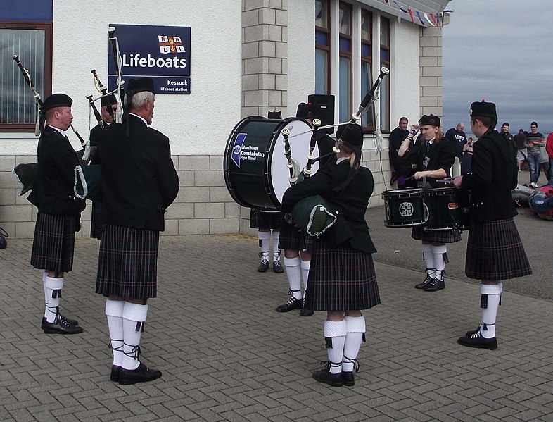
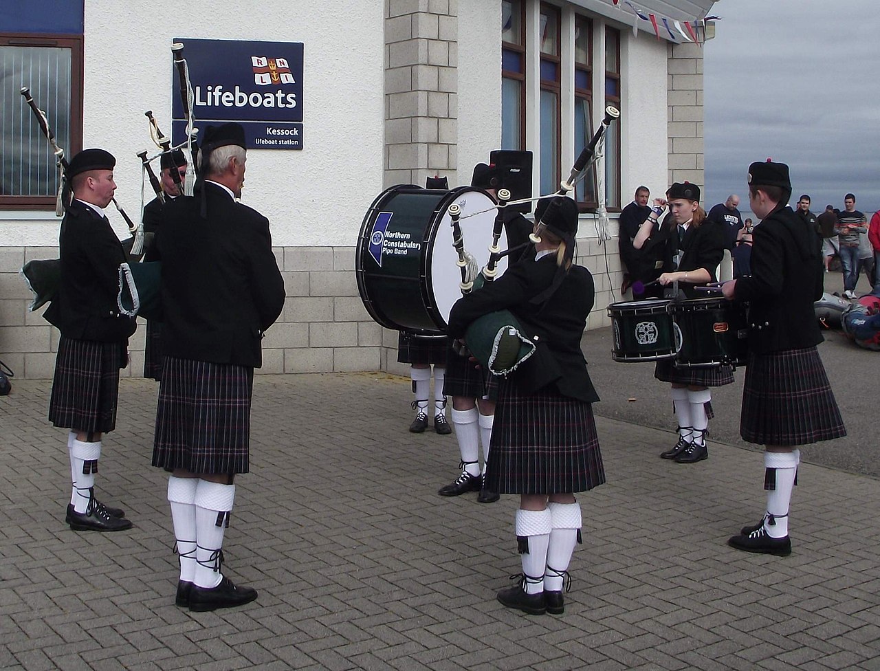
File:Northern Constabulary Pipe Band at Kessock Lifeboat Open Day on the Black Isle Ross & Cromarty Scotland (9583243237).jpg

Original file (2,292 × 1,748 pixels, file size: 369 KB, MIME type: image/jpeg)
Captions
Captions
Summary
[edit].jpg&action=edit§ion=1)
| Description |
The Band playing outside the west side of the Lifeboat Station, slightly sheltered from the breeze off the sea! The village of Kessock (a.k.a. North Kessock) lies directly across the Beauly Firth from the City of Inverness. Until fairly recently, a ferry ran between the two, but since 1982 the imposing Kessock Bridge (carrying the A9 trunk road north from Inverness) has joined the two communities. en.wikipedia.org/wiki/Kessock_Bridge Kessock lies directly opposite the mouth of the River Ness, and Inverness Harbour and Marina, and the entrance to the Caledonian Canal is close by too. As a busy arm of the North Sea/Moray firth., the Beauly Firth is an important maritime route, both for commercial and leisure traffic. It took a long time to get a lifeboat based in the Inverness area but now that we do have the facility, locals are extremely proud - and supportive - of the Kessock lifeboat and its brave crew. The Lifeboat station is located at Craigton Point, directly under the north end of the Kessock Bridge. Several Band members have family or friends in the crew, hence we were delighted to be able to support and assist at the RNLI Kessock Station open day today (24th August 2013) by providing a mini-band to entertain the visitors. Kessock is one of Scotland’s youngest lifeboat stations, operating an inshore B class Atlantic 75 lifeboat – “The Moray Dolphin”. For over 10 years the lifeboat crews have launched the lifeboats, not only to save lives at sea but also to save lives inland during flooding. rnli.org/findmynearest/station/Pages/Kessock-Lifeboat-Sta... |
| Date | |
| Source | Northern Constabulary Pipe Band at Kessock Lifeboat Open Day on the Black Isle Ross & Cromarty Scotland |
| Author | Dave Conner from Inverness, Scotland |
| Camera location | | View this and other nearby images on: OpenStreetMap |
|---|
.jpg¶ms=057.501138_N_-004.234628_E_globe:Earth_type:camera_source:Flickr_&language=en)
Licensing
[edit].jpg&action=edit§ion=2)
- You are free:
- to share – to copy, distribute and transmit the work
- to remix – to adapt the work
- Under the following conditions:
- attribution – You must give appropriate credit, provide a link to the license, and indicate if changes were made. You may do so in any reasonable manner, but not in any way that suggests the licensor endorses you or your use.
| This image was originally posted to Flickr by conner395 at https://flickr.com/photos/91779914@N00/9583243237. It was reviewed on 24 November 2017 by FlickreviewR 2 and was confirmed to be licensed under the terms of the cc-by-2.0. |
File history
Click on a date/time to view the file as it appeared at that time.
| Date/Time | Thumbnail | Dimensions | User | Comment | |
|---|---|---|---|---|---|
| current | 17:44, 24 November 2017 | | 2,292 × 1,748 (369 KB) | Ser Amantio di Nicolao (talk | contribs) | Transferred from Flickr via Flickr2Commons |
You cannot overwrite this file.
File usage on Commons
There are no pages that use this file.
.jpg&oldid=517531853)