File:Nova Scotia and the Bay of Fundy.jpg
Przejdź do nawigacji
Przejdź do wyszukiwania
Rozmiar podglądu – 466 × 599 pikseli. Inne rozdzielczości: 187 × 240 pikseli | 373 × 480 pikseli | 597 × 768 pikseli | 796 × 1024 pikseli | 1400 × 1800 pikseli.
Rozmiar pierwotny (1400 × 1800 pikseli, rozmiar pliku: 691 KB, typ MIME: image/jpeg)
Podpisy
Podpisy
Dodaj jednolinijkowe objaśnienie tego, co ten plik pokazuje
Opis
[edytuj]
| Opis |
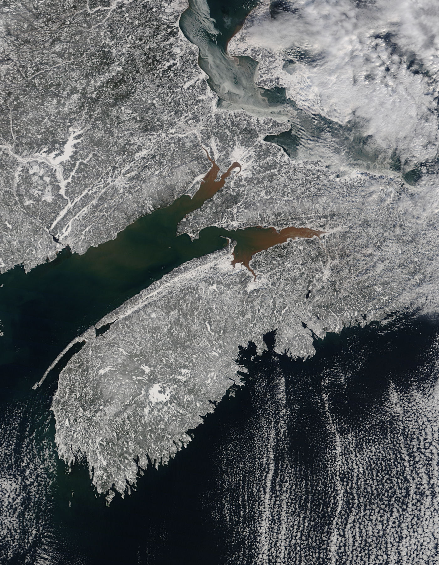
English: Nova Scotia and the Bay of Fundy are featured in this image, acquired January 23, 2010 by the MODIS on the Aqua satellite. Nova Scotia, a Canadian province, is the long peninsula that runs diagonally across the image. Snow covers the ground.
The Bay of Fundy is on the western side of the spit on land. Note the reddish coloration near the northern coastline of the Bay. In this image, much of the red coloring is in the sub-bays - Chignecto Bay is the one to the north. Minas Basin and its eastern portion, the Cobequid Bay, make up the more southern inlet of the two you see here. The color of the water is due to sediment caused by tides. The Bay of Fundy has the highest tides in the world - the water can rise and fall as much as 50 feet each day! During each tidal cycle, huge quantities of fine sediments are brought in to flood the coastal area. Much of the sediment remains in the sheltered areas along the coast, forming the famous red mudflats of the upper Bay. |
| Data | |
| Źródło | http://modis.gsfc.nasa.gov/gallery/individual.php?db_date=2010-02-03 |
| Autor | NASA |
Licencja
[edytuj]
| Ten plik jest w domenie publicznej ponieważ został stworzony przez NASA. Polityka praw autorskich NASA stwierdza, że „materiały NASA nie są chronione prawami autorskimi, chyba że zapisano inaczej”. (NASA copyright policy lub JPL Image Use Policy). | ||
 |
Uwaga:
|
Historia pliku
Kliknij na odpowiedniej dacie/czasie, aby zobaczyć wersję pliku z tamtego okresu.
| Data/czas | Miniatura | Wymiary | Użytkownik | Opis | |
|---|---|---|---|---|---|
| aktualny | 01:41, 5 lut 2010 | | 1400 × 1800 (691 KB) | Captain-tucker (dyskusja | edycje) | {{Information |Description={{en|Nova Scotia and the Bay of Fundy are featured in this image, acquired January 23, 2010 by the MODIS on the Aqua satellite. Nova Scotia, a Canadian province, is the long peninsula that runs diagonally across the image. Snow |
Nie możesz nadpisać tego pliku.
Lokalne wykorzystanie pliku
Żadna strona nie korzysta z tego pliku.
Globalne wykorzystanie pliku
Ten plik jest wykorzystywany także w innych projektach wiki:
- Wykorzystanie na pl.wikipedia.org