File:Nowe (gmina) location map.png
Jump to navigation
Jump to search

Size of this preview: 560 × 600 pixels. Other resolutions: 224 × 240 pixels | 448 × 480 pixels | 887 × 950 pixels.
Original file (887 × 950 pixels, file size: 127 KB, MIME type: image/png)
Captions
Captions
Add a one-line explanation of what this file represents
| Description |
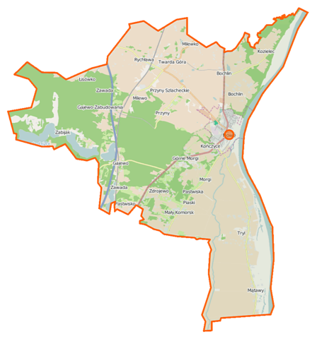
Polski: Mapa gminy Nowe, Polska
English: Map of Gmina Nowe, Poland |
|||||||||
| Date | ||||||||||
| Source | You may find a page on the OpenStreetMap wiki page for Nowe (gmina) | |||||||||
| Creator |
OpenStreetMap contributors OpenStreetMap contributors |
|||||||||
| Permission (Reusing this file) |
OpenStreetMap data is available under the Open Database License (details). Map tiles are licensed under the Creative Commons Attribution-ShareAlike 2.0 license (CC-BY-SA 2.0).
This file is licensed under the Creative Commons Attribution-Share Alike 2.0 Generic license.
|
|||||||||
| Geotemporal data | ||||||||||
| Bounding box |
|
|||||||||
| Georeferencing | If inappropriate please set warp_status = skip to hide. | |||||||||
File history
Click on a date/time to view the file as it appeared at that time.
| Date/Time | Thumbnail | Dimensions | User | Comment | |
|---|---|---|---|---|---|
| current | 11:07, 14 November 2014 | | 887 × 950 (127 KB) | VanWiel (talk | contribs) | {{OpenStreetMap | name = Nowe (gmina) | location = Nowe (gmina) | description = {{pl|Mapa gminy Nowe, Polska}} {{en|Map of Gmina Nowe, Poland}} | top = 53.7079 | left = 18.5528 | right =... |
You cannot overwrite this file.
File usage on Commons
There are no pages that use this file.
File usage on other wikis
The following other wikis use this file:
- Usage on pl.wikipedia.org
- Nowe
- Nowe (gmina)
- Mały Komorsk
- Mątawy
- Pastwiska (województwo kujawsko-pomorskie)
- Rychława
- Twarda Góra
- Zdrojewo (województwo kujawsko-pomorskie)
- Bochlin (województwo kujawsko-pomorskie)
- Kończyce (wieś w województwie kujawsko-pomorskim)
- Milewko (województwo kujawsko-pomorskie)
- Morgi (powiat świecki)
- Osiny (województwo kujawsko-pomorskie)
- Tryl
- Gajewo (powiat świecki)
- Głodowo (powiat świecki)
- Kozielec (powiat świecki)
- Rezerwat przyrody Wiosło Duże
- Gajewo-Zabudowania
- Przyny
- Dolne Morgi
- Milewo (województwo kujawsko-pomorskie)
- Piaski (Mały Komorsk)
- Zawada (Gajewo)
- Zabijak (Osiny)
- Parafia św. Mateusza Apostoła w Nowem nad Wisłą
- Parafia Najświętszej Maryi Panny Królowej Polski w Mątawach
- Nowe (stacja kolejowa)
- Zamek w Nowem nad Wisłą
- Twarda Góra (stacja kolejowa)
- Przyny (przystanek kolejowy)
- Kościół św. Mateusza Apostoła w Nowem nad Wisłą
- Dobre (powiat świecki)
- Nowe (osada w województwie kujawsko-pomorskim)
- Kończyce (kolonia w województwie kujawsko-pomorskim)
- Kościół Najświętszej Maryi Panny Królowej Polski w Mątawach
- Moduł:Mapa/dane/Nowe
- Moduł:Mapa/dane/Nowe (gmina)
- Kościół św. Maksymiliana Kolbego w Nowem
- Kaplica św. Jerzego w Nowem
- Cmentarz ewangelicko-mennonicki w Trylu
- Kościół św. Floriana w Małym Komorsku
- Rybaki (Nowe)
- Usage on pl.wikibooks.org
- Usage on www.wikidata.org
_location_map.png&oldid=519985477)