File:Nowy Korczyn (gmina) location map.png

Original file (2,462 × 1,605 pixels, file size: 398 KB, MIME type: image/png)
Captions
Captions
Summary
[edit]_location_map.png&action=edit§ion=1)
| Description |
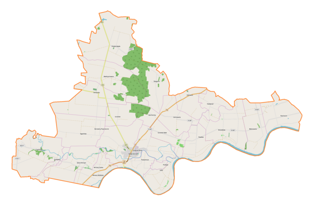
English: Location map |
| Date | |
| Source | Own work |
| Author | Smat |
| Description |
Polski: Mapa gminy Nowy Korczyn, Polska
English: Map of Nowy Korczyn (gmina), Poland |
|||||||||
| Date | ||||||||||
| Source | You may find a page on the OpenStreetMap wiki page for Nowy Korczyn (gmina) | |||||||||
| Creator |
OpenStreetMap contributors OpenStreetMap contributors |
|||||||||
| Permission (Reusing this file) |
OpenStreetMap data is available under the Open Database License (details). Map tiles are licensed under the Creative Commons Attribution-ShareAlike 2.0 license (CC-BY-SA 2.0).
This file is licensed under the Creative Commons Attribution-Share Alike 2.0 Generic license.
|
|||||||||
| Geotemporal data | ||||||||||
| Bounding box |
|
|||||||||
| Georeferencing | If inappropriate please set warp_status = skip to hide. | |||||||||
Licensing
[edit]_location_map.png&action=edit§ion=2)
| This work contains information from OpenStreetMap, which is made available under the Open Database License (ODbL).
The ODbL does not require any particular license for maps produced from ODbL data. Prior to 1 August 2020, map tiles produced by the OpenStreetMap Foundation were licensed under the CC-BY-SA-2.0 license. Maps produced by other people may be subject to other licences. |
File history
Click on a date/time to view the file as it appeared at that time.
| Date/Time | Thumbnail | Dimensions | User | Comment | |
|---|---|---|---|---|---|
| current | 18:54, 8 December 2018 | | 2,462 × 1,605 (398 KB) | Smat (talk | contribs) | User created page with UploadWizard |
You cannot overwrite this file.
File usage on Commons
There are no pages that use this file.
File usage on other wikis
The following other wikis use this file:
- Usage on pl.wikipedia.org
- Nowy Korczyn
- Parchocin
- Badrzychowice
- Błotnowola
- Czarkowy
- Górnowola
- Grotniki Duże
- Grotniki Małe
- Harmoniny
- Ostrowce (województwo świętokrzyskie)
- Piasek Wielki
- Podraje
- Rzegocin (województwo świętokrzyskie)
- Sępichów
- Stary Korczyn
- Strożyska
- Ucisków
- Winiary Dolne
- Brzostków (województwo świętokrzyskie)
- Łęka (województwo świętokrzyskie)
- Żukowice (województwo świętokrzyskie)
- Kawęczyn (powiat buski)
- Pawłów (powiat buski)
- Podzamcze (powiat buski)
- Zamek w Nowym Korczynie
- Synagoga w Nowym Korczynie
- Kościół św. Stanisława w Nowym Korczynie
- Kościół św. Trójcy w Nowym Korczynie
- Parafia Trójcy Świętej w Nowym Korczynie
- Stary cmentarz żydowski w Nowym Korczynie
- Nowy cmentarz żydowski w Nowym Korczynie
- Łąki (Brzostków)
- Radła
- Grądy Świniarskie
- Podwale (Parchocin)
- Winiary Wiślickie
- Wesoła (Badrzychowice)
- Kępa Bolesławska
- Błonie (Brzostków)
- Podlesie (Brzostków)
- Zabłocie (Brzostków)
- Zamoście (Brzostków)
- Błonie (Parchocin)
- Raj (Pawłów)
- Gościniec (Parchocin)
- Piotrówka (Rzegocin)
- Przymiarki (Strożyska)
- Górnowola Majoratna
- Górnowola Szpitalna
- Stojki
View more global usage of this file.
_location_map.png)
_location_map.png&oldid=704424679)