File:O'Hare International Airport (USGS) Phase3.png
跳至導覽
跳至搜尋
預覽大小:600 × 600 像素。 其他解析度:240 × 240 像素 | 480 × 480 像素 | 768 × 768 像素 | 1,132 × 1,132 像素。
原始檔案 (1,132 × 1,132 像素,檔案大小:2.1 MB,MIME 類型:image/png)
說明
說明
添加單行說明來描述出檔案所代表的內容
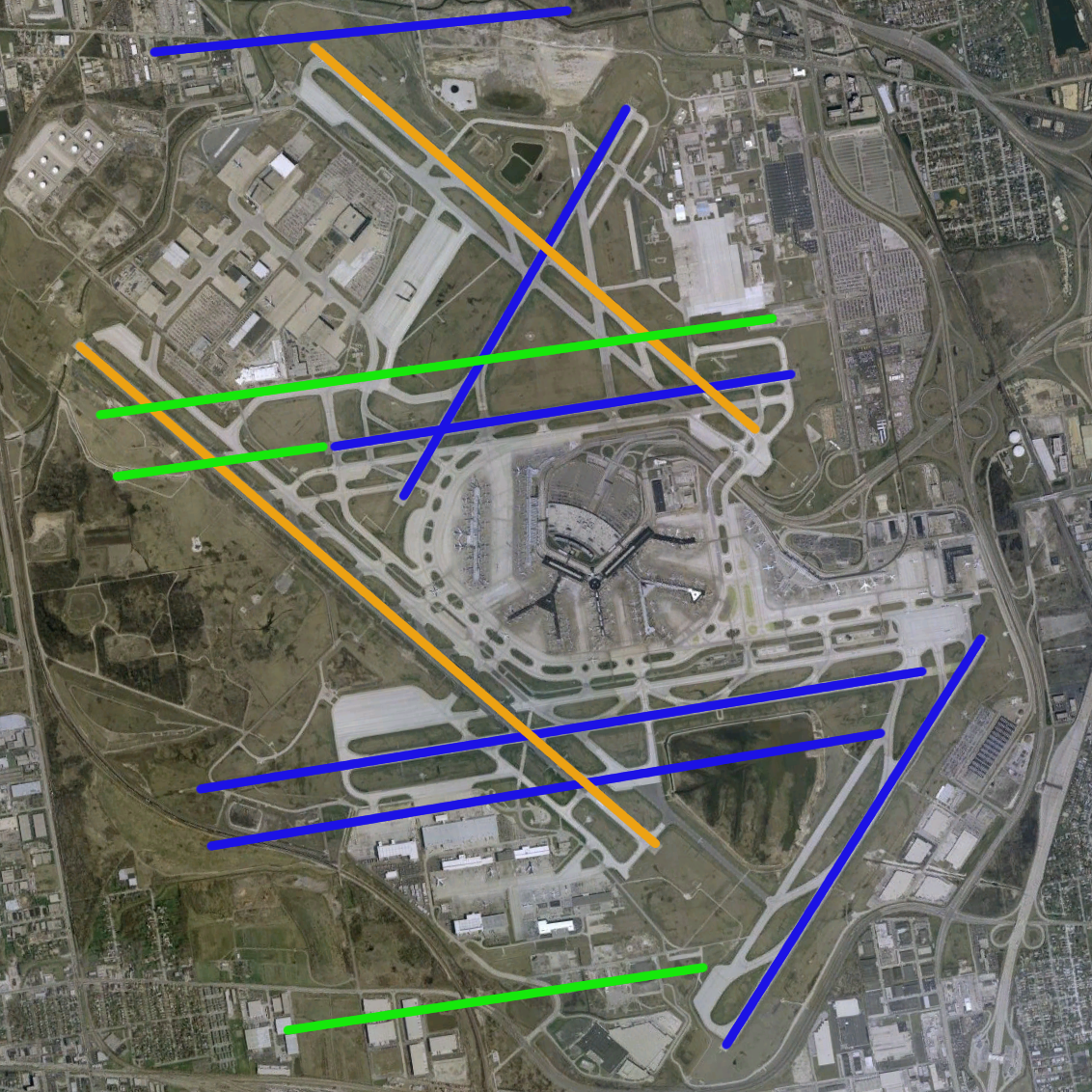
| 描述 | O'Hare International Airport modernization program - phase 3 runway configuration (blue = existing, green = new, orange = removed) | |||
| 來源 | NASA World Wind Screenshot, USGS urban ortho; [1] | |||
| 作者 |
Runway overlay by User:Wangi |
|||
| 其他版本 | Image:O'Hare International Airport (USGS).png, Image:O'Hare International Airport (USGS) Current.png, Image:O'Hare International Airport (USGS) Phase1.png, Image:O'Hare International Airport (USGS) Phase2.png, Image:O'Hare International Airport (USGS) Final.png |
.png)
_Current.png)
_Phase1.png)
_Phase2.png)
_Final.png)
檔案歷史
點選日期/時間以檢視該時間的檔案版本。
| 日期/時間 | 縮圖 | 尺寸 | 使用者 | 備註 | |
|---|---|---|---|---|---|
| 目前 | 2009年2月18日 (三) 23:54 | | 1,132 × 1,132(2.1 MB) | Mahahahaneapneap(留言 | 貢獻) | Compressed |
| 2007年6月30日 (六) 21:49 |  | 1,132 × 1,132(2.12 MB) | Brianski(留言 | 貢獻) | optimized, de-interlaced | |
| 2006年5月14日 (日) 09:58 |  | 1,132 × 1,132(2.55 MB) | Wangi(留言 | 貢獻) | {{Information| |Description=O'Hare International Airport modernization program - phase 3 runway configuration (blue = existing, green = new, orange = removed) |Source=NASA World Wind Screenshot, USGS urban ortho; [http://egov.cityofchicago.org/city/we |
無法覆蓋此檔案。
檔案用途
沒有使用此檔案的頁面。
全域檔案使用狀況
以下其他 wiki 使用了這個檔案:
- de.wikipedia.org 的使用狀況
- en.wikipedia.org 的使用狀況
- fr.wikipedia.org 的使用狀況
- id.wikipedia.org 的使用狀況
- pl.wikipedia.org 的使用狀況
- ru.wikipedia.org 的使用狀況
- th.wikipedia.org 的使用狀況
- zh.wikipedia.org 的使用狀況
_Phase3.png&oldid=656322451)