File:Oh districts map.PNG
ナビゲーションに移動
検索に移動
このプレビューのサイズ: 713 × 600 ピクセル。 その他の解像度: 285 × 240 ピクセル | 571 × 480 ピクセル | 913 × 768 ピクセル | 1,217 × 1,024 ピクセル | 2,457 × 2,067 ピクセル。
元のファイル (2,457 × 2,067 ピクセル、ファイルサイズ: 205キロバイト、MIME タイプ: image/png)
キャプション
キャプション
このファイルの内容を1行で記述してください
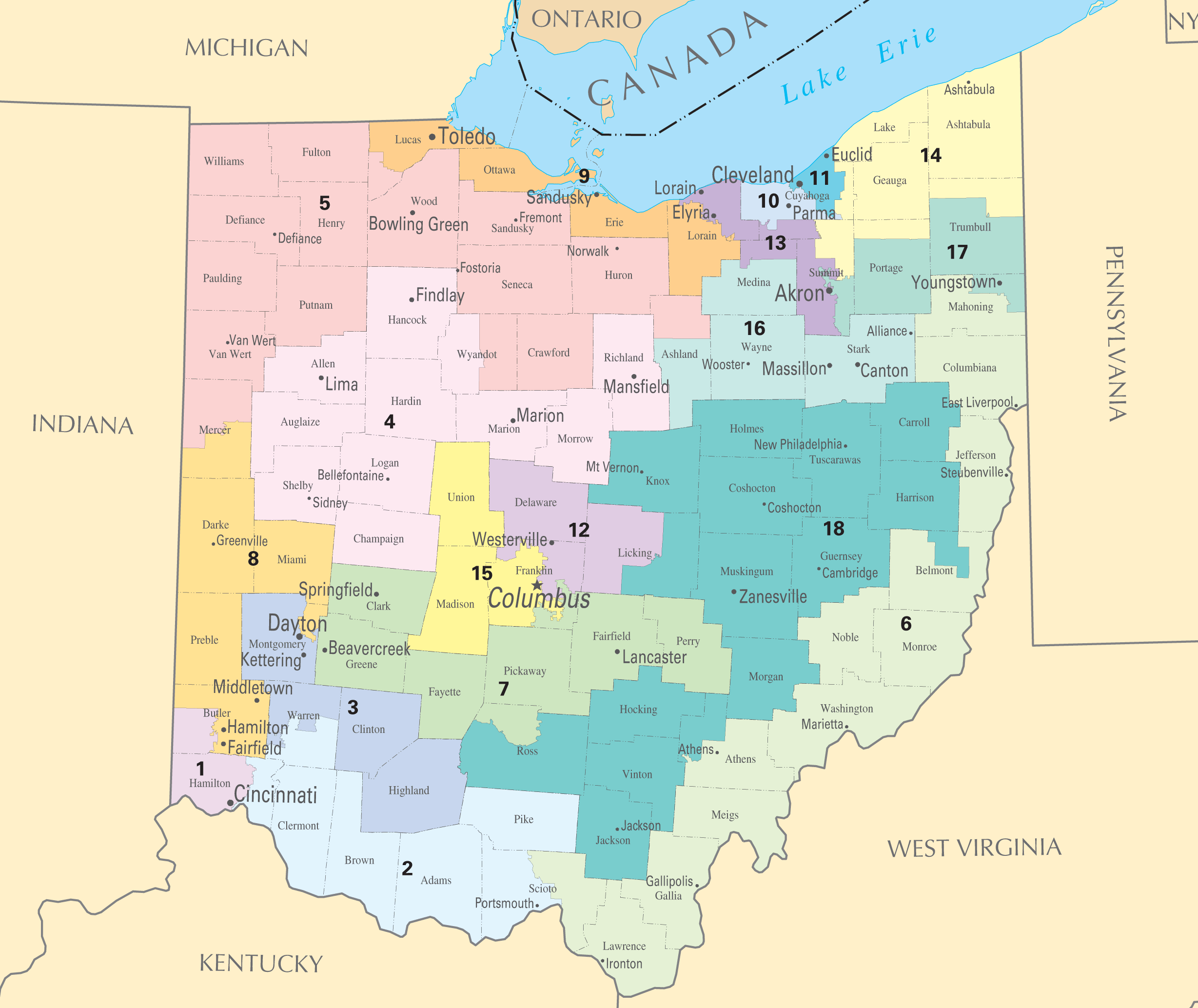
| 解説 | Ohio districts map | |||
| 原典 | National Atlas of the United States | |||
| 作者 | National Atlas of the United States | |||
| 許可 (ファイルの再利用) |
|
ファイルの履歴
過去の版のファイルを表示するには、その版の日時をクリックしてください。
| 日付と時刻 | サムネイル | 寸法 | 利用者 | コメント | |
|---|---|---|---|---|---|
| 現在の版 | 2010年1月2日 (土) 16:14 | | 2,457 × 2,067 (205キロバイト) | Shell Kinney (トーク | 投稿記録) | remove borders, higher resolution |
| 2006年3月1日 (水) 17:11 |  | 588 × 450 (42キロバイト) | Quadell (トーク | 投稿記録) | {{PD-USGov-Atlas}} Category:Maps of Ohio Category:United States congressional district maps |
このファイルは上書きできません。
ファイルの使用状況
このファイルを使用しているページはありません。
グローバルなファイル使用状況
以下に挙げる他のウィキがこの画像を使っています:
- ja.wikipedia.org での使用状況