File:Old Georgetown Rd Beech Ave bike lanes Bethesda MD 20210415 090405 1.jpg
Jump to navigation
Jump to search

Size of this preview: 800 × 533 pixels. Other resolutions: 320 × 213 pixels | 640 × 427 pixels | 1,024 × 683 pixels | 1,280 × 853 pixels | 2,560 × 1,707 pixels | 6,259 × 4,173 pixels.
Original file (6,259 × 4,173 pixels, file size: 20.88 MB, MIME type: image/jpeg)
Captions
Captions
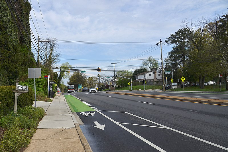
Bike lanes at Old Georgetown Rd and Beech Ave
Summary[edit]
| Description |
English: The bike lanes were build after a 17 year old was struck and killed near here in 2019. Part of the bike lane is painted green where it is shared with the bus stop and the turn area from Beech Avenue. |
| Date | Taken on 15 April 2021, 09:04:05 |
| Source | Own work |
| Author | G. Edward Johnson |
| Camera location | | View this and other nearby images on: OpenStreetMap |
|---|
Bike lane, road, roadway, traffic, bus stop, metrobus
Old Georgetown Rd and Beech Ave, Bethesda, MD
This photo was taken with Nikon D800
Licensing[edit]
I, the copyright holder of this work, hereby publish it under the following license:
This file is licensed under the Creative Commons Attribution 4.0 International license.
- You are free:
- to share – to copy, distribute and transmit the work
- to remix – to adapt the work
- Under the following conditions:
- attribution – You must give appropriate credit, provide a link to the license, and indicate if changes were made. You may do so in any reasonable manner, but not in any way that suggests the licensor endorses you or your use.
File history
Click on a date/time to view the file as it appeared at that time.
| Date/Time | Thumbnail | Dimensions | User | Comment | |
|---|---|---|---|---|---|
| current | 23:53, 17 April 2021 | | 6,259 × 4,173 (20.88 MB) | Lorax (talk | contribs) | Uploaded own work with UploadWizard |
You cannot overwrite this file.
File usage on Commons
The following page uses this file:
File usage on other wikis
The following other wikis use this file:
- Usage on en.wikipedia.org