File:Ontario Highway 417, Ottawa, Ontario (29441810754).jpg
Original file (4,000 × 3,000 pixels, file size: 2.79 MB, MIME type: image/jpeg)
Captions
Captions
Summary[edit]
.jpg&action=edit§ion=1)
| Description |
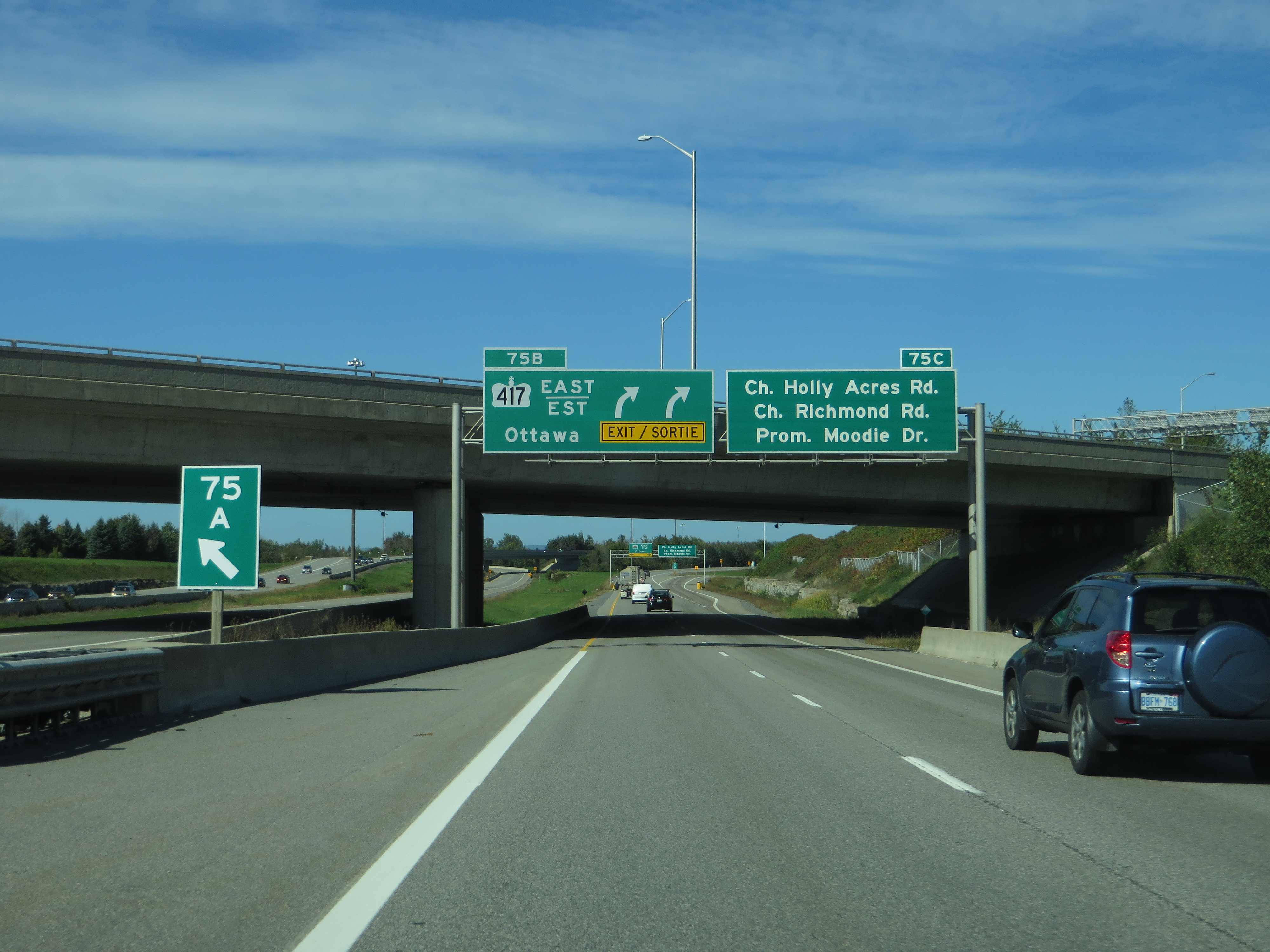
King's Highway 417, commonly referred to as Highway 417 and the Queensway through Ottawa, is a 400-series highway in the Canadian province of Ontario. It connects Montreal (via A40) with Ottawa, and is the backbone of the transportation system in the National Capital Region. Within Ottawa, it forms part of the Queensway west from Highway 7 to Ottawa Regional Road 174 (the Queensway continues east along the 174 to Trim Road). Highway 417 extends from the Quebec border (near Hawkesbury) to Arnprior, where it continues westward as Highway 17. Aside from the urban section through Ottawa, Highway 417 passes through farmland that dominates much of the fertile Ottawa Valley. Within Ottawa, the Queensway was built as part of a grand plan for the city between 1957 and 1966, and later reconstructed to its present form throughout the 1980s. The eastern section, from Gloucester to the Quebec border, opened in 1975 in preparation for the 1976 Montreal Olympics. Sections west of Ottawa have been under construction since the mid-1970s, with the section bypassing Arnprior opening on November 29, 2012 and another 5.3 km stretch in December 2016. <a href="https://en.wikipedia.org/wiki/Ontario_Highway_417" rel="noreferrer nofollow">en.wikipedia.org/wiki/Ontario_Highway_417</a> <a href="https://en.wikipedia.org/wiki/Wikipedia:Text_of_Creative_Commons_Attribution-ShareAlike_3.0_Unported_License" rel="noreferrer nofollow">en.wikipedia.org/wiki/Wikipedia:Text_of_Creative_Commons_...</a> |
| Date | |
| Source | Ontario Highway 417, Ottawa, Ontario |
| Author | Ken Lund from Reno, Nevada, USA |
| Camera location | | View this and other nearby images on: OpenStreetMap |
|---|
.jpg¶ms=045.334619_N_-075.811203_E_globe:Earth_type:camera_source:Flickr_&language=en)
Licensing[edit]
.jpg&action=edit§ion=2)
- You are free:
- to share – to copy, distribute and transmit the work
- to remix – to adapt the work
- Under the following conditions:
- attribution – You must give appropriate credit, provide a link to the license, and indicate if changes were made. You may do so in any reasonable manner, but not in any way that suggests the licensor endorses you or your use.
- share alike – If you remix, transform, or build upon the material, you must distribute your contributions under the same or compatible license as the original.
| This image was originally posted to Flickr by Ken Lund at https://flickr.com/photos/75683070@N00/29441810754. It was reviewed on 10 March 2022 by FlickreviewR 2 and was confirmed to be licensed under the terms of the cc-by-sa-2.0. |
File history
Click on a date/time to view the file as it appeared at that time.
| Date/Time | Thumbnail | Dimensions | User | Comment | |
|---|---|---|---|---|---|
| current | 18:57, 10 March 2022 | | 4,000 × 3,000 (2.79 MB) | Mindmatrix (talk | contribs) | Transferred from Flickr via #flickr2commons |
You cannot overwrite this file.
File usage on Commons
There are no pages that use this file.
.jpg&oldid=638572606)