File:Otsego County outline map Springfield red.png
Jump to navigation
Jump to search
No higher resolution available.
Otsego_County_outline_map_Springfield_red.png (180 × 191 pixels, file size: 18 KB, MIME type: image/png)
Captions
Captions
Add a one-line explanation of what this file represents
Summary[edit]
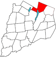
Map of w:Otsego County, New York with the Town of w:Springfield, New York in red
Licensing[edit]
| I, the copyright holder of this work, release this work into the public domain. This applies worldwide. In some countries this may not be legally possible; if so: I grant anyone the right to use this work for any purpose, without any conditions, unless such conditions are required by law. |
File history
Click on a date/time to view the file as it appeared at that time.
| Date/Time | Thumbnail | Dimensions | User | Comment | |
|---|---|---|---|---|---|
| current | 20:44, 4 April 2006 | | 180 × 191 (18 KB) | Cbarown (talk | contribs) | Map of Otsego County, New York with the Town of Springfield, New York in red |
You cannot overwrite this file.
File usage on Commons
There are no pages that use this file.
File usage on other wikis
The following other wikis use this file:
- Usage on azb.wikipedia.org
- Usage on en.wikipedia.org
- Usage on fa.wikipedia.org
- Usage on ur.wikipedia.org