File:Ottawa map.svg
Jump to navigation
Jump to search

Size of this PNG preview of this SVG file: 780 × 595 pixels. Other resolutions: 315 × 240 pixels | 629 × 480 pixels | 1,007 × 768 pixels | 1,280 × 976 pixels | 2,560 × 1,953 pixels.
Original file (SVG file, nominally 780 × 595 pixels, file size: 1.12 MB)
Captions
Captions
Add a one-line explanation of what this file represents
Summary[edit]
| Description |
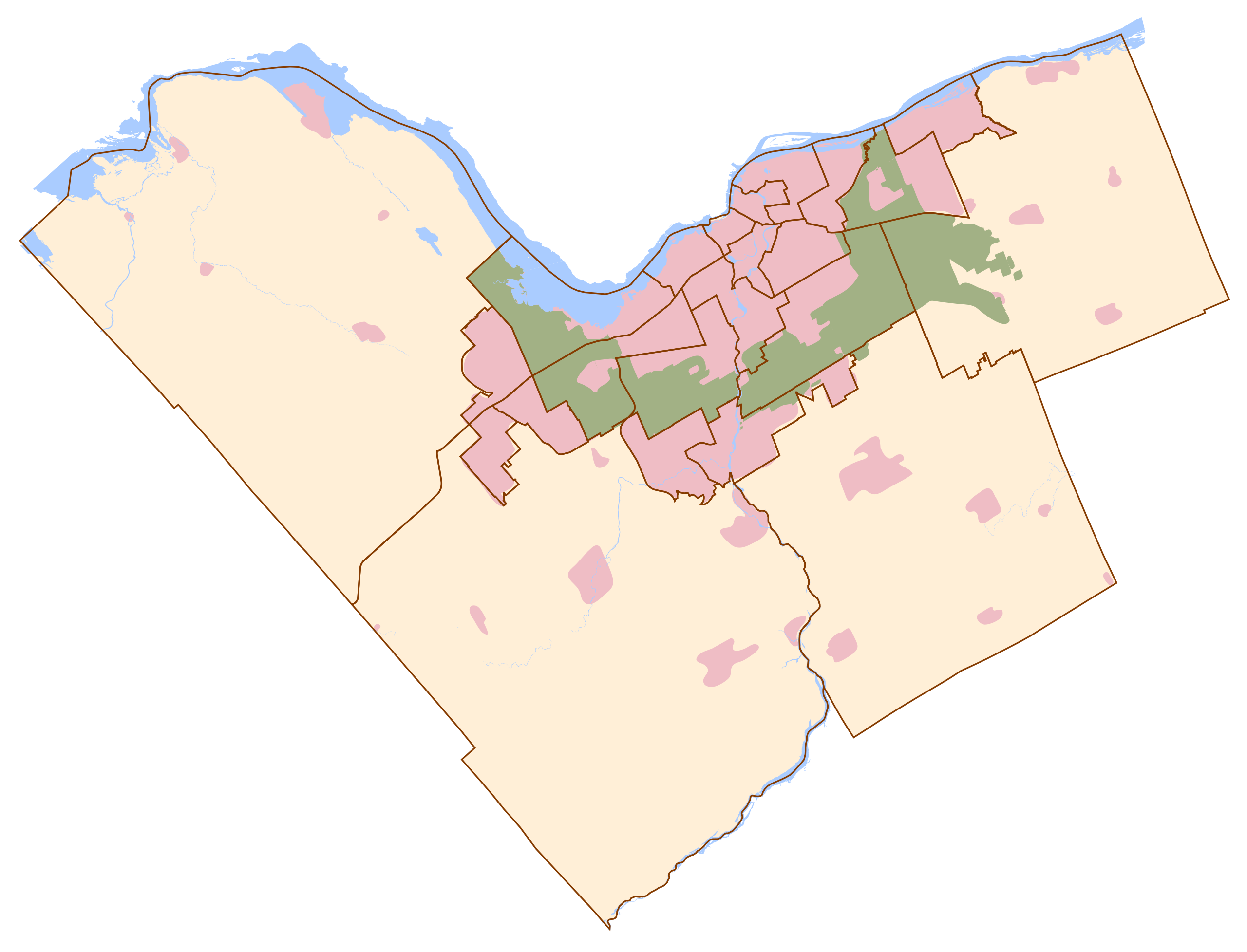
Français : Carte d'Ottawa
En rose : la zone urbaine et les villages alentours, En vert : la "ceinture verte", En jaune orangé : les autres zones, En bleu : les cours et points d'eau remarquables, Traits marron : limites administratives.English: Ottawa map
Rose : Urban zone and towns Green : Green belt, Yellow : Other zones, Blue : Water, Brown lines : Administrative boundary |
| Date | |
| Source | Own work |
| Author | Thibault Pelloquin |
Sources utilisées :
- http://www.ottawa.ca/residents/public_consult/rural_review/images/villages.jpg
- http://ottawa.ca/city_hall/ward/new_structure/final_map.pdf
Licensing[edit]
I, the copyright holder of this work, hereby publish it under the following license:
This file is licensed under the Creative Commons Attribution-Share Alike 3.0 Unported license.
- You are free:
- to share – to copy, distribute and transmit the work
- to remix – to adapt the work
- Under the following conditions:
- attribution – You must give appropriate credit, provide a link to the license, and indicate if changes were made. You may do so in any reasonable manner, but not in any way that suggests the licensor endorses you or your use.
- share alike – If you remix, transform, or build upon the material, you must distribute your contributions under the same or compatible license as the original.
File history
Click on a date/time to view the file as it appeared at that time.
| Date/Time | Thumbnail | Dimensions | User | Comment | |
|---|---|---|---|---|---|
| current | 19:52, 23 January 2012 | | 780 × 595 (1.12 MB) | TiboQorl (talk | contribs) | Ottawa : corrected urban zone - Zone urbaine corrigée |
| 19:41, 22 January 2012 |  | 780 × 595 (1.12 MB) | TiboQorl (talk | contribs) |
You cannot overwrite this file.
File usage on Commons
The following page uses this file:
File usage on other wikis
The following other wikis use this file:
- Usage on en.wikipedia.org
- Usage on fr.wikipedia.org
- Université d'Ottawa
- Environnement et Changement climatique Canada
- Affaires mondiales Canada
- Centre Canadian Tire
- Musée canadien de la guerre
- Diefenbunker
- Conseil privé du Roi pour le Canada
- Innovation, Sciences et Développement économique Canada
- Centre national des Arts
- Musée des beaux-arts du Canada
- Musée canadien de la nature
- Rideau Hall
- OC Transpo
- Conseil du trésor (Canada)
- Monument commémoratif de guerre du Canada
- Château Laurier
- Kanata
- TD Place Arena
- Pont de la Chaudière
- Centre Rideau
- Stade d'Ottawa
- Nonciature apostolique au Canada
- Stade Place TD
- Ambassade de France au Canada
- Chutes de la rivière Rideau
- Cabinet du Premier ministre
- Collège La Cité
- Bureau du Premier ministre et du Conseil privé
- Élections Canada
- Administration canadienne de la sûreté du transport aérien
- Ambassade d'Algérie au Canada
- École de gestion Telfer
- CJOH-DT
- Ministère des Finances (Canada)
- Utilisateur:TiboQorl/SandBox
- Modèle:Géolocalisation/Ottawa
- Wikipédia:Atelier graphique/Cartes/Archives/janvier 2012
- Capital City Speedway
- Maison Laurier
- Bureau du Conseil privé (Canada)
- Pont de la rue Bank
- Église presbytérienne Saint Andrew's
- Parc provincial de la Rivière-Rideau
- Place de la Confédération (Ottawa)
- Fusillade du 22 octobre 2014 à Ottawa
- Porte de la reine
- Édifice de la Confédération (Ottawa)
- Édifice de la Justice
- Édifice de la Cour suprême
View more global usage of this file.