File:Ovalau - Admiralty Chart No 2691 Fiji or Viti Group Surveyed By Commander C. Wilkes, Published 1859.png
Jump to navigation
Jump to search
No higher resolution available.
Ovalau_-_Admiralty_Chart_No_2691_Fiji_or_Viti_Group_Surveyed_By_Commander_C._Wilkes,_Published_1859.png (740 × 561 pixels, file size: 880 KB, MIME type: image/png)
Captions
Captions
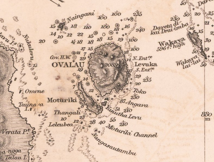
1859 Admiralty Chart - Fiji or Viti Group Surveyed By Commander C. Wilkes
Summary[edit]
| Description |
English: Fiji or Viti Group Surveyed By Commander C. Wilkes, U.S.N. 1840 Nandi Bay, Makongai, Ovalau, Moturiki, Mbatiki, Nairrai, Angau, Moala, Totoya, Matuku, & Kantuva Islands, By Captn. H.M. Denham, R. N. F.R.S. and the Officers of the H. M. S. Herald 1857. Cropped to show Ovalau and nearby islands and geographical features. |
||||||||||
| Date | |||||||||||
| Source | https://www.raremaps.com/gallery/detail/60134/fiji-or-viti-group-surveyed-by-commander-c-wilkes-usn-1-british-admiralty | ||||||||||
| Author |
|
||||||||||
| Other versions | |||||||||||

Licensing[edit]
|
This work is in the public domain in its country of origin and other countries and areas where the copyright term is the author's life plus 70 years or fewer. This work is in the public domain in the United States because it was published (or registered with the U.S. Copyright Office) before January 1, 1929. | |
| This file has been identified as being free of known restrictions under copyright law, including all related and neighboring rights. | |

|
This media file is uncategorized.
Please help improve this media file by adding it to one or more categories, so it may be associated with related media files (how?), and so that it can be more easily found.
Please notify the uploader with {{subst:Please link images|File:Ovalau - Admiralty Chart No 2691 Fiji or Viti Group Surveyed By Commander C. Wilkes, Published 1859.png}} ~~~~ |
File history
Click on a date/time to view the file as it appeared at that time.
| Date/Time | Thumbnail | Dimensions | User | Comment | |
|---|---|---|---|---|---|
| current | 11:58, 26 July 2023 | | 740 × 561 (880 KB) | Toweli (talk | contribs) | Uploaded a work by {{Creator:United Kingdom Hydrographic Office}} from https://www.raremaps.com/gallery/detail/60134/fiji-or-viti-group-surveyed-by-commander-c-wilkes-usn-1-british-admiralty with UploadWizard |
You cannot overwrite this file.
File usage on Commons
There are no pages that use this file.