File:Pątnów (gmina) location map.png

Original file (2,139 × 1,836 pixels, file size: 913 KB, MIME type: image/png)
Captions
Captions
Summary
[edit]_location_map.png&action=edit§ion=1)
| Description |
English: Location map |
| Date | |
| Source | Own work |
| Author | Smat |
| Description |
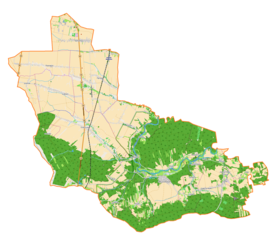
Polski: Mapa gminy Pątnów, Polska
English: Map of Pątnów (gmina), Poland |
|||||||||
| Date | ||||||||||
| Source | You may find a page on the OpenStreetMap wiki page for Pątnów (gmina) | |||||||||
| Creator |
OpenStreetMap contributors OpenStreetMap contributors |
|||||||||
| Permission (Reusing this file) |
OpenStreetMap data is available under the Open Database License (details). Map tiles are licensed under the Creative Commons Attribution-ShareAlike 2.0 license (CC-BY-SA 2.0).
This file is licensed under the Creative Commons Attribution-Share Alike 2.0 Generic license.
|
|||||||||
| Geotemporal data | ||||||||||
| Bounding box |
|
|||||||||
| Georeferencing | If inappropriate please set warp_status = skip to hide. | |||||||||
Licensing
[edit]_location_map.png&action=edit§ion=2)
| This work contains information from OpenStreetMap, which is made available under the Open Database License (ODbL).
The ODbL does not require any particular license for maps produced from ODbL data. Prior to 1 August 2020, map tiles produced by the OpenStreetMap Foundation were licensed under the CC-BY-SA-2.0 license. Maps produced by other people may be subject to other licences. |
File history
Click on a date/time to view the file as it appeared at that time.
| Date/Time | Thumbnail | Dimensions | User | Comment | |
|---|---|---|---|---|---|
| current | 10:57, 29 January 2018 | | 2,139 × 1,836 (913 KB) | Smat (talk | contribs) | User created page with UploadWizard |
You cannot overwrite this file.
File usage on Commons
The following page uses this file:
File usage on other wikis
The following other wikis use this file:
- Usage on de.wikipedia.org
- Usage on pl.wikipedia.org
- Dzietrzniki
- Bieniec (województwo łódzkie)
- Popowice (województwo łódzkie)
- Grębień
- Kałuże
- Załęcze Małe
- Załęcze Wielkie
- Pątnów (województwo łódzkie)
- Grabowa (powiat wieluński)
- Józefów (powiat wieluński)
- Kamionka (powiat wieluński)
- Kluski (powiat wieluński)
- Kępowizna
- Pątnów Wieluński
- Dzietrzniki (przystanek kolejowy)
- Troniny (województwo łódzkie)
- Gligi
- Bukowce (województwo łódzkie)
- Cieśle (powiat wieluński)
- Budziaki (województwo łódzkie)
- Madeły
- Parafia św. Jana Apostoła i Ewangelisty w Pątnowie
- Źródła (województwo łódzkie)
- Stara Wieś (powiat wieluński)
- Cisowa (powiat wieluński)
- Zamłynie (powiat wieluński)
- Kubery
- Parafia Najświętszego Serca Jezusowego w Dzietrznikach
- Moduł:Mapa/dane/Pątnów (gmina)
- Kościół Najświętszego Serca Jezusowego w Dzietrznikach
- Kościół Matki Boskiej Częstochowskiej w Załęczu Wielkim
- Kościół Wszystkich Świętych w Popowicach
- Kościół św. Jana Apostoła i Ewangelisty w Pątnowie
- Młyn w Kępowiźnie
- Usage on pl.wikibooks.org
- Usage on www.wikidata.org
_location_map.png&oldid=837910711)