File:PIA04256 Map of Martian Silicon at Mid-Latitudes.jpg
跳转到导航
跳转到搜索

本预览的尺寸:800 × 360像素。 其他分辨率:320 × 144像素 | 640 × 288像素 | 1,024 × 461像素 | 2,065 × 929像素。
原始文件 (2,065 × 929像素,文件大小:170 KB,MIME类型:image/jpeg)
说明
说明
添加一行文字以描述该文件所表现的内容
摘要
[编辑]| 描述 |
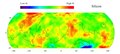
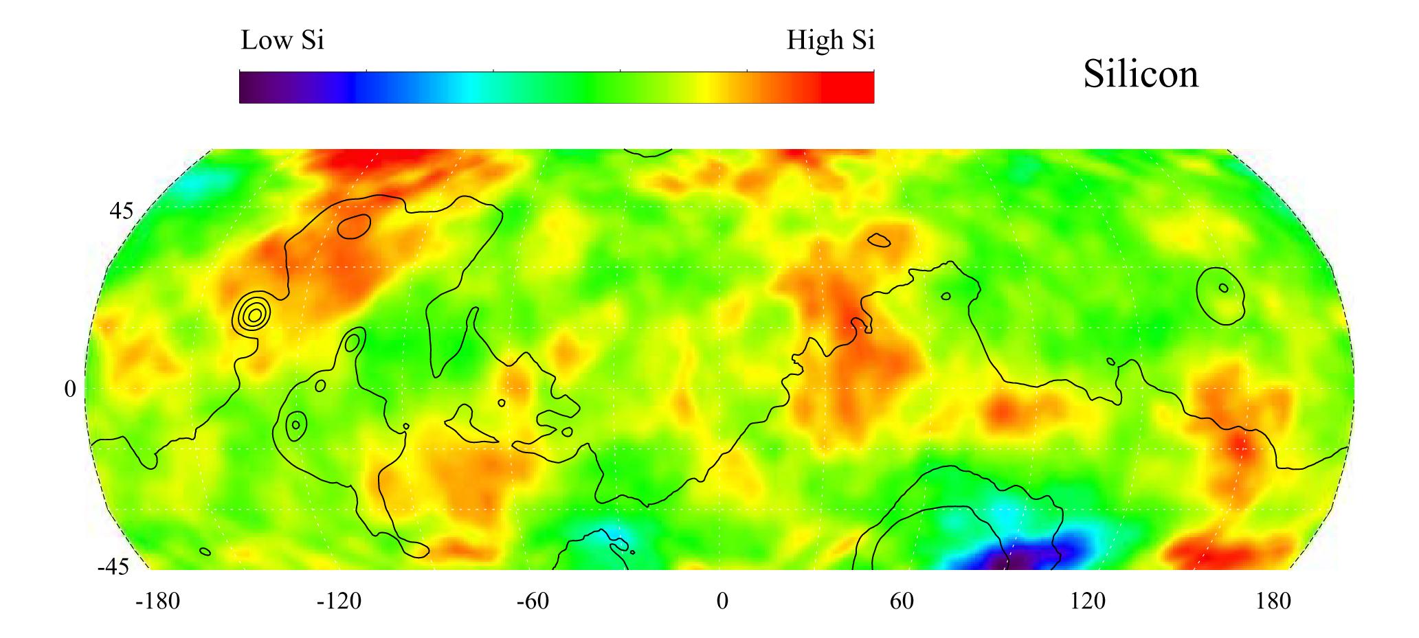
English: This gamma ray spectrometer map of the mid-latitude region of Mars is based on gamma-rays from the element silicon. Silicon is one of the most abundant elements on the surface of both Mars and Earth (second only to oxygen). The most extensive region of highest silicon content, shown in red, is located in the high latitudes north of Tharsis (centered near 45 degrees latitude, -120 degrees longitude). The area of lowest silicon content, shown in blue, lies just to the east of the Hellas Basin (-45 degrees latitude, 90 degrees longitude). Contours of constant surface elevation are also shown. The long continuous contour line running from east to west marks the approximate separation of the younger lowlands in the north from the older highlands in the south.
NASA's Jet Propulsion Laboratory manages the 2001 Mars Odyssey mission for NASA's Office of Space Science, Washington, D.C. The gamma ray spectrometer was provided by the University of Arizona, Tucson. Lockheed Martin Astronautics, Denver, Colo., is the prime contractor for the project, and developed and built the orbiter. Mission operations are conducted jointly from Lockheed Martin and from JPL, a division of the California Institute of Technology in Pasadena. |
| 日期 | (published) |
| 来源 | Catalog page · Full-res (JPEG · TIFF) |
| 作者 | NASA/JPL/University of Arizona |
| 其他版本 |
|

| 此标签不表示文件的著作权状态。任何文件在附有此标签的同時还需要一个有效的著作权标签。请参阅许可协议说明页面以了解更多信息。 其他语言:
|
| This media is a product of the 2001 Mars Odyssey mission Credit and attribution belongs to the Gamma Ray Spectrometer (GRS) team, NASA/JPL/University of Arizona |
许可协议
[编辑]
| 本文件完全由NASA创作,在美国属于公有领域。根据NASA的版权方针,NASA的材料除非另有声明否则不受版权保护。(参见Template:PD-USGov/zh、NASA版权方针页面或JPL图片使用方针。) | ||
 |
警告:
|
原始上传日志
[编辑]
The original description page was here. All following user names refer to en.wikipedia.
- 2010-09-15 03:17 Schaffman 2065×929× (173637 bytes) {{Information |Description = Silicon Map of Mars |Source = JPL Photojournal http://photojournal.jpl.nasa.gov/catalog/PIA04256 |Date = ~~~~~ |Author = University of Arizona |Permission = JPL Public Use Policy |other_v
文件历史
点击某个日期/时间查看对应时刻的文件。
| 日期/时间 | 缩略图 | 大小 | 用户 | 备注 | |
|---|---|---|---|---|---|
| 当前 | 2011年9月21日 (三) 19:49 | | 2,065 × 929(170 KB) | File Upload Bot (Magnus Manske)(留言 | 贡献) | {{BotMoveToCommons|en.wikipedia|year={{subst:CURRENTYEAR}}|month={{subst:CURRENTMONTHNAME}}|day={{subst:CURRENTDAY}}}} {{Information |Description={{en|Silicon Map of Mars}} |Source=Transferred from [http://en.wikipedia.org en.wikipedia]; transferred to C |
您不可以覆盖此文件。
文件用途
以下3个页面使用本文件:
全域文件用途
以下其他wiki使用此文件:
- ca.wikipedia.org上的用途
- en.wikipedia.org上的用途
- en.wikiversity.org上的用途
- es.wikipedia.org上的用途
- no.wikipedia.org上的用途
- sv.wikipedia.org上的用途
- uk.wikipedia.org上的用途
- zh.wikipedia.org上的用途