File:Pabuk 2019-01-04 0640Z.jpg
跳去導覽
跳去搵嘢

預覽大細:450 × 600 像素。 第啲解像度:180 × 240 像素 | 360 × 480 像素 | 576 × 768 像素 | 768 × 1,024 像素 | 1,536 × 2,048 像素 | 4,800 × 6,400 像素。
原本檔案 (4,800 × 6,400 像素,檔案大細:8.08 MB ,MIME類型:image/jpeg)
Captions
Captions
Add a one-line explanation of what this file represents
摘要
[編輯]
| 描述 |
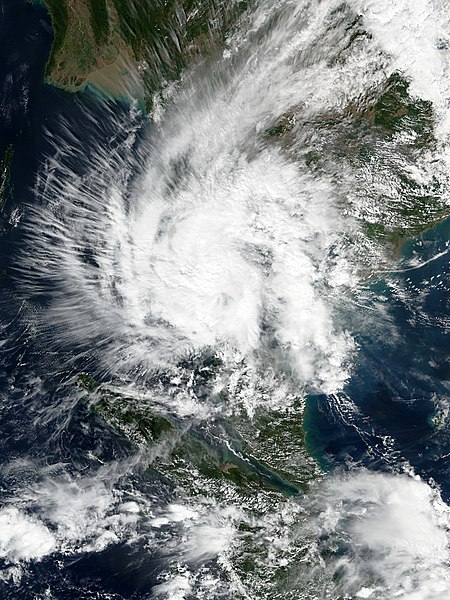
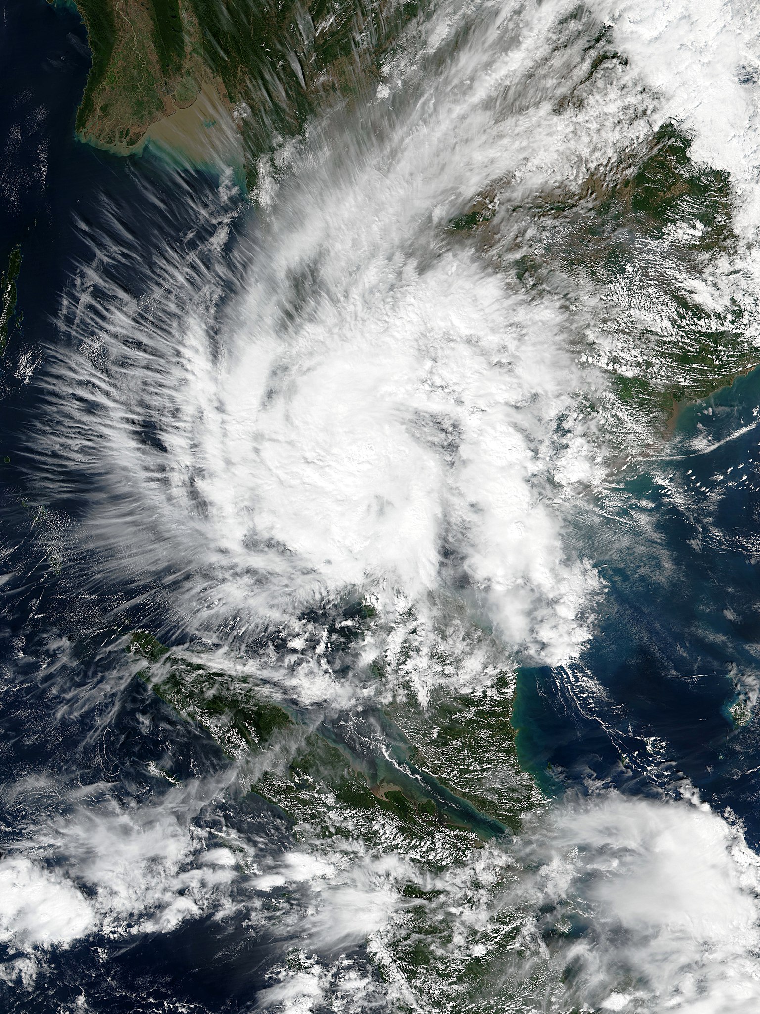
English: Tropical Storm Pabuk making landfall over southern Thailand at peak intensity on January 4, 2019. |
| 日期 | |
| 來源 | EOSDIS Worldview |
| 作者 | VIIRS image captured by NOAA’s Suomi NPP satellite |
| Camera location | | View this and other nearby images on: OpenStreetMap |
|---|
協議
[編輯]
| This file is in the public domain in the United States because it was solely created by NASA. NASA copyright policy states that "NASA material is not protected by copyright unless noted". (See Template:PD-USGov, NASA copyright policy page or JPL Image Use Policy.) | ||
 |
Warnings:
|
檔案歷史
撳個日期/時間去睇響嗰個時間出現過嘅檔案。
| 日期/時間 | 縮圖 | 尺寸 | 用戶 | 註解 | |
|---|---|---|---|---|---|
| 現時 | 2019年1月4號 (五) 15:47 | | 4,800 × 6,400(8.08 MB) | Meow(傾偈 | 貢獻) | User created page with UploadWizard |
你無得衾咗個檔案。
檔案用途
全域檔案使用情況
下面嘅維基都用緊呢個檔案:
- de.wikipedia.org嘅使用情況
- en.wikipedia.org嘅使用情況
- es.wikipedia.org嘅使用情況
- ja.wikipedia.org嘅使用情況
- ko.wikipedia.org嘅使用情況
- ms.wikipedia.org嘅使用情況
- pt.wikipedia.org嘅使用情況
- simple.wikipedia.org嘅使用情況
- th.wikipedia.org嘅使用情況
- vi.wikipedia.org嘅使用情況
- zh-yue.wikipedia.org嘅使用情況
- zh.wikipedia.org嘅使用情況