File:Pacific Ocean.png
Aller à la navigation
Aller à la recherche
Pas de plus haute résolution disponible.
Pacific_Ocean.png (330 × 330 pixels, taille du fichier : 28 kio, type MIME : image/png)
Légendes
Légendes
Ajoutez en une ligne la description de ce que représente ce fichier
Description[modifier]
| Description |
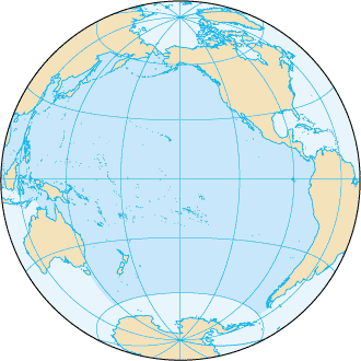
English: Pacific Ocean map, tagged in English |
| Date | |
| Source | CIA World Factbook |
| Auteur | CIA World Factbook |
| Autres versions |
Œuvres dérivées de ce fichier : |
.png)

|
Cette image (de type locator map) devrait être recréée dans un format vectoriel, en tant que fichier SVG. Cela offrirait plusieurs avantages : voir Commons:Media for cleanup pour plus d'informations. Si une version SVG de cette image est déjà disponible, merci de bien vouloir l'envoyer. Après cela, remplacez ce modèle par {{vector version available|nouveau nom d'image.svg}}.
|
Conditions d’utilisation[modifier]
Cette image est dans le domaine public parce que son contenu provient du World Factbook, édité par la Central Intelligence Agency des États-Unis d’Amérique.
|
 |
Journal des téléversements d’origine[modifier]
La page de description originale était ici. Tous les noms d'utilisateur qui suivent se rapportent à en.wikipedia.
This file was originaly uploaded to en.wikipedia as File:Pacificocean.PNG, if you have access to the deleted history, you could to complete this field.
Historique du fichier
Cliquer sur une date et heure pour voir le fichier tel qu'il était à ce moment-là.
| Date et heure | Vignette | Dimensions | Utilisateur | Commentaire | |
|---|---|---|---|---|---|
| actuel | 27 août 2019 à 19:33 | | 330 × 330 (28 kio) | Kaldari (d | contributions) | removing black triagle |
| 27 août 2019 à 19:16 |  | 330 × 330 (14 kio) | Kaldari (d | contributions) | Reverting sloppy background removal leaving jagged edges, and also to be consistent with other ocean maps | |
| 30 juillet 2019 à 10:11 |  | 330 × 330 (13 kio) | Aplaice (d | contributions) | Reduce file size back to previous levels (from 2009) while keeping transparent background (as in 2017). | |
| 21 juin 2017 à 15:47 |  | 330 × 330 (98 kio) | Wiki test 0001 (d | contributions) | Underground the change Surrounding background. | |
| 22 août 2009 à 20:16 |  | 330 × 330 (14 kio) | Serg!o (d | contributions) | language neutral map | |
| 4 décembre 2004 à 22:52 |  | 330 × 330 (17 kio) | Alfio (d | contributions) | Pacific Ocean map |
Vous ne pouvez pas remplacer ce fichier.
Utilisations locales du fichier
Les 8 pages suivantes utilisent ce fichier :
Utilisations du fichier sur d’autres wikis
Les autres wikis suivants utilisent ce fichier :
- Utilisation sur ab.wikipedia.org
- Utilisation sur af.wikipedia.org
- Utilisation sur arc.wikipedia.org
- Utilisation sur ar.wikipedia.org
- Utilisation sur arz.wikipedia.org
- Utilisation sur ast.wikipedia.org
- Utilisation sur as.wikipedia.org
- Utilisation sur av.wikipedia.org
- Utilisation sur az.wikipedia.org
- Utilisation sur az.wiktionary.org
- Utilisation sur ba.wikipedia.org
- Utilisation sur bcl.wikipedia.org
- Utilisation sur be-tarask.wikipedia.org
- Utilisation sur be.wikipedia.org
- Рапануі (востраў)
- Ціхі акіян
- Спіс аб’ектаў Сусветнай спадчыны ЮНЕСКА ў Аўстраліі
- Вялікі бар’ерны рыф
- Сіднейскі оперны тэатр
- Востраў Херд і астравы Мак-Доналд
- Лорд-Хау
- Болс-Пірамід
- Нацыянальны парк Какаду
- Дажджавыя лясы ўсходняга ўзбярэжжа Аўстраліі
- Фрэйзер (востраў)
- Шаблон:Сусветная спадчына ў Акіяніі
- Галапагас
- Уіландра
- Спіс аб’ектаў Сусветнай спадчыны ЮНЕСКА ў Папуа — Новай Гвінеі
- Спіс аб’ектаў Сусветнай спадчыны ЮНЕСКА ў Вануату
- Хендэрсан (востраў)
- Макуоры
- Фенікс (астравы)
- Какос (востраў)
- Бікіні (атол)
- Старажытнае земляробчае паселішча Кук
Voir davantage sur l’utilisation globale de ce fichier.