File:Palau Koror-Babeldaob bridge map-fr.svg
Jump to navigation
Jump to search

Size of this PNG preview of this SVG file: 763 × 552 pixels. Other resolutions: 320 × 232 pixels | 640 × 463 pixels | 1,024 × 741 pixels | 1,280 × 926 pixels | 2,560 × 1,852 pixels.
Original file (SVG file, nominally 763 × 552 pixels, file size: 334 KB)
Captions
Captions
Add a one-line explanation of what this file represents
Summary[edit]
| Description |
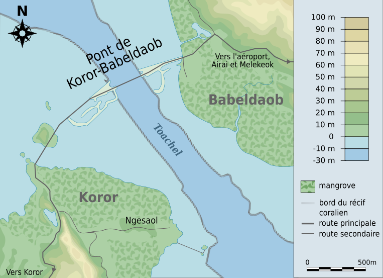
English: Map of the Koror-Babeldaob bridge in Palau Français : Carte du pont Koror-Babeldaob à Palau |
| Date | (UTC) |
| Source | Palau_Koror-Babeldaob_bridge_map.png, map of the Perry-Castañeda Library Map Collection made by the US Geological Survey. |
| Author | Pethrus (talk) |
| This is a retouched picture, which means that it has been digitally altered from its original version. Modifications: vectorization, cropped. The original can be viewed here: Palau Koror-Babeldaob bridge map.png:
|
I, the copyright holder of this work, hereby publish it under the following licenses:

|
Permission is granted to copy, distribute and/or modify this document under the terms of the GNU Free Documentation License, Version 1.2 or any later version published by the Free Software Foundation; with no Invariant Sections, no Front-Cover Texts, and no Back-Cover Texts. A copy of the license is included in the section entitled GNU Free Documentation License. |
This file is licensed under the Creative Commons Attribution-Share Alike Attribution-Share Alike 4.0 International, 3.0 Unported, 2.5 Generic, 2.0 Generic and 1.0 Generic license.
- You are free:
- to share – to copy, distribute and transmit the work
- to remix – to adapt the work
- Under the following conditions:
- attribution – You must give appropriate credit, provide a link to the license, and indicate if changes were made. You may do so in any reasonable manner, but not in any way that suggests the licensor endorses you or your use.
- share alike – If you remix, transform, or build upon the material, you must distribute your contributions under the same or compatible license as the original.
You may select the license of your choice.
Original upload log[edit]
This image is a derivative work of the following images:
- File:Palau_Koror-Babeldaob_bridge_map.png licensed with PD-USGov-USGS
- 2010-03-08T15:24:01Z Pethrus 844x680 (1469705 Bytes) {{Information |Description={{en|Map of the Koror-Babeldaob bridge in Palau}}{{fr|Carte du pont Koror-Babeldaob à Palau}} |Source=Maps of the [http://www.lib.utexas.edu/maps/palau.html Perry-Castañeda Library Map Collection]
Uploaded with derivativeFX
File history
Click on a date/time to view the file as it appeared at that time.
| Date/Time | Thumbnail | Dimensions | User | Comment | |
|---|---|---|---|---|---|
| current | 10:56, 10 March 2010 | | 763 × 552 (334 KB) | Pethrus (talk | contribs) | Added legend, roads direction arrows, corrected topography, added coral reef border, added missing lacke, added village name |
| 22:33, 9 March 2010 |  | 590 × 557 (205 KB) | Pethrus (talk | contribs) | {{Information |Description={{en|Map of the Koror-Babeldaob bridge in Palau}}{{fr|Carte du pont Koror-Babeldaob à Palau}} |Source=File:Palau_Koror-Babeldaob_bridge_map.png, map of the [http://www.lib.utexas.edu/maps/palau.html Perry-Castañeda Libra |
You cannot overwrite this file.
File usage on Commons
The following page uses this file:
File usage on other wikis
The following other wikis use this file:
- Usage on fr.wikipedia.org