File:Palestine Potash Limited, Sketch map of Wadi el Hasa.Dead sea south (FL147448619 4130087).jpg
Jump to navigation
Jump to search

Size of this preview: 800 × 417 pixels. Other resolutions: 320 × 167 pixels | 640 × 333 pixels | 1,024 × 534 pixels | 1,280 × 667 pixels | 2,560 × 1,334 pixels | 17,282 × 9,004 pixels.
Original file (17,282 × 9,004 pixels, file size: 161.42 MB, MIME type: image/jpeg)
Captions
Captions
Add a one-line explanation of what this file represents
Summary
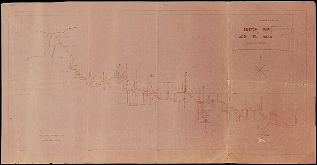
[edit]| Palestine Potash Limited: Sketch map of Wadi el Hasa.Dead sea south
( |
||||||||||||||||||||||||
|---|---|---|---|---|---|---|---|---|---|---|---|---|---|---|---|---|---|---|---|---|---|---|---|---|
| Artist |
|
|||||||||||||||||||||||
| Title |
Sketch map of Wadi el Hasa.Dead sea south |
|||||||||||||||||||||||
| Publisher |
publisher not identified |
|||||||||||||||||||||||
| Description |
Sketch map of Wadi el Hasa : Dead sea south. Palestine potash ltd. |
|||||||||||||||||||||||
| Language | English | |||||||||||||||||||||||
| Publication date | 1942 possibly | |||||||||||||||||||||||
| Medium | 1 sheet ; | |||||||||||||||||||||||
| Dimensions | height: 37 cm (14.5 in); width: 73 cm (28.7 in) | |||||||||||||||||||||||
| Collection |
|
|||||||||||||||||||||||
| Current location |
|
|||||||||||||||||||||||
| Place of publication | unknown | |||||||||||||||||||||||
| search Merhav catalog | unknown | |||||||||||||||||||||||
| Notes | Blueprint.; Drawing no. W.H. 21. | |||||||||||||||||||||||
| scale | 1:50,000 cm | |||||||||||||||||||||||
| IE PID | IE147448616 | |||||||||||||||||||||||
| Rosetta filename | FL147448619 | |||||||||||||||||||||||
| NNL item ID (P3959) | 990041300870205171 | |||||||||||||||||||||||
| search Merhav catalog | English, Palestine Potash Limited | |||||||||||||||||||||||
| search Merhav catalog | publisher not identified | |||||||||||||||||||||||
| Source/Photographer |
|
|||||||||||||||||||||||
| Other versions | ||||||||||||||||||||||||
| Jpg / Tif version |
|
|||||||||||||||||||||||

.jpg)

.jpg&action=edit§ion=1)
Licensing
[edit].jpg&action=edit§ion=2)
This work is in the public domain in the United States because it is a work prepared by an officer or employee of the United States Government as part of that person’s official duties under the terms of Title 17, Chapter 1, Section 105 of the US Code.
Note: This only applies to original works of the Federal Government and not to the work of any individual U.S. state, territory, commonwealth, county, municipality, or any other subdivision. This template also does not apply to postage stamp designs published by the United States Postal Service since 1978. (See § 313.6(C)(1) of Compendium of U.S. Copyright Office Practices). It also does not apply to certain US coins; see The US Mint Terms of Use.
|
 | |
| This file has been identified as being free of known restrictions under copyright law, including all related and neighboring rights. | ||
File history
Click on a date/time to view the file as it appeared at that time.
| Date/Time | Thumbnail | Dimensions | User | Comment | |
|---|---|---|---|---|---|
| current | 20:25, 3 September 2023 | | 17,282 × 9,004 (161.42 MB) | Geagea (talk | contribs) | pattypan 22.03 |
You cannot overwrite this file.
File usage on Commons
The following page uses this file:
.jpg&oldid=798227588)