File:Pam.Deska.Bohumil.Sirinek.Hotel.Beranek.Praha.jpg
Jump to navigation
Jump to search
Size of this preview: 800 × 600 pixels. Other resolutions: 320 × 240 pixels | 640 × 480 pixels | 1,024 × 768 pixels | 1,280 × 960 pixels | 2,560 × 1,920 pixels | 4,608 × 3,456 pixels.
Original file (4,608 × 3,456 pixels, file size: 5.44 MB, MIME type: image/jpeg)
Captions
Captions
Add a one-line explanation of what this file represents
Summary[edit]
| Description |
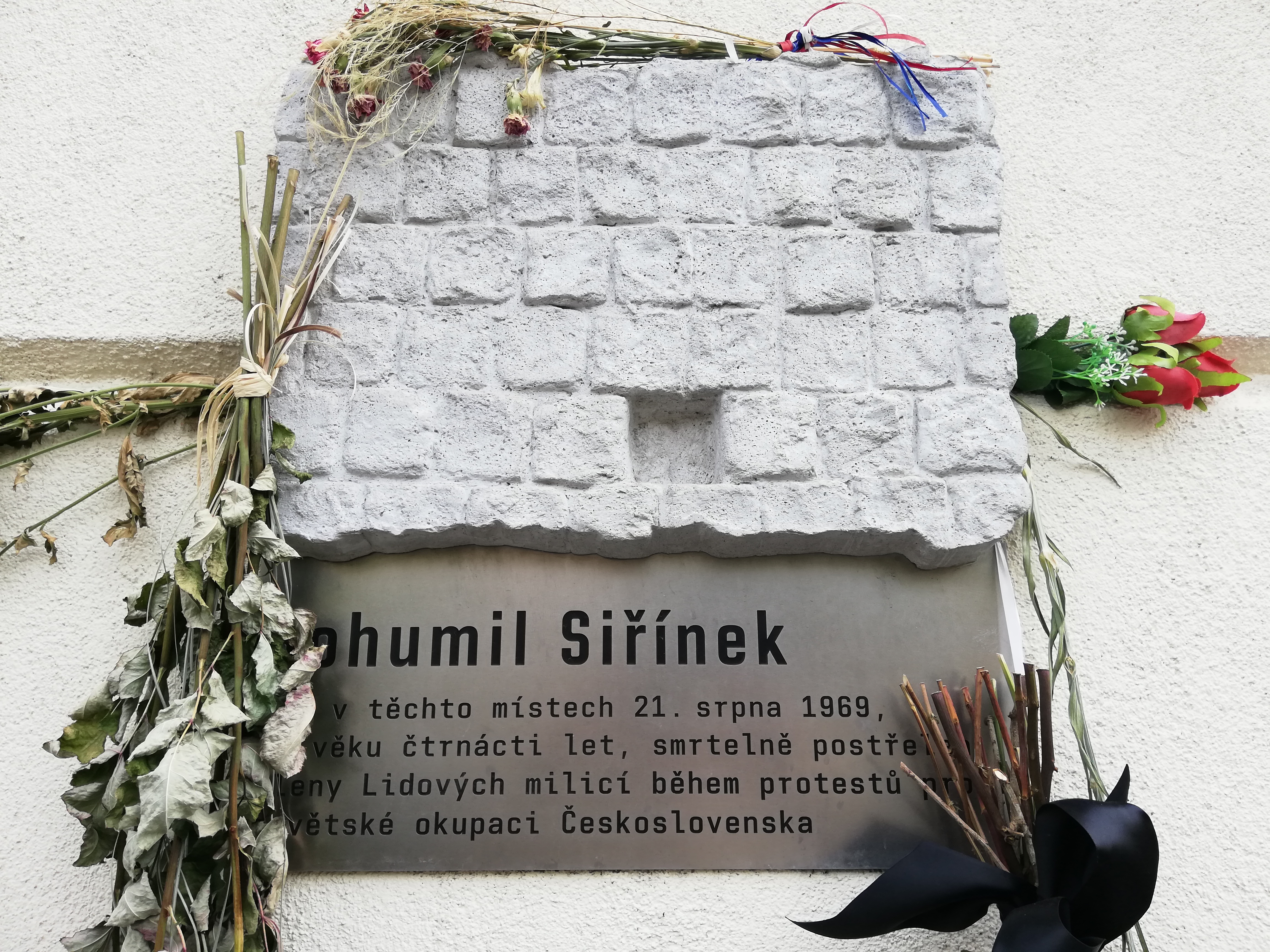
Čeština: * V Praze dne 21. srpna 1969 bylo 15 postřelených a poblíž Tylova náměstí (v bezprostřední blízkosti kliniky v Londýnské ulici na Vinohradech) byl střelbou ze samopalu smrtelně zraněn ozbrojenými milicionáři i čtrnáctiletý žák základní školy z jižních Čech Bohumil Siřínek (* 23. dubna 1955 – † 24. srpna 1969, Praha). Pamětní deska umístěná na vnější zdi hotelu Beránek (adresa: Praha 2, Bělehradská 478/110).
English: * In Prague (on August 21, 1969) 15 people were shot and near Tylovo Square (near the clinic in Londýnská street in Vinohrady), a 14-year-old elementary school pupil from South Bohemia Bohumil Siřínek (* 23 April 1955 - † August 24, 1969, Prague) was fatally wounded by gunfire from armed People's militiamen. The memorial Plaque is on the outer wall of the hotel Beránek (address: Prague 2, Bělehradská 478/110).
|
| Date | |
| Source | Own work |
| Author | Mojmir Churavy |
| Camera location | | View this and other nearby images on: OpenStreetMap |
|---|
Licensing[edit]
I, the copyright holder of this work, hereby publish it under the following license:
This file is licensed under the Creative Commons Attribution-Share Alike 4.0 International license.
- You are free:
- to share – to copy, distribute and transmit the work
- to remix – to adapt the work
- Under the following conditions:
- attribution – You must give appropriate credit, provide a link to the license, and indicate if changes were made. You may do so in any reasonable manner, but not in any way that suggests the licensor endorses you or your use.
- share alike – If you remix, transform, or build upon the material, you must distribute your contributions under the same or compatible license as the original.
File history
Click on a date/time to view the file as it appeared at that time.
| Date/Time | Thumbnail | Dimensions | User | Comment | |
|---|---|---|---|---|---|
| current | 11:58, 28 August 2019 | | 4,608 × 3,456 (5.44 MB) | Mojmir Churavy (talk | contribs) | User created page with UploadWizard |
You cannot overwrite this file.
File usage on Commons
There are no pages that use this file.
File usage on other wikis
The following other wikis use this file:
- Usage on cs.wikipedia.org
- Usage on www.wikidata.org