File:Panissars1.jpg
Jump to navigation
Jump to search

Size of this preview: 800 × 560 pixels. Other resolutions: 320 × 224 pixels | 640 × 448 pixels | 1,024 × 717 pixels | 1,280 × 896 pixels | 2,560 × 1,791 pixels | 3,957 × 2,769 pixels.
Original file (3,957 × 2,769 pixels, file size: 7.32 MB, MIME type: image/jpeg)
Captions
Captions
Add a one-line explanation of what this file represents
Summary
[edit]
| Description |
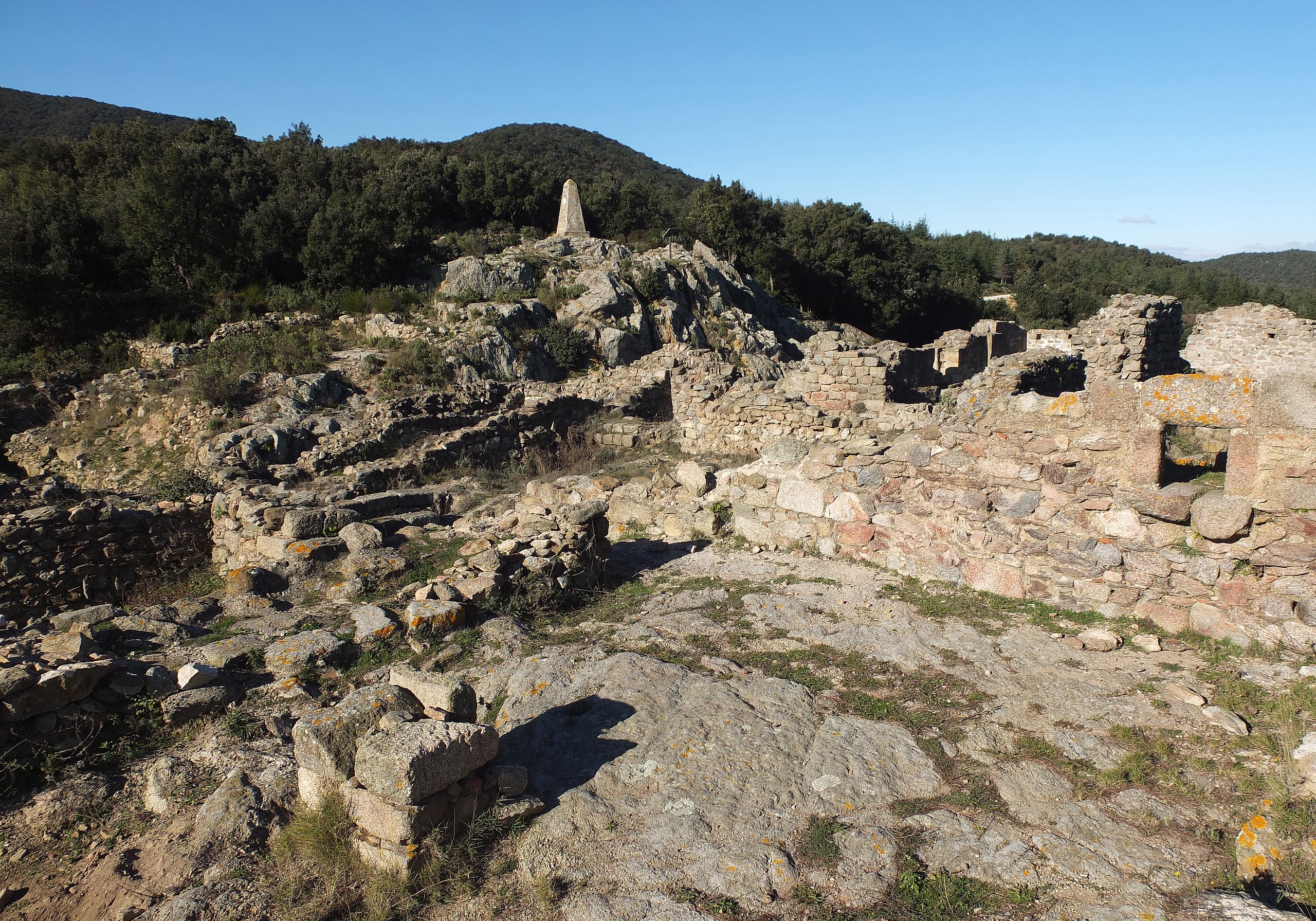
English: Archaeological site of Panissars at the Roman crossroads of Via Domitia and Via Augusta, ruins of the 11th ctry. monastery "Santa Maria de Panissars" near Le Perthus, France. |
| Date | |
| Source | Own work |
| Author | Palauenc05 |
| Object location | | View this and other nearby images on: OpenStreetMap |
|---|
|
This building is classé au titre des monuments historiques de la France. It is indexed in the base Mérimée, a database of architectural heritage maintained by the French Ministry of Culture, under the reference PA66000022
|

|
This image has been assessed under the valued image criteria and is considered the most valued image on Commons within the scope: Archaeological site of Panissars near Le Perthus, France.. You can see its nomination here. |
Licensing
[edit]
I, the copyright holder of this work, hereby publish it under the following license:
This file is licensed under the Creative Commons Attribution-Share Alike 4.0 International license.
- You are free:
- to share – to copy, distribute and transmit the work
- to remix – to adapt the work
- Under the following conditions:
- attribution – You must give appropriate credit, provide a link to the license, and indicate if changes were made. You may do so in any reasonable manner, but not in any way that suggests the licensor endorses you or your use.
- share alike – If you remix, transform, or build upon the material, you must distribute your contributions under the same or compatible license as the original.
File history
Click on a date/time to view the file as it appeared at that time.
| Date/Time | Thumbnail | Dimensions | User | Comment | |
|---|---|---|---|---|---|
| current | 17:28, 8 January 2017 | | 3,957 × 2,769 (7.32 MB) | Palauenc05 (talk | contribs) | Slight corrections. |
| 22:48, 5 January 2017 |  | 3,917 × 2,921 (9.01 MB) | Palauenc05 (talk | contribs) | User created page with UploadWizard |
You cannot overwrite this file.
File usage on Commons
The following 2 pages use this file:
File usage on other wikis
The following other wikis use this file:
- Usage on de.wikipedia.org
- Usage on fr.wikipedia.org