File:Panoramaaussicht vom Gipfel des Pizzo Bombögn (51752617651).jpg
Jump to navigation
Jump to search
Size of this preview: 800 × 176 pixels. Other resolutions: 320 × 70 pixels | 640 × 141 pixels | 1,024 × 225 pixels | 1,280 × 281 pixels | 4,912 × 1,080 pixels.
Original file (4,912 × 1,080 pixels, file size: 1.23 MB, MIME type: image/jpeg)
Captions
Captions
Add a one-line explanation of what this file represents
Summary
[edit].jpg&action=edit§ion=1)
| Description |
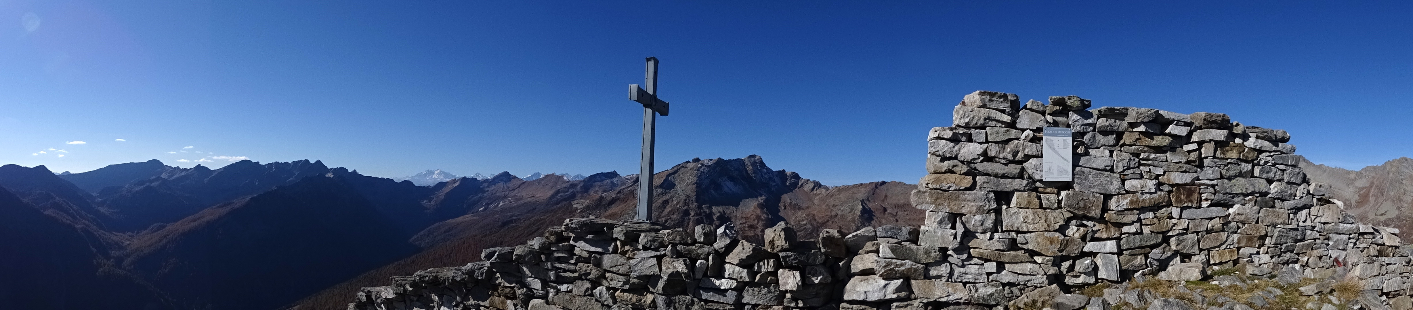
Wanderung von Cimalmotto (1405 m.ü.M.) über Campo (1321m.ü.M.) auf den Gipfel des Pizzo Bombögn (2331 m.ü.M.). Weiter über Alpe Quadrella (1800 m.ü.M.) zurück nach Cimalmotto. Bekannt ist der Pizzo Bombögn vor allem durch seine etwa 300 Meter lange Trockensteinmauer die sich auf den letzten etwa 150 Höhenmetern steil bis zum Gipfel zieht. Die 1948 gebaute Mauer sollte Ziegen daran hindern in benachbarten Hangbereichen zu fressen und die Grasnarbe zu zerstören. |
| Date | |
| Source | Panoramaaussicht vom Gipfel des Pizzo Bombögn |
| Author | Uwe Häntsch from Schluchsee, Germany |
| Camera location | | View this and other nearby images on: OpenStreetMap |
|---|
.jpg¶ms=046.304613_N_0008.497183_E_globe:Earth_type:camera_source:Flickr_&language=en)
Licensing
[edit].jpg&action=edit§ion=2)
This file is licensed under the Creative Commons Attribution-Share Alike 2.0 Generic license.
- You are free:
- to share – to copy, distribute and transmit the work
- to remix – to adapt the work
- Under the following conditions:
- attribution – You must give appropriate credit, provide a link to the license, and indicate if changes were made. You may do so in any reasonable manner, but not in any way that suggests the licensor endorses you or your use.
- share alike – If you remix, transform, or build upon the material, you must distribute your contributions under the same or compatible license as the original.
| This image was originally posted to Flickr by uwelino at https://flickr.com/photos/84143066@N00/51752617651. It was reviewed on 17 December 2021 by FlickreviewR 2 and was confirmed to be licensed under the terms of the cc-by-sa-2.0. |
File history
Click on a date/time to view the file as it appeared at that time.
| Date/Time | Thumbnail | Dimensions | User | Comment | |
|---|---|---|---|---|---|
| current | 18:01, 17 December 2021 | 4,912 × 1,080 (1.23 MB) | Mosbatho (talk | contribs) | Transferred from Flickr via #flickr2commons |
You cannot overwrite this file.
File usage on Commons
There are no pages that use this file.
.jpg&oldid=896189489)