File:Paragorgia arborea bubblegum.jpg
Jump to navigation
Jump to search
Size of this preview: 800 × 450 pixels. Other resolutions: 320 × 180 pixels | 640 × 360 pixels | 1,024 × 576 pixels | 1,280 × 720 pixels | 1,920 × 1,080 pixels.
Original file (1,920 × 1,080 pixels, file size: 1.26 MB, MIME type: image/jpeg)
Captions
Captions
Add a one-line explanation of what this file represents
Summary
[edit]
| Description |
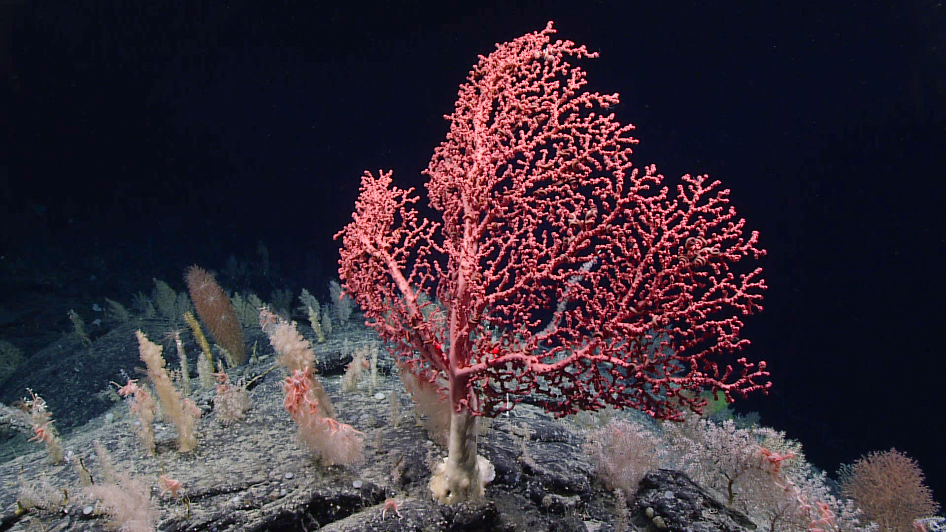
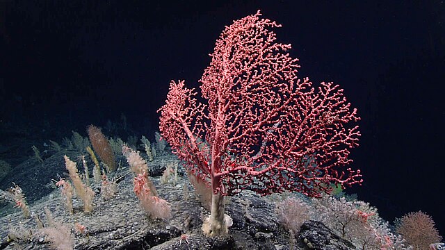
English: This large bubblegum coral (Paragorgia arborea) was observed during Dive 19 of the 2021 North Atlantic Stepping Stones expedition. Based on published radial growth rates for this species, this colony is approximately 100 years old! We saw several large coral colonies during the dive, prompting one of our on-shore scientists to refer to the dive site as“the land of giants.” |
| Date | |
| Source | https://oceanexplorer.noaa.gov/multimedia/daily-image/media/20211218.html |
| Author | NOAA |
| Camera location | | View this and other nearby images on: OpenStreetMap |
|---|
Licensing
[edit]
This image is in the public domain because it contains materials that originally came from the U.S. National Oceanic and Atmospheric Administration, taken or made as part of an employee's official duties.
|
File history
Click on a date/time to view the file as it appeared at that time.
| Date/Time | Thumbnail | Dimensions | User | Comment | |
|---|---|---|---|---|---|
| current | 05:49, 4 September 2023 | | 1,920 × 1,080 (1.26 MB) | TheTechnician27 (talk | contribs) | Uploaded a work by NOAA from https://oceanexplorer.noaa.gov/multimedia/daily-image/media/20211218.html with UploadWizard |
You cannot overwrite this file.
File usage on Commons
There are no pages that use this file.