File:Paris - Église du Saint-Esprit - Orgue.jpg

Original file (1,700 × 1,134 pixels, file size: 697 KB, MIME type: image/jpeg)
Captions
Captions
Summary
[edit]
| Description |
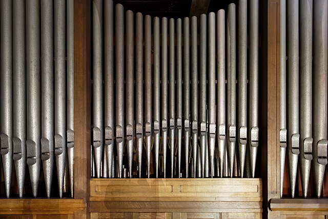
Français : Église du Saint-Esprit, Paris, France : Le projet de grand orgue : en 1933, Albert Alain, père de l’interprète Marie-Claire Alain et du compositeur Jehan Alain, avait prévu la construction de deux orgues : un grand orgue situé au-dessus du portail de l’église et un orgue d’accompagnement - l’orgue actuel - situé au-dessus du déambulatoire ouest. Faute de crédits, seul le petit orgue fut réalisé.
Construit en 1934 par Gloton-Debierre d’après un plan de Albert Alain, cet orgue fut inauguré par Jehan Alain en décembre 1934. A l’occasion d’un relevage général en 1968, le plein jeu du récit fut transféré au grand-orgue et remplacé par une cymbale. C’est en 1985 que de nombreux travaux furent effectués, avec un léger réaménagement des plans sonores, réalisés par le facteur d’orgues Jean-Marc Cicchero. Sa composition actuelle, inchangée depuis, est de 16 jeux réels et un emprunt. I. Grand orgue (56 notes, Ut à Sol) : Montre 8’ - Bourdon 8’ - Prestant 4’ - Plein jeu 4 rangs - Cornet 3 R (1985) à la place de la flûte harmonique supprimée. II. Récit (56 notes, Ut à Sol) : Cor de nuit 8’ - Gambe 8’ - Voix céleste 8’ - Octave 4’ - Doublette 2’ (1984) à la place du nazard réutilisé dans le cornet du G.O. Cymbale 3 rangs (1968) - Bombarde 16’ - Trompette 8’ - Clairon 4’ Pédale (30 notes, Ut à Fa) : Soubasse 16’ - Basse 8’ (Par emprunt du Bourdon du G.O) - Flûte 4’ (1985) Tirasses : I et II Accouplements : II/I (16’ et 8’) Expression : II Appel et renvoi des anches (Source : http://www.st-esprit.org/L-orgue.html)
|
|
| Date | ||
| Source | Own work | |
| Author | Ddeveze |
| Camera location | | View this and other nearby images on: OpenStreetMap |
|---|
Licensing
[edit]
- You are free:
- to share – to copy, distribute and transmit the work
- to remix – to adapt the work
- Under the following conditions:
- attribution – You must give appropriate credit, provide a link to the license, and indicate if changes were made. You may do so in any reasonable manner, but not in any way that suggests the licensor endorses you or your use.
- share alike – If you remix, transform, or build upon the material, you must distribute your contributions under the same or compatible license as the original.

|
This image was uploaded as part of Wiki Loves Monuments 2017.
|
File history
Click on a date/time to view the file as it appeared at that time.
| Date/Time | Thumbnail | Dimensions | User | Comment | |
|---|---|---|---|---|---|
| current | 20:56, 29 September 2017 | | 1,700 × 1,134 (697 KB) | Ddeveze (talk | contribs) | User created page with UploadWizard |
You cannot overwrite this file.
File usage on Commons
The following page uses this file:
- File:6H2A6307.jpg (file redirect)
File usage on other wikis
The following other wikis use this file:
- Usage on cs.wikipedia.org
- Usage on de.wikipedia.org
- Usage on fr.wikipedia.org
- Usage on it.wikibooks.org