File:Paris europe train map.png
跳转到导航
跳转到搜索
本预览的尺寸:552 × 600像素。 其他分辨率:221 × 240像素 | 442 × 480像素 | 707 × 768像素 | 1,024 × 1,113像素。
原始文件 (1,024 × 1,113像素,文件大小:62 KB,MIME类型:image/png)
说明
说明
添加一行文字以描述该文件所表现的内容
| 描述 |
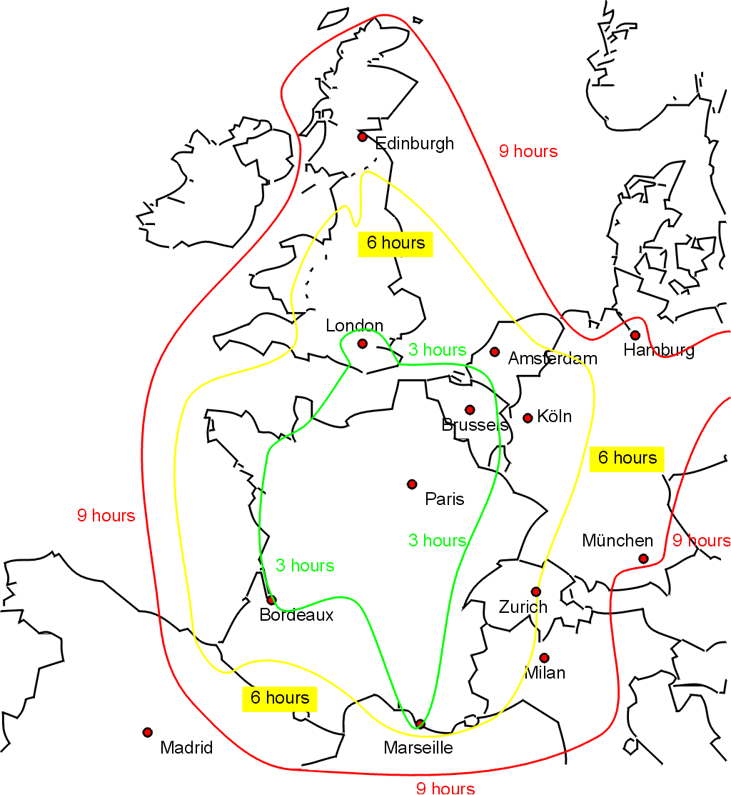
English: Sketch map showing approximate journey times on the train from Paris to the rest of western Europe. Drawn by Bob Tubbs, based on queries to the SNCF website. |
||
| 日期 | 2005年5月31日 (原始上传日期) | ||
| 来源 | 自己的作品 | ||
| 作者 | User:Rnt20 | ||
| 授权 (二次使用本文件) |
|
||
| 其他版本 |
此文件衍生的作品: |

|
此transport map图片可使用矢量图形重新创建为SVG文件。这具有很多好处;更多信息请参见共享资源:待清理媒体。如果存在此图片的SVG格式,请将其上传,然后将此模板替换为
{{vector version available|新图片名称}}。
建议您将SVG命名为“Paris europe train map.svg”,这样在使用Vector version available(或Vva)模板时就不需要填写新图片名称参数。 |
文件历史
点击某个日期/时间查看对应时刻的文件。
| 日期/时间 | 缩略图 | 大小 | 用户 | 备注 | |
|---|---|---|---|---|---|
| 当前 | 2005年5月31日 (二) 19:36 | | 1,024 × 1,113(62 KB) | Rnt20(留言 | 贡献) | Sketch map showing approximate journey times on the train from Paris to the rest of western Europe. Drawn by Bob Tubbs, based on queries to the SNCF website. A French version can be seen at Image:paris_europe_train_map_fr.png {{PD-self}} |
您不可以覆盖此文件。
文件用途
以下页面使用本文件:
全域文件用途
以下其他wiki使用此文件:
- cs.wikipedia.org上的用途
- en.wikipedia.org上的用途
- en.wikinews.org上的用途
- en.wikivoyage.org上的用途
- fa.wikivoyage.org上的用途
- he.wikivoyage.org上的用途
- incubator.wikimedia.org上的用途
- zh.wikipedia.org上的用途
- zh.wikivoyage.org上的用途