File:Partition-plan-Talleyrand-en.svg
跳转到导航
跳转到搜索

此SVG文件的PNG预览的大小:426 × 599像素。 其他分辨率:171 × 240像素 | 341 × 480像素 | 546 × 768像素 | 728 × 1,024像素 | 1,456 × 2,048像素。
原始文件 (SVG文件,尺寸为426 × 599像素,文件大小:312 KB)
说明
说明
添加一行文字以描述该文件所表现的内容
摘要[编辑]
| 描述 |
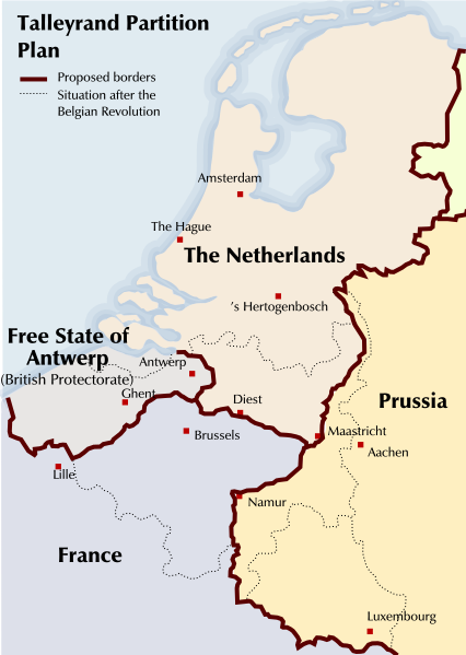
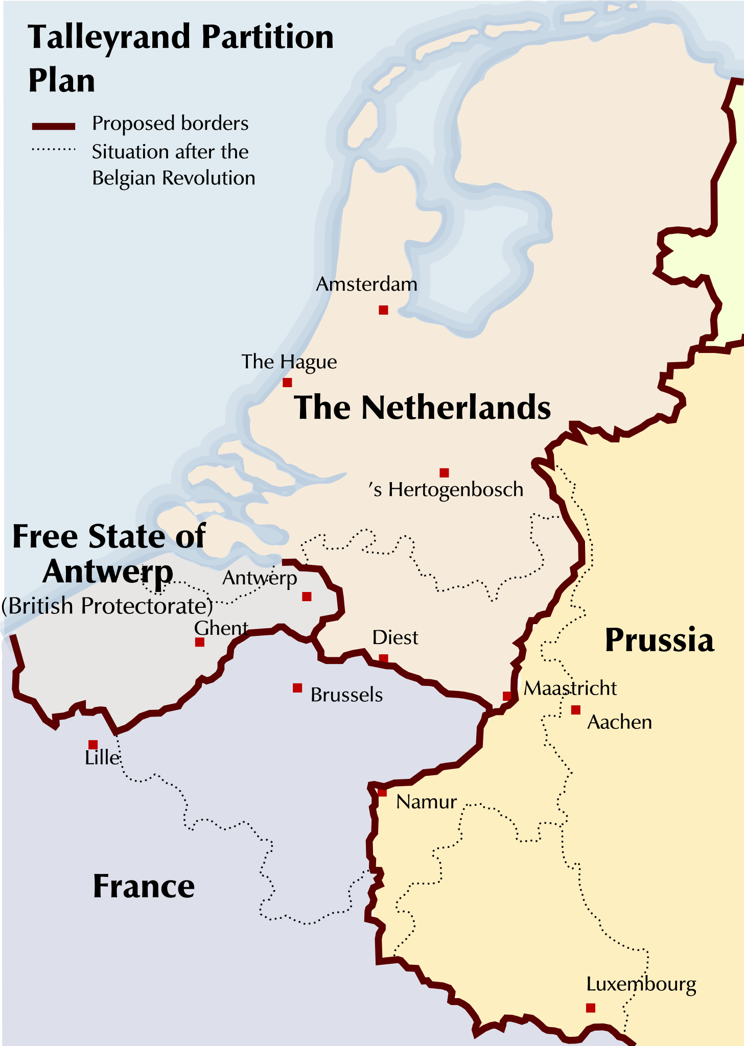
English: Map of a partitioning of the Southern Netherlands proposed by Talleyrand after the Belgian Revolution of 1830 |
| 日期 | |
| 来源 | Based on a GFDL Image: Image:Verdelingsplan_Talleyrand.PNG |
| 作者 | Michiel Buddingh', basing it on an image by Nederlandse Leeuw, which was itself based on an image by Karel Anthonissen |
| 其他版本 |
此文件衍生的作品: Partition-plan-Talleyrand-nl.svg Image:Talleyrand_partition_plan.jpg, Image:Verdelingsplan_Talleyrand.PNG |
许可协议[编辑]

|
已授权您依据自由软件基金会发行的无固定段落及封面封底文字(Invariant Sections, Front-Cover Texts, and Back-Cover Texts)的GNU自由文件许可协议1.2版或任意后续版本的条款,复制、传播和/或修改本文件。该协议的副本请见“GNU Free Documentation License”。 |
| 本文件采用知识共享署名-相同方式共享 3.0 未本地化版本许可协议授权。 | ||
| ||
| 本许可协议标签作为GFDL许可协议更新的组成部分被添加至本文件。 |
文件历史
点击某个日期/时间查看对应时刻的文件。
| 日期/时间 | 缩略图 | 大小 | 用户 | 备注 | |
|---|---|---|---|---|---|
| 当前 | 2011年8月19日 (五) 21:09 | | 426 × 599(312 KB) | Hans Erren(留言 | 贡献) | north-limburg talleyrand boundary moved river Meuse |
| 2008年9月4日 (四) 23:38 |  | 426 × 599(426 KB) | Michiel Buddingh'~commonswiki(留言 | 贡献) | {{Information |Description={{en|1=Map of a partitioning of the Southern Netherlands proposed by Talleyrand after the Belgian Revolution of 1830}} |Source=Based on a GFDL Image: Image:Verdelingsplan_Talleyrand.PNG |Author=[[User:Michiel Buddingh'|Mich |
您不可以覆盖此文件。
文件用途
全域文件用途
以下其他wiki使用此文件:
- ar.wikipedia.org上的用途
- azb.wikipedia.org上的用途
- bg.wikipedia.org上的用途
- en.wikipedia.org上的用途
- fr.wikipedia.org上的用途
- id.wikipedia.org上的用途
- ja.wikipedia.org上的用途
- lv.wikipedia.org上的用途
- ms.wikipedia.org上的用途
- pt.wikipedia.org上的用途
- zh.wikipedia.org上的用途