File:Partition-plan-Talleyrand-en.svg
跳至導覽
跳至搜尋

此 SVG 檔案的 PNG 預覽的大小:426 × 599 像素。 其他解析度:171 × 240 像素 | 341 × 480 像素 | 546 × 768 像素 | 728 × 1,024 像素 | 1,456 × 2,048 像素。
原始檔案 (SVG 檔案,表面大小:426 × 599 像素,檔案大小:312 KB)
說明
說明
添加單行說明來描述出檔案所代表的內容
摘要[編輯]
| 描述 |
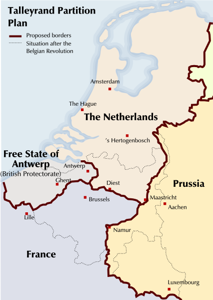
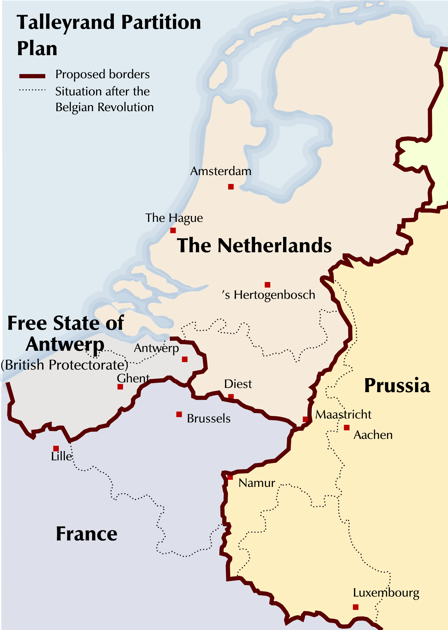
English: Map of a partitioning of the Southern Netherlands proposed by Talleyrand after the Belgian Revolution of 1830 |
| 日期 | |
| 來源 | Based on a GFDL Image: Image:Verdelingsplan_Talleyrand.PNG |
| 作者 | Michiel Buddingh', basing it on an image by Nederlandse Leeuw, which was itself based on an image by Karel Anthonissen |
| 其他版本 |
Derivative works of this file: Partition-plan-Talleyrand-nl.svg Image:Talleyrand_partition_plan.jpg, Image:Verdelingsplan_Talleyrand.PNG |
授權條款[編輯]

|
已授權您依據自由軟體基金會發行的無固定段落、封面文字和封底文字GNU自由文件授權條款1.2版或任意後續版本,對本檔進行複製、傳播和/或修改。該協議的副本列在GNU自由文件授權條款中。 |
| 此檔案採用共享創意 姓名標示-相同方式分享 3.0 未在地化版本授權條款。 | ||
| ||
| 已新增授權條款標題至此檔案,作為GFDL授權更新的一部份。 |
檔案歷史
點選日期/時間以檢視該時間的檔案版本。
| 日期/時間 | 縮圖 | 尺寸 | 用戶 | 備註 | |
|---|---|---|---|---|---|
| 目前 | 2011年8月19日 (五) 21:09 | | 426 × 599(312 KB) | Hans Erren(對話 | 貢獻) | north-limburg talleyrand boundary moved river Meuse |
| 2008年9月4日 (四) 23:38 |  | 426 × 599(426 KB) | Michiel Buddingh'~commonswiki(對話 | 貢獻) | {{Information |Description={{en|1=Map of a partitioning of the Southern Netherlands proposed by Talleyrand after the Belgian Revolution of 1830}} |Source=Based on a GFDL Image: Image:Verdelingsplan_Talleyrand.PNG |Author=[[User:Michiel Buddingh'|Mich |
無法覆蓋此檔案。
檔案用途
全域檔案使用狀況
以下其他 wiki 使用了這個檔案:
- ar.wikipedia.org 的使用狀況
- azb.wikipedia.org 的使用狀況
- bg.wikipedia.org 的使用狀況
- en.wikipedia.org 的使用狀況
- fr.wikipedia.org 的使用狀況
- id.wikipedia.org 的使用狀況
- ja.wikipedia.org 的使用狀況
- lv.wikipedia.org 的使用狀況
- ms.wikipedia.org 的使用狀況
- pt.wikipedia.org 的使用狀況
- zh.wikipedia.org 的使用狀況