File:Pays des P-O Aspres locator map.svg
跳转到导航
跳转到搜索

此SVG文件的PNG预览的大小:780 × 485像素。 其他分辨率:320 × 199像素 | 640 × 398像素 | 1,024 × 637像素 | 1,280 × 796像素 | 2,560 × 1,592像素。
原始文件 (SVG文件,尺寸为780 × 485像素,文件大小:72 KB)
说明
说明
添加一行文字以描述该文件所表现的内容
摘要
[编辑]| 相机位置 | | 在以下服务上查看本图像和附近其他图像: OpenStreetMap |
|---|
| 描述 |
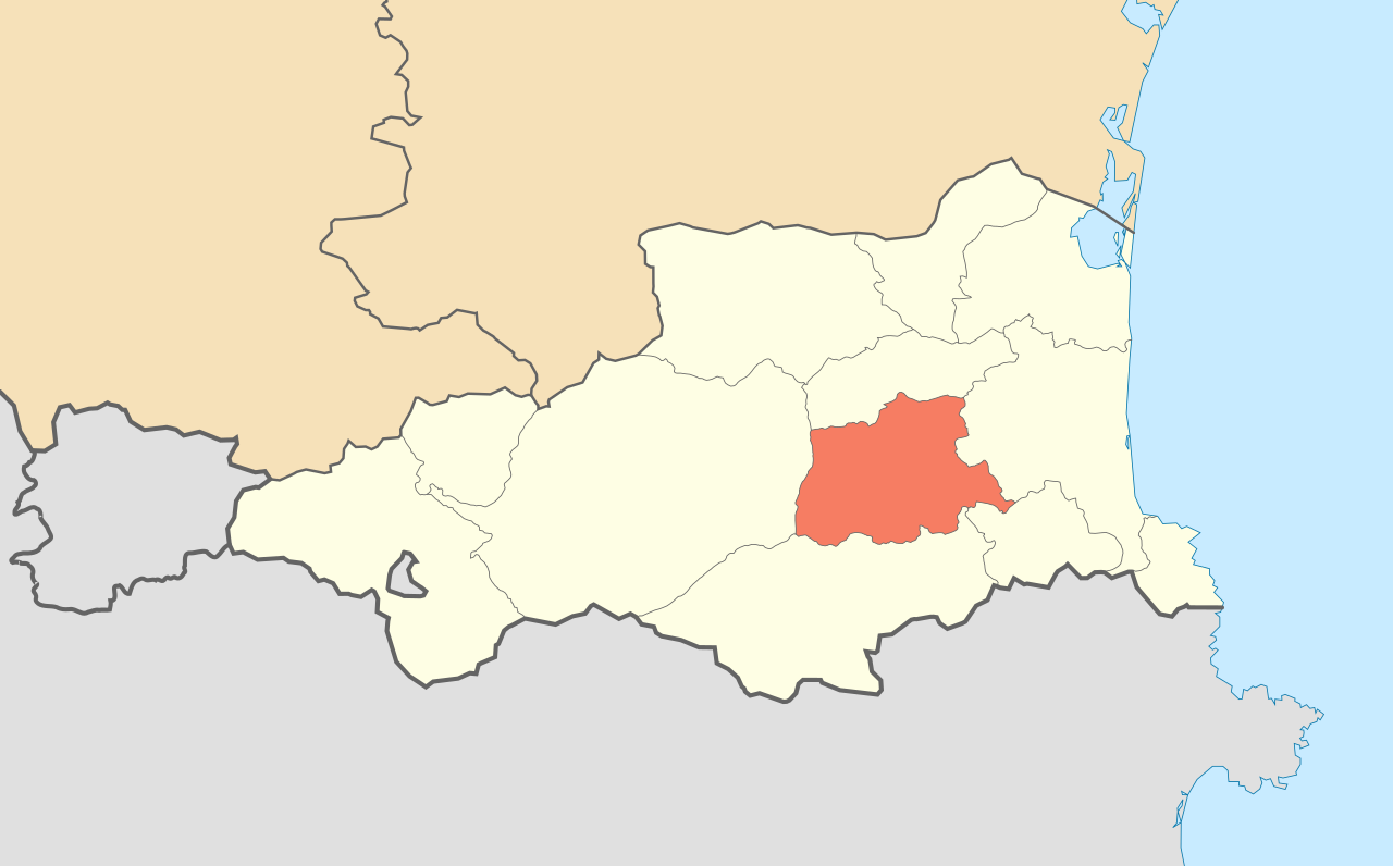
English: Locator map of the natural region of the Aspres in the department of the Pyrénées-Orientales, France.
Français : Carte de localisation de la région naturelle française des Aspres dans le département des Pyrénées-Orientales. Mercator projection
|
| 日期 | |
| 来源 |
自己的作品
|
| 作者 | Eric Gaba (Sting - fr:Sting) |
| 授权 (二次使用本文件) |
Released in Public Domain |
| 其他版本 |
|


许可协议
[编辑]
| 我,本作品著作权人,释出本作品至公有领域。这适用于全世界。 在一些国家这可能不合法;如果是这样的话,那么: 我无条件地授予任何人以任何目的使用本作品的权利,除非这些条件是法律规定所必需的。 |
文件历史
点击某个日期/时间查看对应时刻的文件。
| 日期/时间 | 缩略图 | 大小 | 用户 | 备注 | |
|---|---|---|---|---|---|
| 当前 | 2009年7月10日 (五) 23:14 | | 780 × 485(72 KB) | Sting(留言 | 贡献) | == Summary == {{Location|42|36|00|N|2|30|00|E|scale:600000}} <br/> {{Information| |Description={{en|Locator map of the natural region of the Aspres in the department of the [[:en:Pyrénées-Orientales|Pyrénées-Orien |
您不可以覆盖此文件。
文件用途
以下13个页面使用本文件:
- User:Sting/Gallery: Location and locator maps
- File:Pays des P-O Aspres locator map.svg
- File:Pays des P-O Capcir locator map.svg
- File:Pays des P-O Cerdagne locator map.svg
- File:Pays des P-O Conflent locator map.svg
- File:Pays des P-O Corbières catalanes locator map.svg
- File:Pays des P-O Côte Vermeille locator map.svg
- File:Pays des P-O Fenouillèdes locator map.svg
- File:Pays des P-O Massif des Albères locator map.svg
- File:Pays des P-O Plaine du Roussillon locator map.svg
- File:Pays des P-O Ribéral locator map.svg
- File:Pays des P-O Salanque locator map.svg
- File:Pays des P-O Vallespir locator map.svg
全域文件用途
以下其他wiki使用此文件:
- es.wikipedia.org上的用途
- fr.wikipedia.org上的用途
- ru.wikipedia.org上的用途
- zh.wikipedia.org上的用途