File:Peñón de Vélez Inset from Map of Fez and the Kingdom of Morocco.png
Jump to navigation
Jump to search
Size of this preview: 800 × 484 pixels. Other resolutions: 320 × 194 pixels | 640 × 387 pixels | 1,024 × 619 pixels | 1,280 × 774 pixels | 2,409 × 1,457 pixels.
Original file (2,409 × 1,457 pixels, file size: 6.39 MB, MIME type: image/png)
Captions
Captions
Add a one-line explanation of what this file represents
Summary[edit]
| Description |
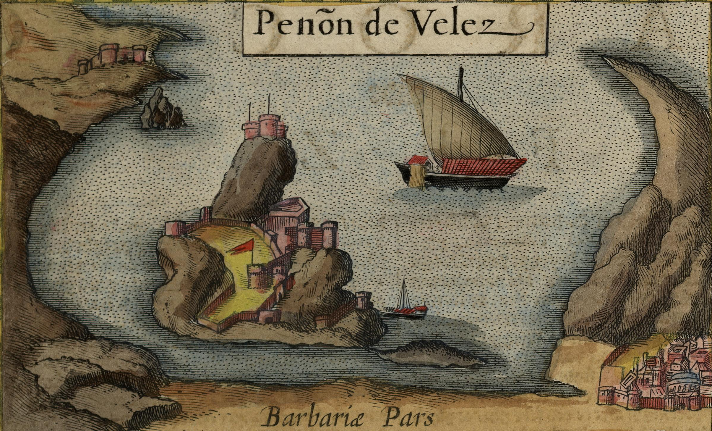
English: This is an illustrated inset showing Peñón de Vélez de la Gomera, a Spanish territory off the Moroccan coast, as envisioned in a 1606 map of Fez and the Kingdom of Morocco by the cartographer Jodocus Hondius. |
|||||||||||||||||||||||
| Date | ||||||||||||||||||||||||
| Source |
Original publication: Mercator-Hondius Atlas |
|||||||||||||||||||||||
| Author |
|
|||||||||||||||||||||||

Licensing[edit]
|
This is a faithful photographic reproduction of a two-dimensional, public domain work of art. The work of art itself is in the public domain for the following reason:
The official position taken by the Wikimedia Foundation is that "faithful reproductions of two-dimensional public domain works of art are public domain".
This photographic reproduction is therefore also considered to be in the public domain in the United States. In other jurisdictions, re-use of this content may be restricted; see Reuse of PD-Art photographs for details. | ||||
File history
Click on a date/time to view the file as it appeared at that time.
| Date/Time | Thumbnail | Dimensions | User | Comment | |
|---|---|---|---|---|---|
| current | 22:22, 3 March 2017 | | 2,409 × 1,457 (6.39 MB) | Peripatesy (talk | contribs) | Uploading an old public-domain work using File Upload Wizard |
You cannot overwrite this file.
File usage
There are no pages that use this file.
Global file usage
The following other wikis use this file:
- Usage on en.wikipedia.org
- Usage on hr.wikipedia.org
- Usage on ko.wikipedia.org
- Usage on sq.wikipedia.org