File:Pinatubo relief map-fr.png
Jump to navigation
Jump to search
Size of this preview: 800 × 421 pixels. Other resolutions: 320 × 168 pixels | 640 × 336 pixels | 1,324 × 696 pixels.
Original file (1,324 × 696 pixels, file size: 1.29 MB, MIME type: image/png)
Captions
Captions
Add a one-line explanation of what this file represents
| Description |
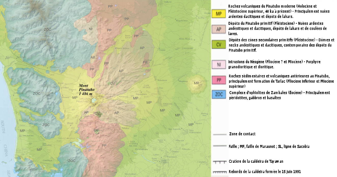
Français : Carte géologique du volcan Pinatubo
English: Geologic map of Pinatubo
Deutsch: Karte von Pinatubo |
||
| Date | |||
| Source | travail personnel à partir d'une carte de l'USGS (donc Domaine Public) [1] + relief topographique issu de la carte de Sardon [[image:]] | ||
| Author | Bourrichon - | ||
| Permission (Reusing this file) |
I, the copyright holder of this work, hereby publish it under the following licenses:
This file is licensed under the Creative Commons Attribution-Share Alike 3.0 Unported, 2.5 Generic, 2.0 Generic and 1.0 Generic license.
You may select the license of your choice. |
||
| Other versions |
|


File history
Click on a date/time to view the file as it appeared at that time.
| Date/Time | Thumbnail | Dimensions | User | Comment | |
|---|---|---|---|---|---|
| current | 21:27, 24 February 2009 | | 1,324 × 696 (1.29 MB) | Bourrichon (talk | contribs) | {{Information |Description= {{fr|Carte géologique du volcan Pinatubo}} {{en|Geologic map of Pinatubo}} {{de|Karte von Pinatubo}} |Source=travail personnel |Date=fév 2009 |Author= [[User:Bourrichon|Bourr |
You cannot overwrite this file.
File usage on Commons
The following page uses this file:
File usage on other wikis
The following other wikis use this file:
- Usage on fr.wikipedia.org