File:Pincerno - Niederelbe 1860.jpg

Original file (1,191 × 842 pixels, file size: 315 KB, MIME type: image/jpeg)
Captions
Captions
Summary
[edit]
| Description |
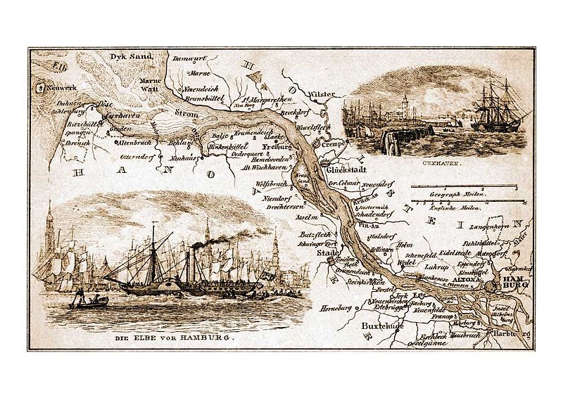
Deutsch: Niederelbe 1857 oder früher. |
| Date | before 1857 |
| Source | http://www.hamburg.de/bilder/hamburg-historisch/241658/historische-hamburg-ansichten-von-hafen-und-elbe.html#pic14 Von Pincerno am 9. Februar 2009 in die deutschsprachige Wikipedia geladen. |
| Author | Gebrüder Suhr († 1842 bzw. 1857) |
Licensing
[edit]
|
This work is in the public domain in its country of origin and other countries and areas where the copyright term is the author's life plus 70 years or fewer.
| |
| This file has been identified as being free of known restrictions under copyright law, including all related and neighboring rights. | |
File history
Click on a date/time to view the file as it appeared at that time.
| Date/Time | Thumbnail | Dimensions | User | Comment | |
|---|---|---|---|---|---|
| current | 17:50, 30 March 2010 | | 1,191 × 842 (315 KB) | Mogelzahn (talk | contribs) | {{Information |Description={{de|1=Niederelbe 1857 oder früher.}} |Source=http://www.hamburg.de/bilder/hamburg-historisch/241658/historische-hamburg-ansichten-von-hafen-und-elbe.html#pic14 Von Pincerno am 9. Februar 200 |
You cannot overwrite this file.
File usage on Commons
There are no pages that use this file.
File usage on other wikis
The following other wikis use this file:
- Usage on da.wikipedia.org
- Usage on de.wikipedia.org
- Usage on en.wikipedia.org
- Usage on fr.wikipedia.org
Metadata
- Maps of the Elbe
- Alster (River)
- Historic views of Hamburg by Suhr brothers
- 19th-century maps of Schleswig-Holstein
- 19th-century maps of Lower Saxony
- 19th-century maps of Hamburg
- Maps of Hamburg-Alsterdorf
- Maps of Hamburg-Altona-Altstadt
- Maps of Hamburg-Barmbek-Süd
- Maps of Hamburg-Blankenese
- Maps of Hamburg-Eidelstedt
- Maps of Hamburg-Eimsbüttel
- Maps of Hamburg-Eppendorf
- Maps of Hamburg-Finkenwerder
- Maps of Hamburg-Francop
- Maps of Hamburg-Fuhlsbüttel
- Maps of Hamburg-Harburg
- Maps of Hamburg-Langenhorn
- Maps of Hamburg-Moorburg
- Maps of Hamburg-Neuenfelde
- Maps of Hamburg-Neugraben-Fischbek
- Maps of Hamburg-Ottensen
- Maps of Hamburg-Wilhelmsburg
- Hamburg-Hausbruch
- Hamburg-Lurup
- Maps of Buxtehude
- Maps of Stade
- Maps of Wedel
- Brokdorf
- Brunsbüttel
- Old maps of Cuxhaven
- Freiburg/Elbe
- Maps of Glückstadt
- Jork
- Krempe
- Neuendeich
- History of Wilster
- Old maps of Ritzebüttel
- Old maps of Neuwerk