File:Pingualuit aerial 2007 (cropped).jpg
Jump to navigation
Jump to search

Size of this preview: 800 × 450 pixels. Other resolutions: 320 × 180 pixels | 640 × 360 pixels | 1,024 × 576 pixels | 1,280 × 720 pixels | 2,560 × 1,441 pixels | 5,442 × 3,063 pixels.
Original file (5,442 × 3,063 pixels, file size: 3.49 MB, MIME type: image/jpeg)
Captions
Captions
Add a one-line explanation of what this file represents
Summary[edit]
| Description |
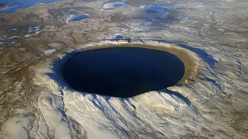
English: Pingualuit crater in Nunavik, northern Quebec, Canada, looking west. It contains a lake named Lake Pingualuk.
Français : Le cratère des Pingualuit est un cratère d'impact dans le territoire du Nunavik, Québec, Canada. Le bassin qu'il renferme se nomme lac Pingualuk. |
| Date | |
| Source | http://earthobservatory.nasa.gov/IOTD/view.php?id=79743&src=eoa-iotd |
| Author | NASA. Courtesy of Denis Sarrazin. |
| Other versions |

.jpg&action=edit§ion=1)
Licensing[edit]
.jpg&action=edit§ion=2)
| This file is in the public domain in the United States because it was solely created by NASA. NASA copyright policy states that "NASA material is not protected by copyright unless noted". (See Template:PD-USGov, NASA copyright policy page or JPL Image Use Policy.) | ||
 |
Warnings:
|
File history
Click on a date/time to view the file as it appeared at that time.
| Date/Time | Thumbnail | Dimensions | User | Comment | |
|---|---|---|---|---|---|
| current | 02:37, 9 October 2021 | | 5,442 × 3,063 (3.49 MB) | Huntster (talk | contribs) | File:Pingualuit aerial 2007.jpg cropped 9 % horizontally, 23 % vertically using CropTool with lossless mode. |
You cannot overwrite this file.
File usage on Commons
The following 2 pages use this file:
File usage on other wikis
The following other wikis use this file:
- Usage on ceb.wikipedia.org
- Usage on es.wikipedia.org
- Usage on eu.wikipedia.org
- Usage on uk.wikipedia.org
- Usage on www.wikidata.org
.jpg&oldid=748260507)