File:Piton de la Fournaise - 2022-10-03.png
Jump to navigation
Jump to search
Size of this preview: 699 × 600 pixels. Other resolutions: 280 × 240 pixels | 560 × 480 pixels | 895 × 768 pixels | 1,070 × 918 pixels.
Original file (1,070 × 918 pixels, file size: 1,011 KB, MIME type: image/png)
Captions
Captions
Add a one-line explanation of what this file represents
Summary
[edit]
| Description |
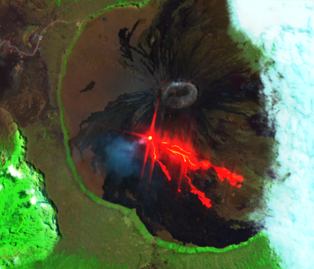
Français : Image SWIR (bandes 12, 8A et 4) Sentinel-2 du 2022-10-03 |
| Date | |
| Source | Sentinel-2 |
| Author | Contains modified Copernicus Sentinel data |
| Camera location | | View this and other nearby images on: OpenStreetMap |
|---|
Licensing
[edit]

|
The copyright holder of this file allows anyone to use it for any purpose, provided that the copyright holder is properly attributed. Redistribution, derivative work, commercial use, and all other use is permitted. |
|
|
EU law grants free access to Copernicus Sentinel Data - https://sentinel.esa.int/documents/247904/690755/Sentinel_Data_Legal_Notice
File history
Click on a date/time to view the file as it appeared at that time.
| Date/Time | Thumbnail | Dimensions | User | Comment | |
|---|---|---|---|---|---|
| current | 15:25, 7 December 2023 | | 1,070 × 918 (1,011 KB) | Rémih (talk | contribs) | Cropped 1 % vertically using CropTool with precise mode. |
| 18:22, 1 November 2022 |  | 1,070 × 926 (1 MB) | Oeneis (talk | contribs) | Uploaded a work by Contains modified Copernicus Sentinel data from Sentinel-2 with UploadWizard |
You cannot overwrite this file.
File usage on Commons
The following page uses this file:
- File:Piton de laFournaise - 2022-10-03.png (file redirect)
File usage on other wikis
The following other wikis use this file:
- Usage on fr.wikipedia.org
- Usage on pt.wikipedia.org
- Usage on www.wikidata.org