File:Piz Platta, Jupperhorn and Mazzaspitz as seen from Chlin Hüreli.jpg
Jump to navigation
Jump to search

Size of this preview: 800 × 362 pixels. Other resolutions: 320 × 145 pixels | 640 × 290 pixels | 1,024 × 464 pixels | 1,280 × 579 pixels | 3,506 × 1,587 pixels.
Original file (3,506 × 1,587 pixels, file size: 823 KB, MIME type: image/jpeg)
Captions
Captions
Add a one-line explanation of what this file represents
Summary
[edit]
| Description |
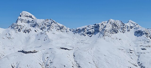
English: Piz Platta, Jupperhorn and Mazzaspitz, picture taken from Chlin Hüreli (Avers, Grison, Switzerland)
Deutsch: Piz Platta, Jupperhorn and Mazzaspitz, aufgenommen von Chlin Hüreli (Avers, Graubünden, Schweiz)
Rumantsch: Piz Platta, Jupperhorn and Mazzaspitz, piglia se davent da Chlin Hüreli (Avers, Grischun, Svizra)
Italiano: Piz Platta, Jupperhorn and Mazzaspitz, fotografato dal Chlin Hüreli (Avers, Grigioni, Svizzera) |
|
| Date | ||
| Source | Own work | |
| Author | Capricorn4049 | |
| Permission (Reusing this file) |
|
|
| Other versions |
| Object location | | View this and other nearby images on: OpenStreetMap |
|---|
| Camera location | | View this and other nearby images on: OpenStreetMap |
|---|
Licensing
[edit]
I, the copyright holder of this work, hereby publish it under the following license:
This file is licensed under the Creative Commons Attribution-Share Alike 4.0 International license.
- You are free:
- to share – to copy, distribute and transmit the work
- to remix – to adapt the work
- Under the following conditions:
- attribution – You must give appropriate credit, provide a link to the license, and indicate if changes were made. You may do so in any reasonable manner, but not in any way that suggests the licensor endorses you or your use.
- share alike – If you remix, transform, or build upon the material, you must distribute your contributions under the same or compatible license as the original.
| Annotations | This image is annotated: View the annotations at Commons |
File history
Click on a date/time to view the file as it appeared at that time.
| Date/Time | Thumbnail | Dimensions | User | Comment | |
|---|---|---|---|---|---|
| current | 20:41, 8 May 2021 | | 3,506 × 1,587 (823 KB) | Capricorn4049 (talk | contribs) | File:Chlin Hüreli Panorama.jpg cropped 91 % horizontally, 54 % vertically using CropTool with lossless mode. |
You cannot overwrite this file.
File usage on Commons
The following 3 pages use this file:
File usage on other wikis
The following other wikis use this file:
- Usage on ceb.wikipedia.org
- Usage on de.wikipedia.org
- Usage on www.wikidata.org