File:Plan de la station terminus de la Porte Maillot.jpg
Jump to navigation
Jump to search
Size of this preview: 800 × 450 pixels. Other resolutions: 320 × 180 pixels | 640 × 360 pixels | 1,024 × 576 pixels | 1,505 × 847 pixels.
Original file (1,505 × 847 pixels, file size: 159 KB, MIME type: image/jpeg)
Captions
Captions
Add a one-line explanation of what this file represents
Summary[edit]
| Description |
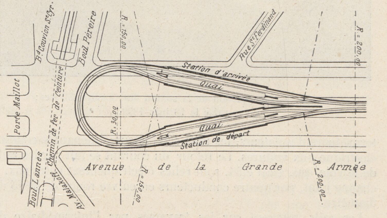
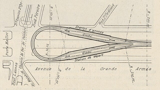
Deutsch: Plan der Endstation Porte Maillot, wie sie bei der Eröffnung am 19. Juli 1900 als Endstation der Linie 1 genutzt wurde. Die heutige Station liegt weiter westlich, die Wendeschleife besteht aber noch. |
| Date | |
| Source | A. Dumas. (1903) 'Le métropolitain de Paris'. Le Génie civil, 37 (12), p. 206, Fig. 19 |
| Author | Unknown author |
Licensing[edit]
|
This work is in the public domain in its country of origin and other countries and areas where the copyright term is the author's life plus 70 years or fewer. This work is in the public domain in the United States because it was published (or registered with the U.S. Copyright Office) before January 1, 1929. | |
| This file has been identified as being free of known restrictions under copyright law, including all related and neighboring rights. | |
File history
Click on a date/time to view the file as it appeared at that time.
| Date/Time | Thumbnail | Dimensions | User | Comment | |
|---|---|---|---|---|---|
| current | 08:17, 4 November 2023 | | 1,505 × 847 (159 KB) | Pechristener (talk | contribs) | Uploaded a work by {{unknown|author}} from A. Dumas. (1903) 'Le métropolitain de Paris'. ''Le Génie civil'', 37 (12), p. 206, [https://gallica.bnf.fr/ark:/12148/bpt6k6473911x/f10.item Fig. 20] with UploadWizard |
You cannot overwrite this file.
File usage on Commons
The following 2 pages use this file: