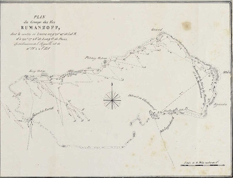
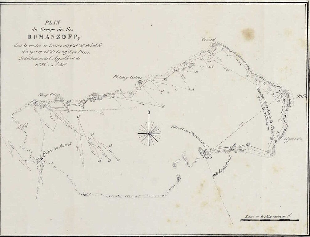
File:Plan du Groupe des îles Rumanzoff Cropped from Choris 1822 gri 33125010887327 0578.jpg
Jump to navigation
Jump to search

Size of this preview: 786 × 600 pixels. Other resolutions: 315 × 240 pixels | 629 × 480 pixels | 1,007 × 768 pixels | 1,280 × 977 pixels | 1,490 × 1,137 pixels.
Original file (1,490 × 1,137 pixels, file size: 81 KB, MIME type: image/jpeg)
Captions
Captions
Add a one-line explanation of what this file represents
Summary[edit]
| Description |
English: From: Voyage pittoresque autour du monde Français : Extrait de : Voyage pittoresque autour du monde |
|||||||||
| Date | ||||||||||
| Source | https://archive.org/details/gri_33125010887327 | |||||||||
| Creator |
Louis Choris (1795–1828) |
|||||||||
| Geotemporal data | ||||||||||
| Bounding box |
|
|||||||||
| Georeferencing | ||||||||||
| Other versions | ||||||||||

Licensing[edit]
|
This work is in the public domain in its country of origin and other countries and areas where the copyright term is the author's life plus 70 years or fewer. This work is in the public domain in the United States because it was published (or registered with the U.S. Copyright Office) before January 1, 1929. | |
| This file has been identified as being free of known restrictions under copyright law, including all related and neighboring rights. | |
File history
Click on a date/time to view the file as it appeared at that time.
| Date/Time | Thumbnail | Dimensions | User | Comment | |
|---|---|---|---|---|---|
| current | 20:32, 6 July 2023 | | 1,490 × 1,137 (81 KB) | Kognos (talk | contribs) | File:Choris 1822 gri 33125010887327 0578.jpg cropped 11 % horizontally, 58 % vertically using CropTool with precise mode. |
You cannot overwrite this file.
File usage on Commons
The following 2 pages use this file: