File:Plan du Louvre médiéval.jpg
Jump to navigation
Jump to search

Size of this preview: 800 × 600 pixels. Other resolutions: 320 × 240 pixels | 640 × 480 pixels | 1,024 × 768 pixels | 1,280 × 960 pixels | 2,560 × 1,920 pixels | 2,816 × 2,112 pixels.
Original file (2,816 × 2,112 pixels, file size: 1.45 MB, MIME type: image/jpeg)
Captions
Captions
Add a one-line explanation of what this file represents
Summary
[edit]
| Description |
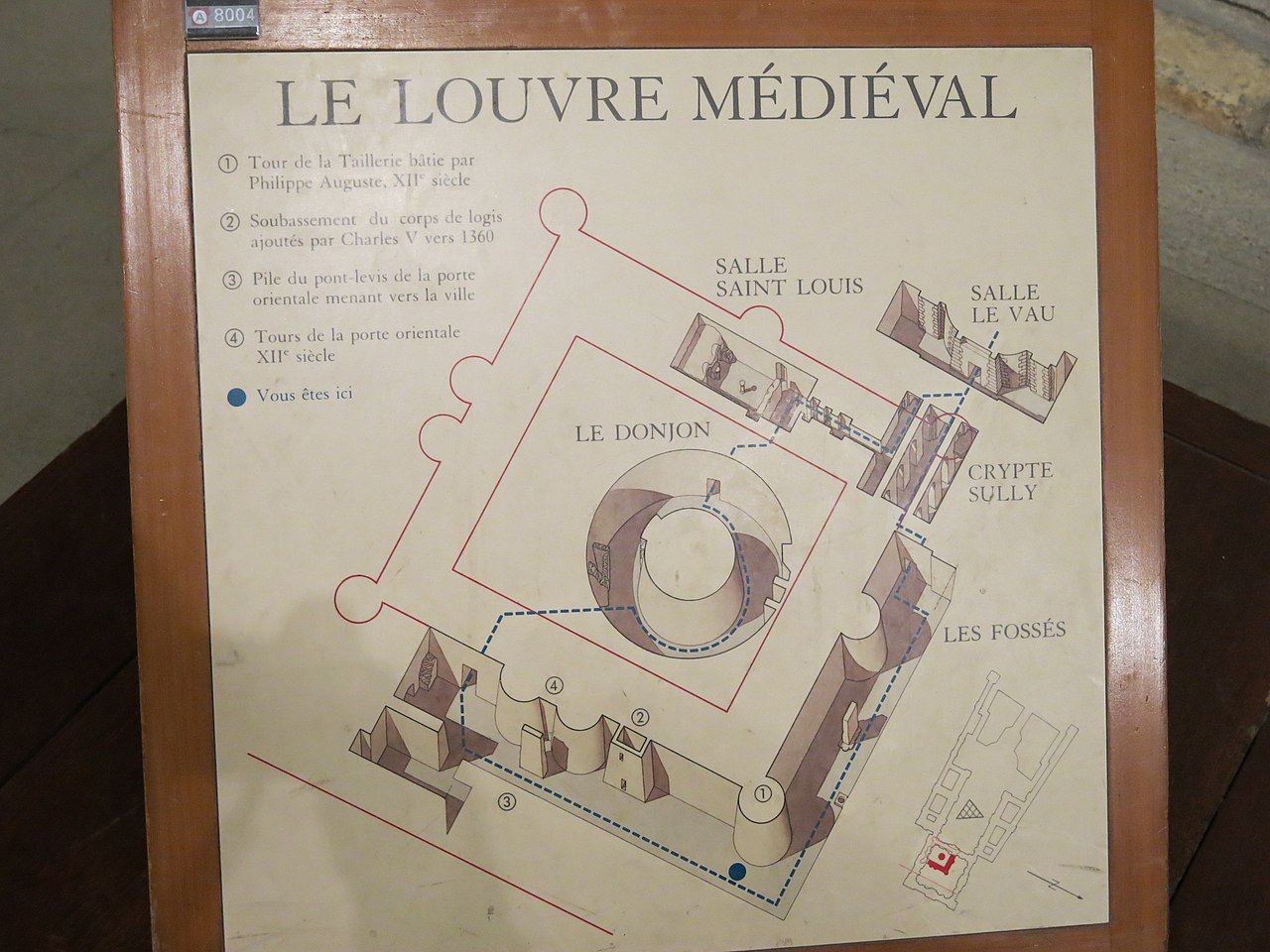
English: Map of the medieval Louvre (Paris, France). The Seine river are at the top and the left, on the side of the wall in red (because destroyed) with two central towers.
Français : Plan du Louvre médiéval (Paris). La Seine et le sud sont en haut à gauche, du coté du mur en rouge (car détruit) avec deux tours centrales. |
| Date | |
| Source | Self-photographed |
| Author | Tangopaso |
| Object location | | View this and other nearby images on: OpenStreetMap |
|---|
Licensing
[edit]
| I, the copyright holder of this work, release this work into the public domain. This applies worldwide. In some countries this may not be legally possible; if so: I grant anyone the right to use this work for any purpose, without any conditions, unless such conditions are required by law. |
File history
Click on a date/time to view the file as it appeared at that time.
| Date/Time | Thumbnail | Dimensions | User | Comment | |
|---|---|---|---|---|---|
| current | 22:08, 27 January 2015 | | 2,816 × 2,112 (1.45 MB) | Tangopaso (talk | contribs) | == {{int:filedesc}} == {{Information |Description= {{en|1=Map of the medieval Louvre (Paris, France). The Seine river are at the top and the left, on the side of the wall in red (because destroyed) with two central towers.}} {{fr|1=Plan du Louvre médi... |
You cannot overwrite this file.
File usage on Commons
The following page uses this file:
File usage on other wikis
The following other wikis use this file:
- Usage on fr.wikipedia.org