File:Plan getta w Łukowie.png
Jump to navigation
Jump to search
Size of this preview: 600 × 600 pixels. Other resolutions: 240 × 240 pixels | 480 × 480 pixels | 768 × 768 pixels | 1,024 × 1,024 pixels | 2,048 × 2,048 pixels | 3,000 × 3,000 pixels.
Original file (3,000 × 3,000 pixels, file size: 1.36 MB, MIME type: image/png)
Captions
Captions
Add a one-line explanation of what this file represents
Summary[edit]
| Description |
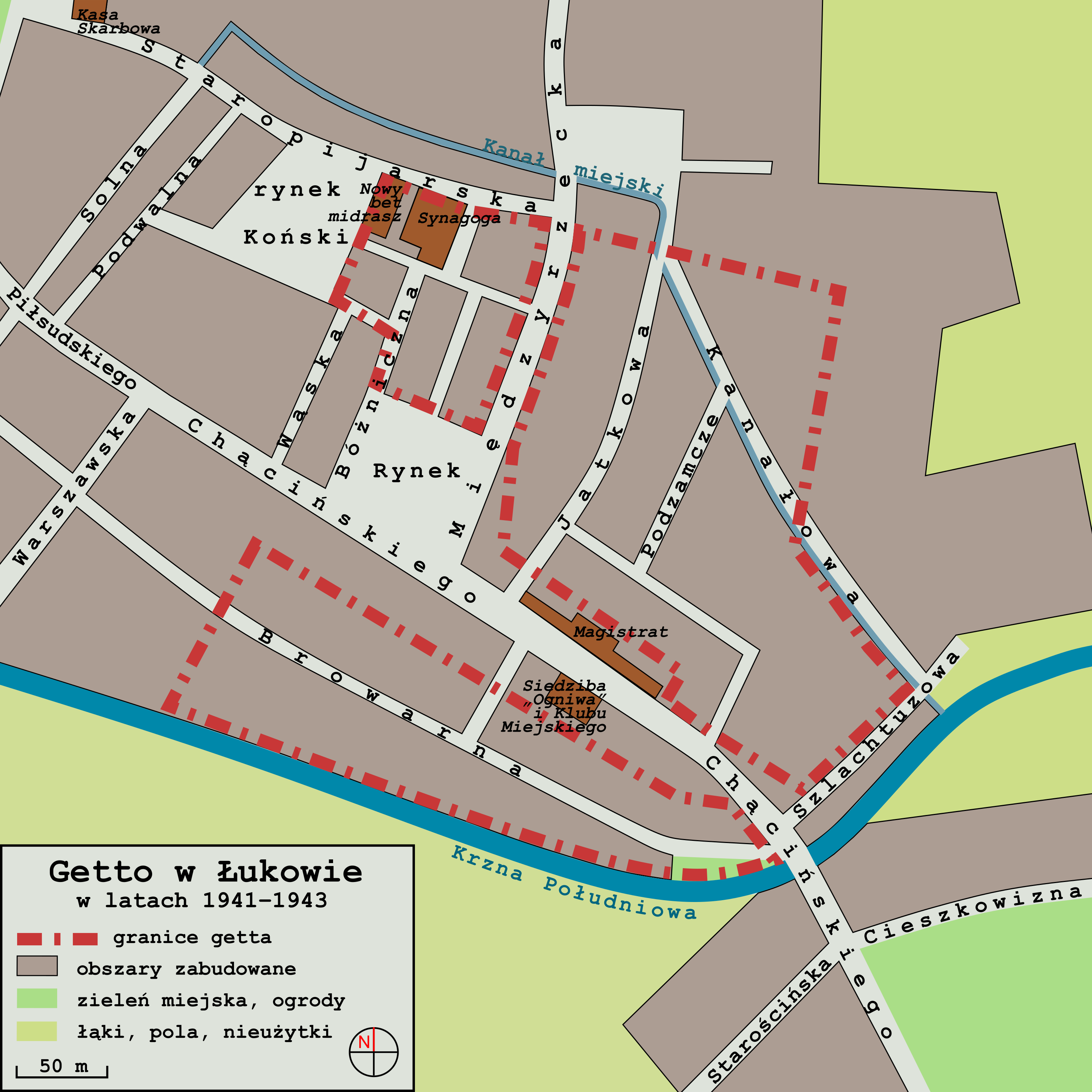
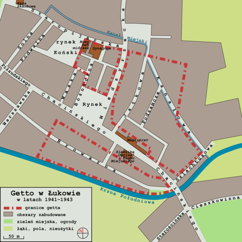
Polski: Plan przedstawiający przybliżone granice getta żydowskiego w Łukowie, utworzonego przez niemieckich okupantów, funkcjonującego w latach 1941–1943.
Źródła: Lukow, miasto powiatowe w woj. lubelskiem - monografja 1930 (85519199).jpg (plan miasta z 1928 r.); [1] (granice getta – ilustracja i opis); [2] (niemieckie zdjęcia lotnicze z 1944 r. – widoczne także ruiny getta, rozmieszczenie budynków i dróg); [3] (mapy w serwisie geoportal.gov.pl – współczesny układ ulic i budynków jako punkt odniesienia przy tworzeniu planu) |
| Date | |
| Source | Own work |
| Author | Logi Aer |
.jpg)
Licensing[edit]
I, the copyright holder of this work, hereby publish it under the following license:
This file is licensed under the Creative Commons Attribution-Share Alike 4.0 International license.
- You are free:
- to share – to copy, distribute and transmit the work
- to remix – to adapt the work
- Under the following conditions:
- attribution – You must give appropriate credit, provide a link to the license, and indicate if changes were made. You may do so in any reasonable manner, but not in any way that suggests the licensor endorses you or your use.
- share alike – If you remix, transform, or build upon the material, you must distribute your contributions under the same or compatible license as the original.
File history
Click on a date/time to view the file as it appeared at that time.
| Date/Time | Thumbnail | Dimensions | User | Comment | |
|---|---|---|---|---|---|
| current | 17:56, 4 June 2022 | | 3,000 × 3,000 (1.36 MB) | Logi Aer (talk | contribs) | Uploaded own work with UploadWizard |
You cannot overwrite this file.
File usage on Commons
There are no pages that use this file.
File usage on other wikis
The following other wikis use this file:
- Usage on fr.wikipedia.org
- Usage on pl.wikipedia.org
- Usage on pt.wikipedia.org