File:PlanoMontevideoSitioGrande.JPG
Jump to navigation
Jump to search
Size of this preview: 800 × 569 pixels. Other resolutions: 320 × 228 pixels | 640 × 455 pixels | 924 × 657 pixels.
Original file (924 × 657 pixels, file size: 147 KB, MIME type: image/jpeg)
Captions
Captions
Add a one-line explanation of what this file represents
Summary
[edit]| Description |
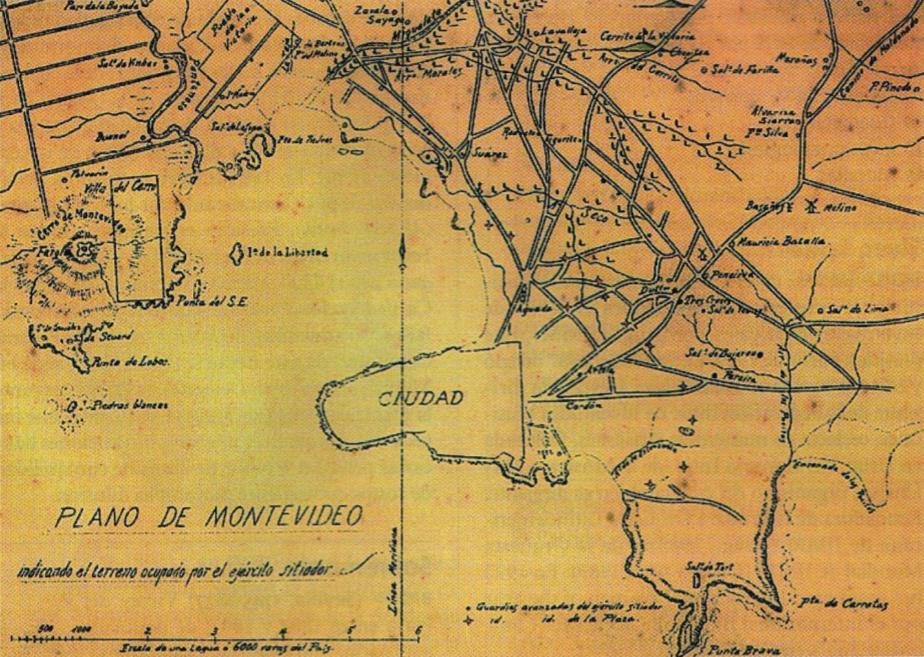
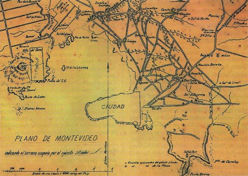
English: Former map of Montevideo (Uruguay) and surrounding towns (now converted into neighborhoods of the city), developed during the called Guerra Grande (Great War, 1843 - 1851), where the demarcation area occupied by the siege army of Montevideo.
Español: Mapa antiguo de Montevideo y pueblos aledaños (Pueblo de la Victoria, actual barrio de La Teja, y el hoy también barrio de Villa del Cerro) donde se indica el territorio ocupado por el ejército sitiador de Montevideo en el transcurso de la Guerra Grande. |
|||
| Date | Entre 1843 y 1851 (Período temporal de duración de la Guerra Grande) | |||
| Source | Digitalizado del libro Gran Enciclopedia del Uruguay | |||
| Author | Unknown author | |||
| Other versions |
|

Licensing
[edit]
|
This work is in the public domain in its country of origin and other countries and areas where the copyright term is the author's life plus 70 years or fewer. | |
| This file has been identified as being free of known restrictions under copyright law, including all related and neighboring rights. | |
File history
Click on a date/time to view the file as it appeared at that time.
| Date/Time | Thumbnail | Dimensions | User | Comment | |
|---|---|---|---|---|---|
| current | 22:15, 17 July 2008 | | 924 × 657 (147 KB) | Uruguayo-92 (talk | contribs) | {{Information |Description={{en|1=Former map of Montevideo (Uruguay) and surrounding towns (now converted into neighborhoods of the city), developed during the called ''Guerra Grande'' (Great War, 1843 - 1851), where the demarcation area occupied by the s |
You cannot overwrite this file.
File usage on Commons
There are no pages that use this file.
File usage on other wikis
The following other wikis use this file:
- Usage on de.wikipedia.org
- Usage on en.wikipedia.org
- Usage on es.wikipedia.org
- Usage on ru.wikipedia.org