File:Poland from Rogowo - Żnin - Łabiszyn - Złotniki Kujawskie - Toruń - Chełmża, photographed by the Corona 98 (KH-4A 1023) satellite (1968-08-23).png
Jump to navigation
Jump to search

Size of this preview: 743 × 600 pixels. Other resolutions: 298 × 240 pixels | 595 × 480 pixels | 952 × 768 pixels | 1,269 × 1,024 pixels | 2,538 × 2,048 pixels | 17,907 × 14,449 pixels.
Original file (17,907 × 14,449 pixels, file size: 69.18 MB, MIME type: image/png)
Captions
Captions
Add a one-line explanation of what this file represents
Summary
[edit]_satellite_(1968-08-23).png&action=edit§ion=1)
| Warning | The original file is very high-resolution. It might not load properly or could cause your browser to freeze when opened at full size. |
|---|
_satellite_(1968-08-23).png&flash=no)
| Description |
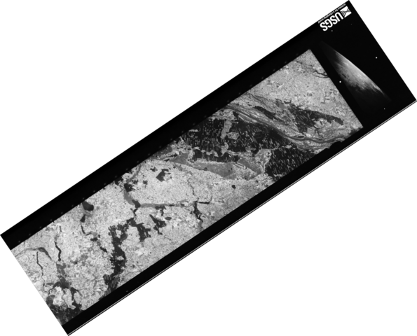
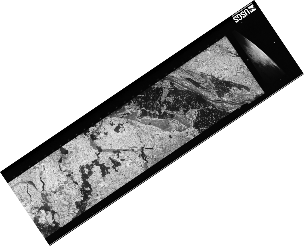
Polski: Obszar Polski, od Rogowa i Żnina, przez Łabiszyn, Złotniki Kujawskie, do Torunia i Chełmży, sfotografowany 23 sierpnia 1968 przez amerykańskiego satelitę wywiadowczego Corona 98 (KH-4A 1023).
Zdjęcie stanowi część d klatki nr 88. Zdjęcie odbite lustrzanie w obu kierunkach i obrócone tak, aby odzwierciedlało rzeczywiste położenie sfotografowanych obiektów. Zdjęcie w połowie oryginalnej rozdzielczości. |
| Date | |
| Source | US Geological Survey via Wikigrant no. WG 2014-52 |
| Author | USAF / CIA / NRO |
Licensing
[edit]_satellite_(1968-08-23).png&action=edit§ion=2)
| This work originally came from a National Reconnaissance Office (NRO) website or publication and has been specifically released into the public domain in the United States. Unless specifically released, NRO information should be assumed to be classified. The NRO seal is usage-restricted. See the site policy security notice and the site policy copyright notice for more information. Please note that if a copyright is indicated on a photo, graphic, or any other material, permission to copy these materials must be obtained from the original source.[1] |

|
The making of this document was supported by Wikimedia Polska Association, within Wikigrant no. WG 2014-52.
|
| Annotations | This image is annotated: View the annotations at Commons |
_satellite_(1968-08-23).png)
File history
Click on a date/time to view the file as it appeared at that time.
| Date/Time | Thumbnail | Dimensions | User | Comment | |
|---|---|---|---|---|---|
| current | 19:04, 17 December 2014 | | 17,907 × 14,449 (69.18 MB) | NH2501 (talk | contribs) | User created page with UploadWizard |
You cannot overwrite this file.
File usage on Commons
There are no pages that use this file.
_satellite_(1968-08-23).png&oldid=854268861)