File:Polygon Network and Scalloped Depressions PSP 010034 2250 RED.jpg
Original file (2,048 × 6,201 pixels, file size: 3.21 MB, MIME type: image/jpeg)
Captions
Captions
Summary[edit]
| Description |
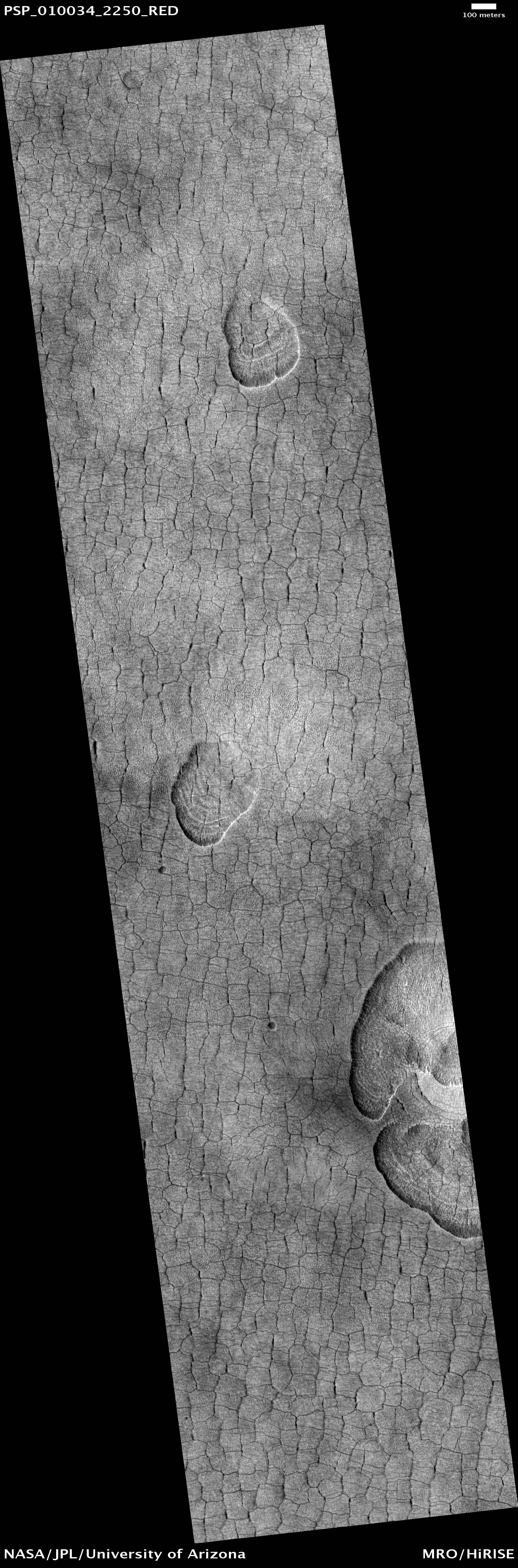
English: Polygon Network and Scalloped Depressions in Western Utopia Planitia.
This image shows a typical landscape from the far western part of Utopia Planitia in the Northern lowlands of Mars. These areas are characterized by a network of polygonal cracks and elongated, scallop-shaped depressions. The cracks are similar to thermal contraction cracks in periglacial and alpine regions on Earth formed by seasonal contraction of the permafrost (permanently frozen ground). In cold regions of Earth, polygonal cracks like this usually indicate ground ice. The scalloped depressions (or "scallops") generally have a steep "pole-facing" scarp and a gentle "equator-facing" slope. Scallop formation may be due to the degradation of ice-rich subsurface material by sublimation (process of ice going directly from a solid state to a gas state). On scallop floors, we often see nested series of curvilinear ridges that probably point to earlier locations of the scarp and contribute to the "shell-like" appearance. Scallops are observed in other areas of the Martian mid-latitudes (40 to 60 degrees) in both northern and southern hemispheres. They probably represent a form of degradation that erodes an ice-rich mantle thought to have been deposited by precipitation during periods of high obliquity (the tilt of the Martian axis of rotation relative to the plane of Mars' orbit). These features add weight to the evidence that water ice has been a dynamic component of the Martian sub-surface during recent geological ages and they they may slowly be continuing their development at the present time. Written by: Alexandra Lefort (29 October 2008) |
| Date | |
| Source | https://www.uahirise.org/PSP_010034_2250 |
| Author | NASA |
Licensing[edit]
| This file is in the public domain in the United States because it was solely created by NASA. NASA copyright policy states that "NASA material is not protected by copyright unless noted". (See Template:PD-USGov, NASA copyright policy page or JPL Image Use Policy.) | ||
 |
Warnings:
|
File history
Click on a date/time to view the file as it appeared at that time.
| Date/Time | Thumbnail | Dimensions | User | Comment | |
|---|---|---|---|---|---|
| current | 17:50, 31 October 2023 | 2,048 × 6,201 (3.21 MB) | Jstuby (talk | contribs) | Uploaded a work by NASA from https://www.uahirise.org/PSP_010034_2250 with UploadWizard |
You cannot overwrite this file.
File usage on Commons
There are no pages that use this file.