File:Porechje1919.jpg
Jump to navigation
Jump to search
No higher resolution available.
Porechje1919.jpg (420 × 220 pixels, file size: 61 KB, MIME type: image/jpeg)
Captions
Captions
Add a one-line explanation of what this file represents
= Summary
[edit]
| Description |
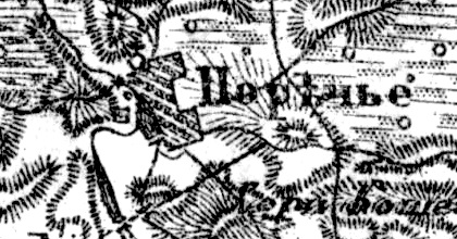
Русский: Деревня Поречье на карте 1919 года. |
| Date | |
| Source | http://geoportal.rgo.ru/record/381 |
| Author | «Военно-топографическая карта Петроградской и Эстляндской губерний», ряд IV, лист 7 |
Licensing
[edit]
|
This work is in the public domain in its country of origin and other countries and areas where the copyright term is the author's life plus 70 years or fewer. | |
| This file has been identified as being free of known restrictions under copyright law, including all related and neighboring rights. | |
File history
Click on a date/time to view the file as it appeared at that time.
| Date/Time | Thumbnail | Dimensions | User | Comment | |
|---|---|---|---|---|---|
| current | 23:05, 2 February 2019 | | 420 × 220 (61 KB) | Valeriy10f (talk | contribs) | {{Information |description ={{ru|1==== {{int:filedesc}} == {{Information |Description ={{ru|1= Деревня Поречье на карте 1919 года.}} |Source = http://geoportal.rgo.ru/record/381 |Author = «Военно-топографическая карта Петроградской и Эстляндской губерний», ряд IV, лист 7 |Date = 1919 |Permission = |other_versions = }} == {{int:license-header}} == {{PD-old}} Category:Maps of the Slantsevsky District}} |date = |source ={{own}} |author =User:Valeriy10f }} |
You cannot overwrite this file.
File usage on Commons
There are no pages that use this file.
File usage on other wikis
The following other wikis use this file:
- Usage on ru.wikipedia.org