File:Possible Czech areas.jpg
Jump to navigation
Jump to search
Size of this preview: 800 × 376 pixels. Other resolutions: 320 × 150 pixels | 640 × 301 pixels | 1,431 × 672 pixels.
Original file (1,431 × 672 pixels, file size: 366 KB, MIME type: image/jpeg)
Captions
Captions
Add a one-line explanation of what this file represents
Summary[edit]
| Description |
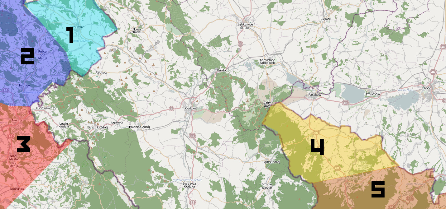
English: Areas in the Czech Republic, bordering with Poland, described for preparations in 2013 Wikiexpedtion. The list of the villages that might be documented for this very wikiexpedition is available. Colorful sections represent artifical regions in order to better organize the vast borderland. |
| Date | |
| Source | Open Street map |
| Author | Modyfied by Aktron |
| Description |
This map was created from OpenStreetMap project data, collected by the community. This map may be incomplete, and may contain errors. Don't rely solely on it for navigation. |
| Date | (see file history) |
| Source | openstreetmap.org |
| Creator |
OpenStreetMap contributors |
| Permission (Reusing this file) |
OpenStreetMap data and maps are licensed under the Creative Commons Attribution-ShareAlike 2.0 license (CC-BY-SA 2.0). This file is licensed under the Creative Commons Attribution-Share Alike 2.0 Generic license.
|
| Georeferencing | If inappropriate please set warp_status = skip to hide. |
File history
Click on a date/time to view the file as it appeared at that time.
| Date/Time | Thumbnail | Dimensions | User | Comment | |
|---|---|---|---|---|---|
| current | 12:47, 30 June 2013 | | 1,431 × 672 (366 KB) | Aktron (talk | contribs) | User created page with UploadWizard |
You cannot overwrite this file.
File usage on Commons
The following page uses this file:
File usage on other wikis
The following other wikis use this file:
- Usage on pl.wikimedia.org