File:Powiat żarski location map.png
Jump to navigation
Jump to search

Size of this preview: 443 × 599 pixels. Other resolutions: 177 × 240 pixels | 355 × 480 pixels | 944 × 1,276 pixels.
Original file (944 × 1,276 pixels, file size: 177 KB, MIME type: image/png)
Captions
Captions
Add a one-line explanation of what this file represents
| Description |
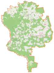
Polski: Mapa powiatu żarskiego, Polska
English: Map of Powiat żarski, Poland |
|||||||||
| Date | ||||||||||
| Source | You may find a page on the OpenStreetMap wiki page for Powiat żarski | |||||||||
| Creator |
OpenStreetMap contributors OpenStreetMap contributors |
|||||||||
| Permission (Reusing this file) |
OpenStreetMap data is available under the Open Database License (details). Map tiles are licensed under the Creative Commons Attribution-ShareAlike 2.0 license (CC-BY-SA 2.0).
This file is licensed under the Creative Commons Attribution-Share Alike 2.0 Generic license.
|
|||||||||
| Geotemporal data | ||||||||||
| Bounding box |
|
|||||||||
| Georeferencing | If inappropriate please set warp_status = skip to hide. | |||||||||
File history
Click on a date/time to view the file as it appeared at that time.
| Date/Time | Thumbnail | Dimensions | User | Comment | |
|---|---|---|---|---|---|
| current | 06:24, 22 April 2015 | | 944 × 1,276 (177 KB) | VanWiel (talk | contribs) | {{OpenStreetMap | name = Powiat żarski | location = Powiat żarski | description = {{pl|Mapa powiatu żarskiego, Polska}} {{en|Map of Powiat żarski, Poland}} | top = 51.8994 | bottom = 51.3555 | l... |
You cannot overwrite this file.
File usage on Commons
There are no pages that use this file.
File usage on other wikis
The following other wikis use this file:
- Usage on eo.wikipedia.org
- Usage on fr.wikipedia.org
- Usage on id.wikipedia.org
- Usage on pl.wikipedia.org
- Żary
- Powiat żarski
- Lubsko
- Olbrachtów
- Buczyny
- Jasień (miasto)
- Łęknica
- Park Mużakowski
- Trzebiel
- Kunice (Żary)
- Biecz (województwo lubuskie)
- Brody (powiat żarski)
- Przewóz (powiat żarski)
- Biedrzychowice Dolne
- Brożek (wieś)
- Brzostowa
- Budziechów
- Bieszków
- Chełmica
- Chełm Żarski
- Chlebice
- Chocicz
- Chocimek
- Chudzowice
- Chwaliszowice
- Cielmów
- Datyń (Polska)
- Dobrochów
- Drożków
- Dąbrowa Łużycka
- Gniewoszyce
- Gręzawa
- Jagłowice
- Jałowice
- Jeziory Dolne
- Jeziory Wysokie
- Jędrzychowiczki
- Królów
- Kumiałtowice
- Kadłubia
- Karsówka
- Kamienica nad Nysą Łużycką
- Lipinki Łużyckie
- Lipsk Żarski
- Lubanice
- Lubomyśl
View more global usage of this file.