File:Powiat płocki location map.png
Jump to navigation
Jump to search
Size of this preview: 734 × 599 pixels. Other resolutions: 294 × 240 pixels | 588 × 480 pixels | 964 × 787 pixels.
Original file (964 × 787 pixels, file size: 271 KB, MIME type: image/png)
Captions
Captions
Add a one-line explanation of what this file represents
| Description |
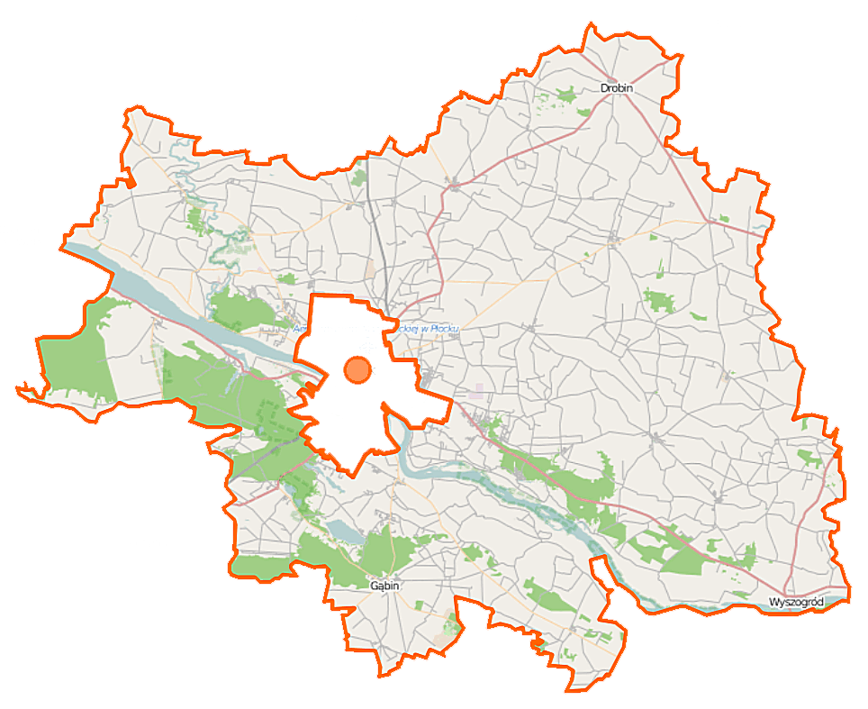
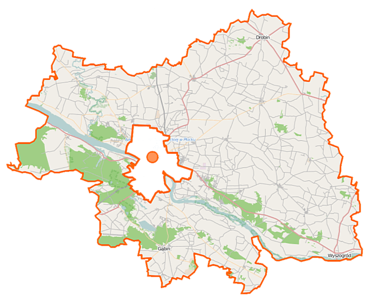
Polski: Mapa powiatu płockiego, Polska
English: Map of Powiat płocki, Poland |
|||||||||
| Date | ||||||||||
| Source | You may find a page on the OpenStreetMap wiki page for Powiat płocki | |||||||||
| Creator |
OpenStreetMap contributors OpenStreetMap contributors |
|||||||||
| Permission (Reusing this file) |
OpenStreetMap data is available under the Open Database License (details). Map tiles are licensed under the Creative Commons Attribution-ShareAlike 2.0 license (CC-BY-SA 2.0).
This file is licensed under the Creative Commons Attribution-Share Alike 2.0 Generic license.
|
|||||||||
| Geotemporal data | ||||||||||
| Bounding box |
|
|||||||||
| Georeferencing | If inappropriate please set warp_status = skip to hide. | |||||||||
File history
Click on a date/time to view the file as it appeared at that time.
| Date/Time | Thumbnail | Dimensions | User | Comment | |
|---|---|---|---|---|---|
| current | 10:46, 22 September 2014 | | 964 × 787 (271 KB) | VanWiel (talk | contribs) | {{OpenStreetMap | name = Powiat płocki | location = Powiat płocki | description = {{pl|Mapa powiatu płockiego, Polska}} {{en|Map of Powiat płocki, Poland}} | top = 52.7969 | left = 19.3002 | r... |
You cannot overwrite this file.
File usage on Commons
There are no pages that use this file.
File usage on other wikis
The following other wikis use this file:
- Usage on eo.wikipedia.org
- Usage on id.wikipedia.org
- Usage on pl.wikipedia.org
- Maszt radiowy w Konstantynowie
- Maszewo Duże
- Radzanowo
- Łęg Probostwo
- Powiat płocki
- Słupno (powiat płocki)
- Dobrzyków
- Drobin
- Wyszogród (województwo mazowieckie)
- Gąbin
- Murzynowo (województwo mazowieckie)
- Nowy Duninów
- Siecień
- Sobowo
- Brudzeń Duży
- Gorzechowo
- Kobierniki (województwo mazowieckie)
- Główina
- Cierszewo
- Radotki
- Stary Duninów
- Parzeń
- Sikórz (województwo mazowieckie)
- Konstantynów (powiat płocki)
- Brudzeń Mały
- Cegielnia (powiat płocki)
- Lasotki (województwo mazowieckie)
- Rembielin (powiat płocki)
- Krzyżanowo (województwo mazowieckie)
- Rokicie (powiat płocki)
- Uniejewo
- Bądkowo Kościelne
- Archutowo
- Archutówko
- Bądkowo Jeziorne
- Bądkowo-Podlasie
- Bądkowo-Rumunki
- Blichowo
- Bolino
- Borowiczki-Pieńki
- Borzeń
- Brelki
- Bromierz (województwo mazowieckie)
- Bronowo-Zalesie
- Brudzyno
- Brwilno Dolne
- Brzechowo
- Brzezinna Góra
View more global usage of this file.