File:Poznań - mapa jednostki obszarowej Centrum.png
Jump to navigation
Jump to search
Size of this preview: 581 × 600 pixels. Other resolutions: 232 × 240 pixels | 465 × 480 pixels | 744 × 768 pixels | 992 × 1,024 pixels | 1,954 × 2,017 pixels.
Original file (1,954 × 2,017 pixels, file size: 4.37 MB, MIME type: image/png)
Captions
Captions
Add a one-line explanation of what this file represents
| Description |
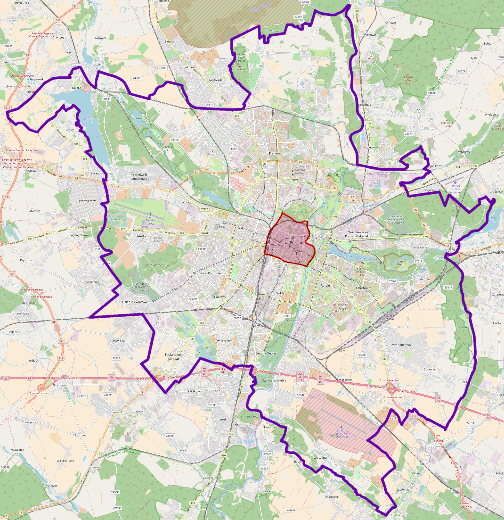
Polski: Mapa poznańskiej jednostki obszarowej Centrum. Przebieg granic na podstawie mapy jednostek obszarowych Systemu Informacji Miejskiej. |
|||
| Date | ||||
| Source | Own work | |||
| Author | Miko101 | |||
| Permission (Reusing this file) |
This file is licensed under the Creative Commons Attribution-Share Alike 2.0 Generic license.
|
Bbox: 52.2900 (top), 52.5114 (bottom), 16.7266 (left), 17.0782 (right)
File history
Click on a date/time to view the file as it appeared at that time.
| Date/Time | Thumbnail | Dimensions | User | Comment | |
|---|---|---|---|---|---|
| current | 20:14, 15 November 2017 | | 1,954 × 2,017 (4.37 MB) | Miko101 (talk | contribs) | {{Information |Description = {{pl|1=Mapa poznańskiej jednostki obszarowej Centrum. Przebieg granic na podstawie [http://zdm.poznan.pl/informacje.php?sp=sim&layer=10 mapy jednostek obszarowych Systemu Informacji Miejskiej].}} |Source = {{own... |
You cannot overwrite this file.
File usage on Commons
There are no pages that use this file.
File usage on other wikis
The following other wikis use this file:
- Usage on pl.wikipedia.org