File:Praha Ulice Pechmanovych Tabulky.jpg
Jump to navigation
Jump to search
Size of this preview: 702 × 599 pixels. Other resolutions: 281 × 240 pixels | 562 × 480 pixels | 900 × 768 pixels | 1,199 × 1,024 pixels | 2,024 × 1,728 pixels.
Original file (2,024 × 1,728 pixels, file size: 992 KB, MIME type: image/jpeg)
Captions
Captions
Add a one-line explanation of what this file represents
Summary[edit]
| Description |
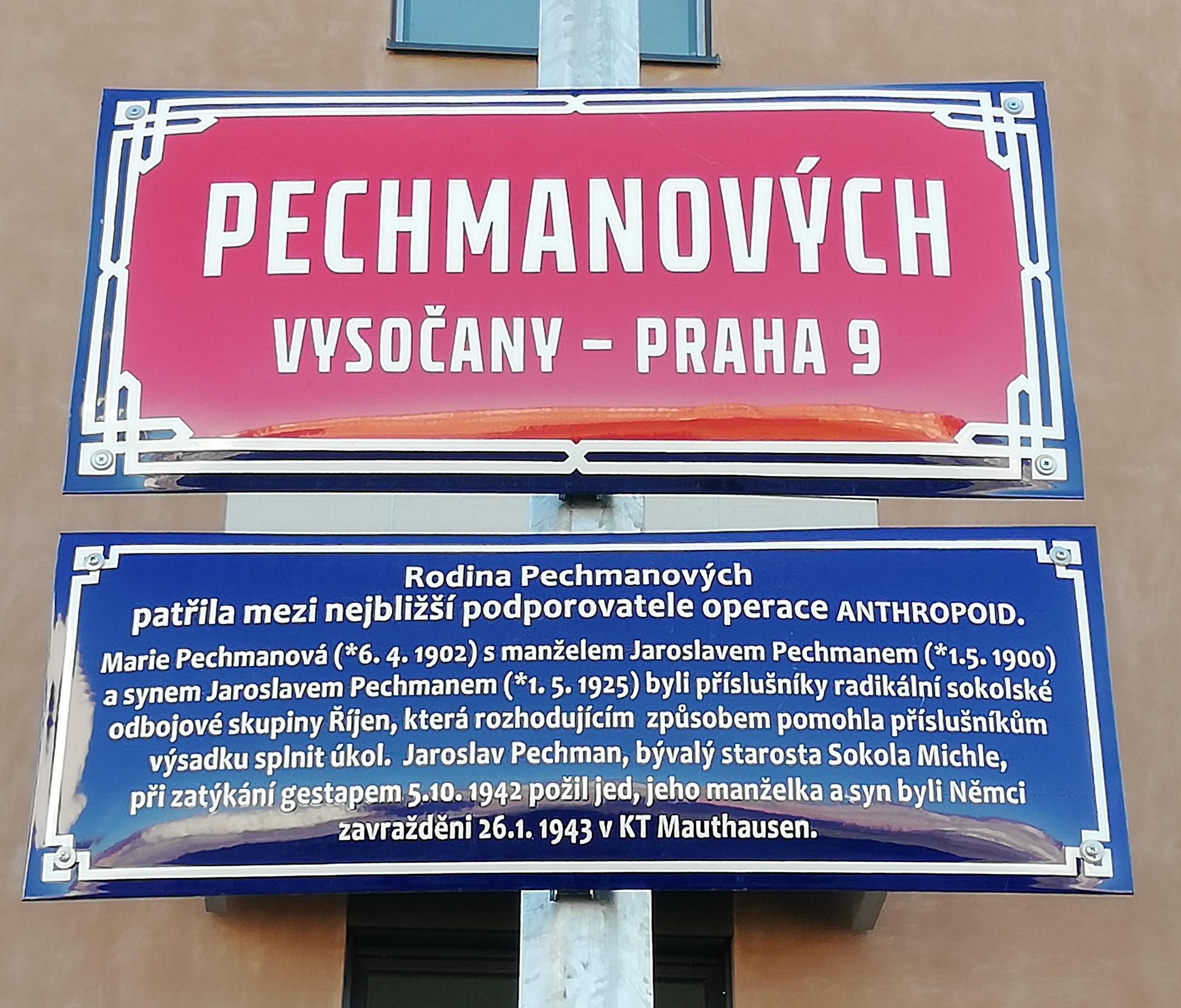
Čeština: V Praze 9 byla po rodině Pechmanových pojmenována ulice. Kromě červené tabule se jménem ulice je na sloupu umístěna i modrá vysvětlující tabulka s následujícím textem: Rodina Pechmanových / patřila mezi nejbližší podporovatele operace ANTHROPOID. // Marie Pechmanová (*6.4.1902) s manželem Jaroslavem Pechmanem (*1.5.1900) / a synem Jaroslavem Pechmanem (*1.5.1925) byli příslušníky radikální sokolské / odbojové skupiny Říjen, která rozhodujícím způsobem pomohla příslušníkům / výsadku splnit úkol. Jaroslav Pechman, bývalý starosta Sokola Michle, / při zatýkání gestapem 5.10.1942 požil jed, jeho manželka a syn byli Němci / zavražděni 26.1.1943 v KT Mauthausen.
English: In Prague 9, a street was named after the Pechman family. In addition to the red plaque with the street name, there is also a blue explanatory plaque on the pole with the following text. // Marie Pechman (*6.4.1902) with her husband Jaroslav Pechman (*1.5.1900) / and son Jaroslav Pechman (*1.5.1925) were members of the radical Sokol / resistance group October, which decisively helped the / paratroopers to accomplish the task. Jaroslav Pechman, the former mayor of Sokol Michle, / ingested poison during the arrest by the Gestapo on 5.10.1942, his wife and son were murdered by the Germans / on 26.1.1943 in the Mauthausen concentration camp. |
| Date | |
| Source | Own work |
| Author | Mojmir Churavy |
| Camera location | | View this and other nearby images on: OpenStreetMap |
|---|
Pechmanových 1031/6, 190 00 Praha 9 - Vysočany, Česko (50.1100961N, 14.5136625E)
Licensing[edit]
I, the copyright holder of this work, hereby publish it under the following license:
This file is licensed under the Creative Commons Attribution-Share Alike 4.0 International license.
- You are free:
- to share – to copy, distribute and transmit the work
- to remix – to adapt the work
- Under the following conditions:
- attribution – You must give appropriate credit, provide a link to the license, and indicate if changes were made. You may do so in any reasonable manner, but not in any way that suggests the licensor endorses you or your use.
- share alike – If you remix, transform, or build upon the material, you must distribute your contributions under the same or compatible license as the original.
File history
Click on a date/time to view the file as it appeared at that time.
| Date/Time | Thumbnail | Dimensions | User | Comment | |
|---|---|---|---|---|---|
| current | 20:02, 16 March 2023 | | 2,024 × 1,728 (992 KB) | Mojmir Churavy (talk | contribs) | Uploaded own work with UploadWizard |
You cannot overwrite this file.
File usage on Commons
There are no pages that use this file.
File usage on other wikis
The following other wikis use this file:
- Usage on cs.wikipedia.org