File:Prameniště Chrudimky, CZ180114-062.jpg
Jump to navigation
Jump to search
Size of this preview: 398 × 599 pixels. Other resolutions: 159 × 240 pixels | 319 × 480 pixels | 510 × 768 pixels | 680 × 1,024 pixels | 1,360 × 2,048 pixels | 2,737 × 4,121 pixels.
Original file (2,737 × 4,121 pixels, file size: 6.32 MB, MIME type: image/jpeg)
Captions
Captions
Add a one-line explanation of what this file represents
Summary[edit]
| Description |
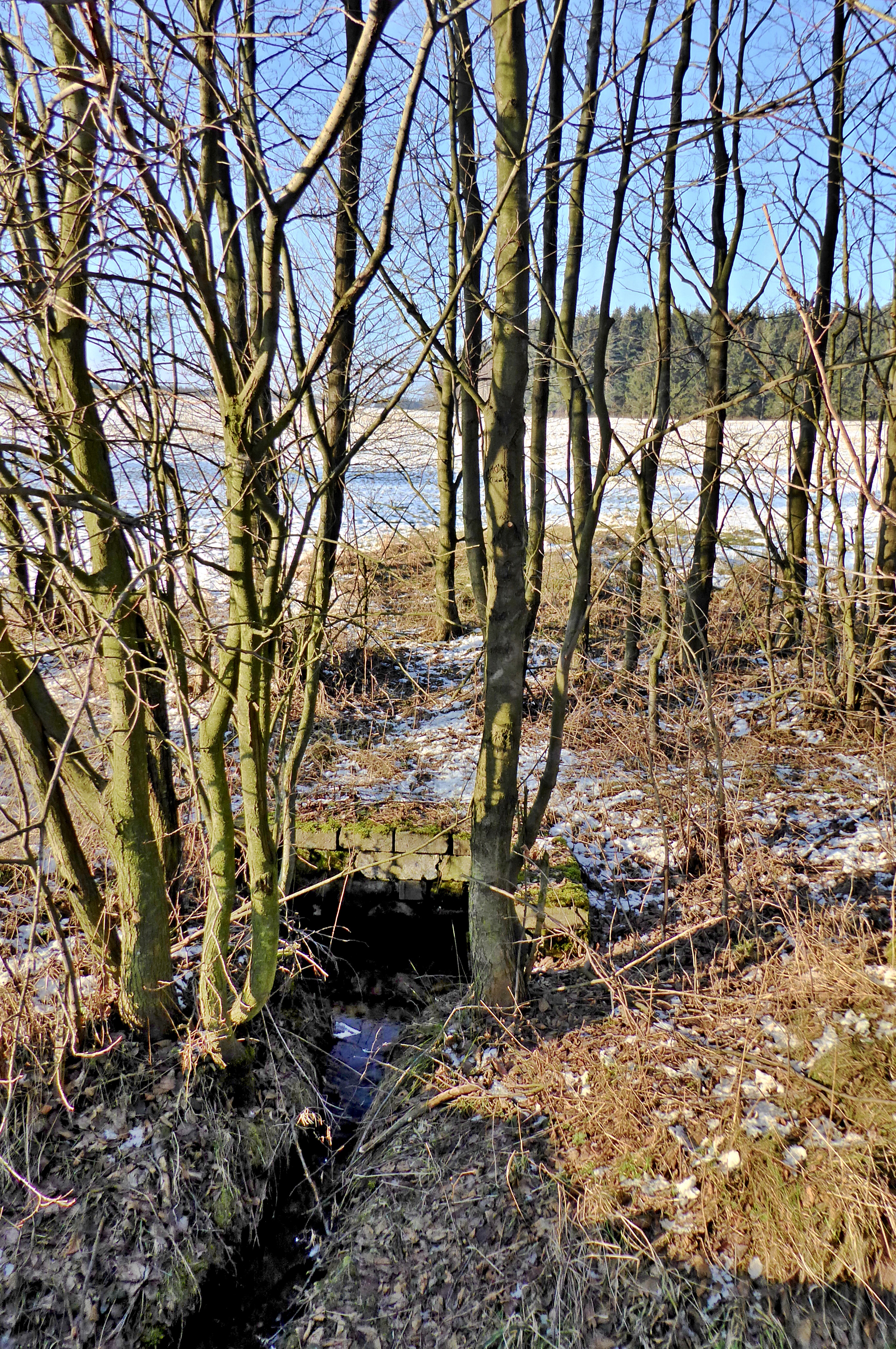
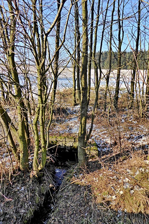
English: The springs area of "Chrudimka" river near the village "Dědová", source on a meadow is led by a pipe. In the photo the watercourse in the trough appears near the road "Dědová – Kameničky". Photo locality: Czechia, Pardubice Region, municipality Dědová, forest locality Humperky, "Kameničská" Highlands, source of river "Chrudimka".
Čeština: Prameniště řeky Chrudimky u obce Dědová, zdrojnice na louce je vedená trubkou. Na fotografii ústí trubky svodnice u silnice Dědová – Kameničky. Foto lokace: Česko, Pardubický kraj, obec Dědová, Kameničská vrchovina, prameniště řeky Chrudimky (240°). |
| Date | |
| Source | Own work |
| Author | Josef Kreuz (PEPan) |
| Camera location | | View this and other nearby images on: OpenStreetMap |
|---|
Faktografie:[edit]
Prameniště na vlhkých loukách ve 20. století upraveno melioracemi, pramen Chrudimka veden pod č. 8739 v národním registru vodních pramenů. Zdrojnice od silnice III/3439 (úsek Dědová – Kameničky) ve směru k Filipovu je součástí evropsky významné lokality Údolí Chrudimky.
Externí odkazy:[edit]
- Turistická mapa (letecký pohled) – prameniště řeky Chrudimky, zdrojnice u Dědové viz
- Národní registr vodních pramenů – pramen Chrudimka viz
- Agentura ochrany přírody a krajiny ČR – evropsky významná lokalita Údolí Chrudimky viz
Licensing[edit]
I, the copyright holder of this work, hereby publish it under the following license:
This file is licensed under the Creative Commons Attribution-Share Alike 4.0 International license.
- You are free:
- to share – to copy, distribute and transmit the work
- to remix – to adapt the work
- Under the following conditions:
- attribution – You must give appropriate credit, provide a link to the license, and indicate if changes were made. You may do so in any reasonable manner, but not in any way that suggests the licensor endorses you or your use.
- share alike – If you remix, transform, or build upon the material, you must distribute your contributions under the same or compatible license as the original.
File history
Click on a date/time to view the file as it appeared at that time.
| Date/Time | Thumbnail | Dimensions | User | Comment | |
|---|---|---|---|---|---|
| current | 14:30, 23 January 2018 | | 2,737 × 4,121 (6.32 MB) | PEPan (talk | contribs) | User created page with UploadWizard |
You cannot overwrite this file.
File usage on Commons
There are no pages that use this file.
File usage on other wikis
The following other wikis use this file:
- Usage on cs.wikipedia.org