File:Presanella da val Nardis.JPG
Jump to navigation
Jump to search

Size of this preview: 800 × 600 pixels. Other resolutions: 320 × 240 pixels | 640 × 480 pixels | 1,024 × 768 pixels | 1,280 × 960 pixels | 2,592 × 1,944 pixels.
Original file (2,592 × 1,944 pixels, file size: 992 KB, MIME type: image/jpeg)
Captions
Captions
Add a one-line explanation of what this file represents
| Description |
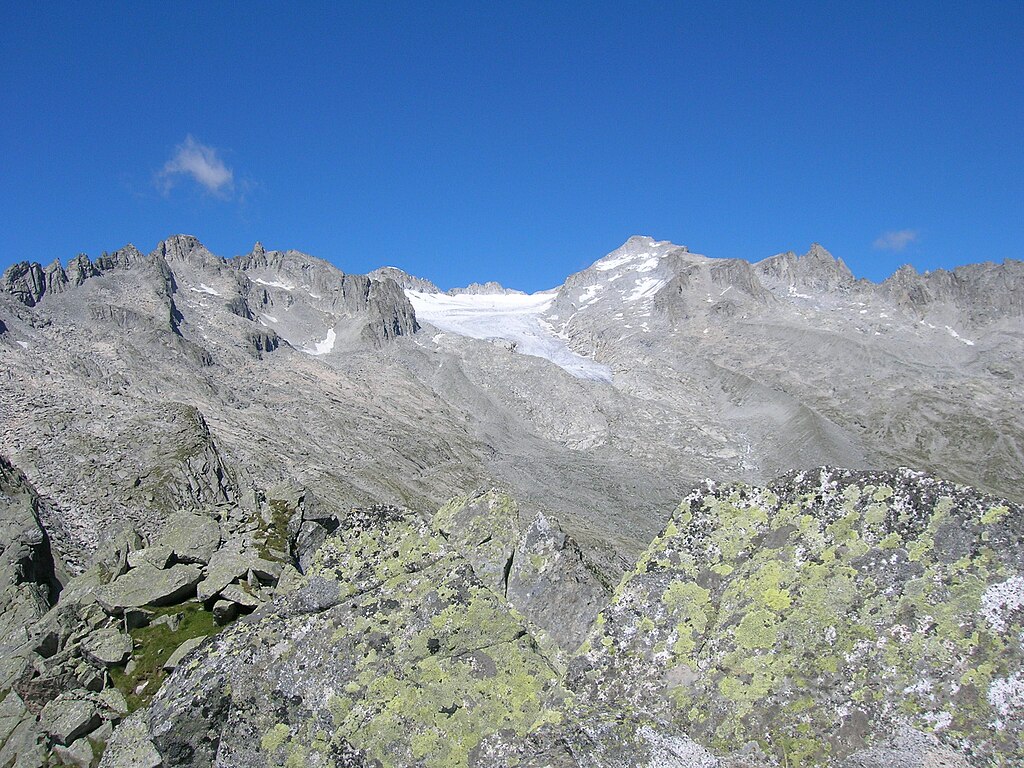
English: Presanella from Tamalè (val Nardis); from left to right: Cimon delle Rocchette 3289m (under the cloud), Ago di Nardis 3289m, monte Gabbiolo 3458m, Presanella 3558, monte Nero 3344m |
||
| Date | |||
| Source | Own work | ||
| Author | Fdbef | ||
| Permission (Reusing this file) |
|
| Camera location | | View this and other nearby images on: OpenStreetMap |
|---|
| Annotations | This image is annotated: View the annotations at Commons |
File history
Click on a date/time to view the file as it appeared at that time.
| Date/Time | Thumbnail | Dimensions | User | Comment | |
|---|---|---|---|---|---|
| current | 14:04, 16 January 2011 | | 2,592 × 1,944 (992 KB) | Ianezz (talk | contribs) | Removed date watermark using The Gimp + Resynthesizer plugin |
| 11:42, 3 June 2010 |  | 2,592 × 1,944 (1.01 MB) | Fdbef (talk | contribs) | {{Information |Description={{en|1=Presanella from Tamalè (val Nardis); from left to right: Cimon delle Rocchette 3289m (under the cloud), Ago di Nardis 3289m, monte Gabbiolo 3458m, Presanella 3558, monte Nero 3344m}} |Source={{own}} |Author=[[User:Fdbef| |
You cannot overwrite this file.
File usage on Commons
There are no pages that use this file.
File usage on other wikis
The following other wikis use this file:
- Usage on fr.wikipedia.org
- Usage on it.wikipedia.org
- Usage on pl.wikipedia.org