File:Priene North of Sacred Hall 2015 3187.jpg
Jump to navigation
Jump to search
Size of this preview: 399 × 599 pixels. Other resolutions: 160 × 240 pixels | 319 × 480 pixels | 511 × 768 pixels | 681 × 1,024 pixels | 1,363 × 2,048 pixels | 3,280 × 4,928 pixels.
Original file (3,280 × 4,928 pixels, file size: 9.21 MB, MIME type: image/jpeg)
Captions
Captions
Add a one-line explanation of what this file represents
Summary
[edit]
| Description |
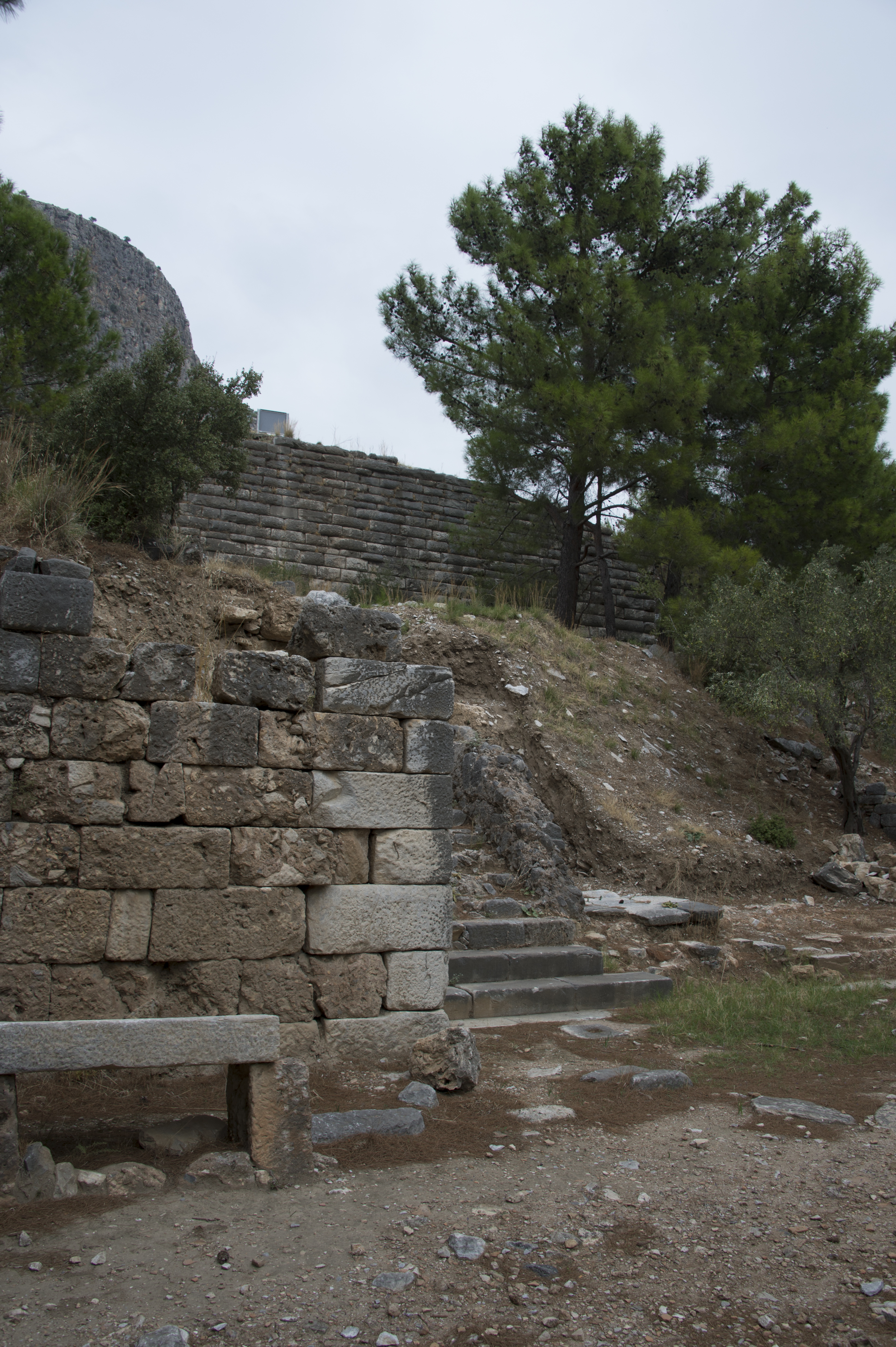
English: One of pictures used to merge into a panoramic picture. Descending from the Athena Temple one gets into a complicated area. First there is an area, called Sacred Hall. Then there is the agora. But the Sacred Hall has been changed repeatedly, and now looks partly as a range of shops. Its southern part seems to have remains from earlier functions, but it can also be interpreted as the north edge of the agora. This picture is one of what seem to be remains of the Sacred Hall and its later shops. A notice explains more:
The main public square, the Agora, measured c. 75 x 46 meters. It was surrounded by porticoes on all side, which were successively added in the 3rd and 2nd centuries BC. The public nature of the square is emphasized by the foundations and bases of numerous honorary monuments in front of the porticoes. A food market adjoined the Agora to the northwest. A stepped slope led to the northern portico (Sacred Hall). It was nearly 120 meters long and was constructed in the 2nd century BC, replacing an earlier structure which was not so deep. The external columns of the {“Sacred Hall: were of the Doric order, the internal columns were Ionic with a range of rooms behind. Official documents and decrees of the City of Priene were displayed on the walls at either end of the colonnade. During the early Byzantine period the rooms in the north aisle were converted into a row of shops. |
| Date | |
| Source | Own work |
| Author | Dosseman |
| Camera location | | View this and other nearby images on: OpenStreetMap |
|---|
Licensing
[edit]
I, the copyright holder of this work, hereby publish it under the following license:
This file is licensed under the Creative Commons Attribution-Share Alike 4.0 International license.
- You are free:
- to share – to copy, distribute and transmit the work
- to remix – to adapt the work
- Under the following conditions:
- attribution – You must give appropriate credit, provide a link to the license, and indicate if changes were made. You may do so in any reasonable manner, but not in any way that suggests the licensor endorses you or your use.
- share alike – If you remix, transform, or build upon the material, you must distribute your contributions under the same or compatible license as the original.
File history
Click on a date/time to view the file as it appeared at that time.
| Date/Time | Thumbnail | Dimensions | User | Comment | |
|---|---|---|---|---|---|
| current | 09:44, 9 June 2022 | | 3,280 × 4,928 (9.21 MB) | Dosseman (talk | contribs) | Uploaded own work with UploadWizard |
You cannot overwrite this file.
File usage on Commons
There are no pages that use this file.